Last update: 1/9/15
 |
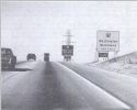
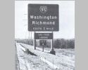
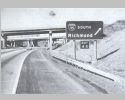
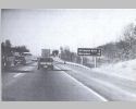
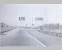
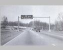
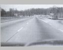
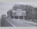
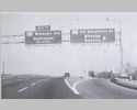
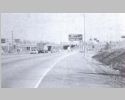
Not far past MD 5 is this mileage sign for Alexandria and Richmond. The expert took issue with needing to identify that these locations were in Virginia on this sign. |
 |
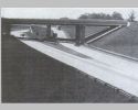
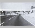
On the west side of the original Woodrow Wilson Bridge nearing the Virginia shore. |
 |
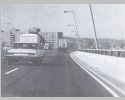
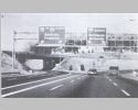
Over Virginia land nearing the end of the bridge, which was replaced in 2008. The apartment building nearest the highway on the left in this photo was torn down as part of the bridge replacement. |
 |
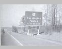
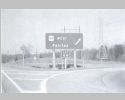
Welcome to Virginia. |
 |
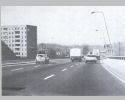
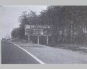
Services are available in Virginia. |
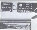 |
US 1 exits have always had the C/D lanes. |
 |
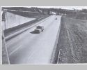
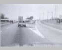
This is the view from the Washington St overpass. The experts were testifying about people stopping in the gore area due to driver confusion. This picture shows 3 people doing this. |
 |
Entering the C/D lanes for Exit 1. Back then, exit suffixes were N and S or E and W depending upon the cardinal direction of the route at the interchange instead of A and B like is done today. Since there is a 3rd ramp to Mount Vernon Hwy here, they gave the suffix for this exit as E instead of C like would be done today. |
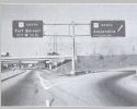 |
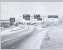
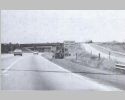
At the US 1 north offramp. Note that the population of Alexandria was given on the BGS. Oddly both US 1 south Fort Belvoir BGS's on this and the previous pic list the ramp as being 1/5 mile away. |
 |
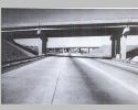
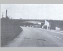
Now we are a little past Exit 2 for VA 241 showing the mileage to the next exit plus I-95. The overpass in this picture and the frontage road to the right are completely gone today. |
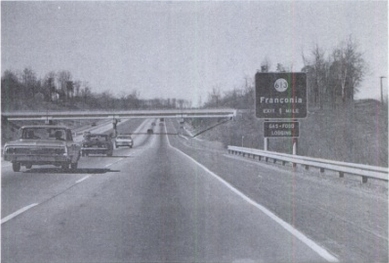 |
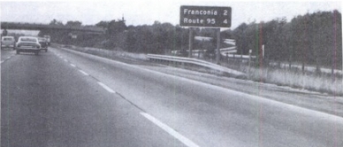
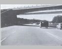
Approaching Exit 3 for SR 613 Franconia. This overpass has also been removed. |
 |
Nearing the SR 613 offramp. |
 |
At the SR 613 offramp. |
 |
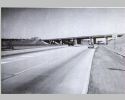
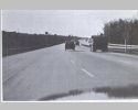
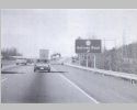
A little past Exit 3. |
 |
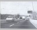
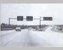
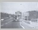
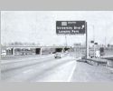
Approaching the I-95 interchange. Note VDOT was experimenting with a BWS posting. I guess it didn't catch on. |
 |
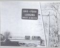
I-95 is 1 mile. The expert didn't like that gas-food-lodging was said to be available on the interstate, even if it was immediately so in either direction. |
 |
Springfield gets a mention from the Beltway. |
 |
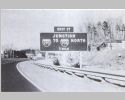
Approaching the ramp for Exit 4N to I-95 North |
 |
At the ramp for Exit 4N to I-95 North |
 |
At the ramp for Exit 4S to I-95 South |
 |
This picture was taken later than the others in this set. It shows "This Lane Right Turn Only" postings have been put up. |
 |
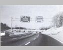
Passing through the interchange as the ramp to 95 south starts to form. This overpass was the ramp from I-495 Outer Loop to I-95 north. |
 |
From the point of view of exiting to I-95 south. |
 |
From the point of view of remaining on the Beltway. |
 |
Here comes the ramp from I-95 north to the Inner Loop. To see this movement fully from I-95 just north of SR 644 Springfield, go here. |
 |
This ramp merging in from the left. |
 |
At the merge. The experts complained that there were two lane drops here with no signage indicating this. |
 |
This is from the 495 WB to 95 SB flyover looking back at where the 95 NB ramp to 495 WB arrives. |
 |
Nearly through the interchange, here comes the ramp from I-95 south to the Inner Loop. |
 |
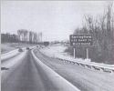
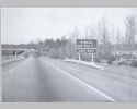
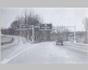
Further along, here is a mileage sign after Exit 7 for VA 236. The expert noted that while Arlington Blvd is named here, this designation appears on zero signs around the US 50 Arlington Blvd interchange coming up. |
 |
Here we are at Exit 7 for SR 650 Gallows Rd. They did not have many pictures of this exit, but at least in this view there is nothing telling drivers that they cannot get back onto I-495 this direction at this interchage. Today this interchange has full movements. |
 |
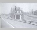
At the exit gore for exit 7. Virginia did not adopt interchange numbers for its free interstates until the late 1960s. Most add-on signage was a square with EXIT x, but at some gore locations they installed a tiny square with just the number only. This picture shows an example of that. |
 |
Approaching Exit 8 for US 50. Today, the ramp to do this is actually behind this sign from the 1960s. |
 |
Then as now, you can reach US 29 via US 50. US 211 stopped being available here in 1981. The expert noted there was no other US 29-211 posting in the C/D lane - you had to remember 8-W. |
 |
At the ramp to the C/D lane for Exit 8. |
 |
On the C/D lane for Exit 8 nearing the US 50 east ramp. |
 |
On the C/D lane at the US 50 west ramp. |
 |
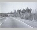
Approaching Exit 9 which you can use to reach Vienna. The overpass is US 29-211 and the unmentioned VA 237. |
 |
Approaching Exit 9 for I-66 West. |
 |
Nearing the ramp for the left exit to I-66 west. Until 1982 there was no I-66 east constructed. This left ramp stayed in place even though a clover from the right lane was eventually built. There is still a left exit today for the 495 Express Lanes. |
 |
At the ramp for I-66 heading for Front Royal. |
 |
At the ramp from I-66 east merging in. To see the full movement of I-66 east heading for I-495 north, go here. |
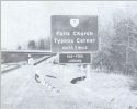 |
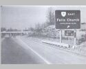
Approaching Exit 10 for VA 7 Falls Church and Tysons Corner. The overpass is Oak St. |
 |
Approaching the ramp to Exit 10-E for VA 7 east and Falls Church. |
 |
At the ramp to Exit 10-E for VA 7 east and Falls Church. Later this was converted to have a C/D lane. |
 |
At the VA 7 overpass. |
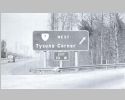 |
At the ramp for Exit 10-W and VA 7 Tysons Corner. Since there was no ramp from 495 north to VA 123 south then, you had to know to exit here to do that. |
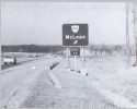 |
Approaching the ramp for Exit 11 for VA 7 McLean. |
 |
At the ramp for Exit 11 for VA 7 McLean. |
 |
Approaching Exit 12 which is the Dulles Access Road. There was no separate toll road back then. Airport Only meant the next opportunity to leave that road was at the Airport. Because there was no financial reason to go to the airport and head back east to a nearby destination, I wonder if there was any enforcement when someone did that. |
 |
Approaching the left ramp for Exit 12. |
 |
At the left ramp for Exit 12. This is still a left ramp today. On the right side of the picture is an oversized NO RIGHT TURN sign which is meant to prevent you from turning right onto the ramp leading from the Dulles Access Rd to I-495 north. Today Virginia still posts the symbol version of this at on-ramps. |
 |
Approaching Exit 13 for VA 193 Langley/Great Falls. The overpass is SR 738 Old Dominion Dr. |
 |
Approaching the Exit 13 ramp. |
 |
At the Exit 13 ramp. In this direction this interchange has not changed. |
 |
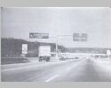
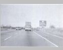
Approaching the ramp to Exit 14 for the George Washington Memorial Parkway which has always excluded trucks. |
 |
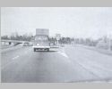
At the ramp to Exit 14 which has also not changed in this direction. |
 |
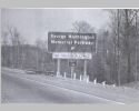
Welcome to Maryland and the ramp to Exit 15 for Carderock and Glen Echo. Today this is also signed as the Clara Barton Pkwy but back then this was also called the George Washington Pkwy which I'm sure would've been confusing had it been signed as such. |
 |
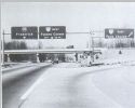
Approaching the split to I-270 which leads to I-70S. |
 |
Lanes forming for the split to I-270 which leads to I-70S. |
 |
At the overpass for MD 191 Bradley Blvd near the split. You can see the configuration of the split in this photo. Today the 495 south bridge crosses both directions of what is now I-270 SPUR instead of just the NB lanes. |
 |
At the split. I-70S is now I-270 and I-270 is now the I-270 SPUR. Note that US 240, which was concurrent with the entirety of I-70S is nowhere to be seen. |
 |
Approaching Exit 18 for MD 187 Old Georgetown Rd for Rockville and Bethesda. The experts liked exit tabs that Maryland was doing as opposed to what Virginia was doing. |
 |
Nearing the ramp for Exit 18. |
 |
At the ramp for Exit 18. Coming up is Exit 19 for US 240 Wisconsin Ave and Bethesda. Like now, you could only go southbound at Exit 19. US 240 was decommissioned not too long after these photos. |
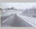 |
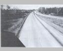
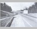
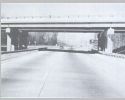
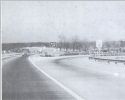
Skipping a few exits we are at the Sligo Creek Bridge. |
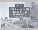 |
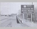
Approaching Exit 23, US 29 Colesville Rd for Silver Spring and Burtonsville. |
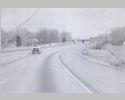 |
A little further along. |
 |
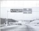
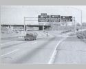
Approaching the ramp for US 29 south to Silver Spring. in Maryland, there were no exit suffixes then. Instead, the exit tab would be plural if there were multiple ramps. |
 |
At the ramp for US 29 south to Silver Spring. |
 |
At the ramp for US 29 north to Burtonsville. Today US 29 north is signed for Columbia. |
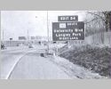 |
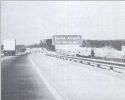
Approaching Exit 24 to MD 193 and Langley Park. |
 |
Approaching the ramp for Exit 24 to MD 193 and Langley Park. |
 |
At the ramp for Exit 24 to MD 193 and Langley Park. Though not signed on the beltway here, you can only go east on MD 193 which is still true today. |
Return to 495 Vintage Gallery main page.
![]()
![]()
Page last modified 9 January 2015
(C) 2015-2008 Mike Roberson, Adam Froehlig