| Virginia Highways
Project 1920s Bridges of Virginia |
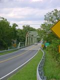
Last update (1/17/12): 1928 new entry
Year: 1920 (per National Bridge Inventory Database)
Location:SR 7xx over Mason Creek, Hanging Rock
Notes: This was original VA 22 when built. VA 311 was still using this bridge in 1936, but was moved before 1968.
Photos: (by Mapmikey 1/26/07)
 |
 |
Year: 1924
Location:Stones Keep Ln over South Fork Roanoke River, Elliston
Notes: This was VA 10 when built. This is the earliest example of this tall, elegant style railing I know of. This style of railing was used on 2-lane and a few 3-lane bridges in Virginia from 1926 to at least 1945. While the date plate says there is a 15 ton weight limit, the road has a posting for 20 tons. I don't think this has been part of US 11 for many years, but it remains open because there are a few houses on the other side that have no other road access.
Photos: (by Chris E 10/9/05)
 |
 |
 |
Year: 1924
Location:VA 91 southern Tazewell County
Notes: This is just below the unpaved part of VA 91
Photos: (by Mapmikey 7/21/07)
 |
 |
 |
 |
Year: 1925
Location:SR 766 over Mill Creek in Hamburg.
Notes: This was Lee Hwy, VA 21, when built. 1925 is the earliest known date to use the shield-shaped date plates. Just up the rise from this bridge (pic 3) is US 211. The Endless Caverns ad on the store wall ahead is interesting as this is only 3 miles from Luray Caverns.
Photos: (by Mapmikey 3/18/06)
 |
 |
 |
Year: 1925
Location:VA 158 over Toms Creek, Coeburn
Notes: This bridge carried VA 11 when it first opened.
Photos: (by Mapmikey 8/1/08)
 |
 |
 |
Year: 1926
Location:US 11 over Roanoke River, Roanoke
Notes: When built, this was VA 10, and was dedicated to WW1 veterans "Memorial Bridge." This bridge connects SW Memorial Dr to SW 13th St. A site dedicated (Author: Twig Gravely) to documenting pictures of Roanoke's past has a picture of the underside from years back here. Scroll down to the third picture at this link to see this bridge under construction with the older bridge in use nearby. This page shows the original bridge in a 1908 picture.
Photos: (by Chris E 2005)
 |
 |
 |
 |
|
 |
Year: 1926
Location:SR 764(?) over Brake Branch, Elliston
Notes: When built, this was VA 10, and is about a half mile south of the 1924 bridge shown above. This was US 11 until the mid-40's, I believe.
Photos: (by Mapmikey, taken 7/16/06)
 |
 |
 |
Year: 1927
Location:US 58 Bus, US 220 Bus over Smith River, Martinsville
Notes: This is a gorgeous arching bridge. The supports under the roadbed and over the arches have the same shape as the regular pier supports on other bridges of the era. When this bridge was built this was US 311 and VA 12-33.
Photos: (by Mapmikey 10/26/06)
 |
 |
 |
 |
 |
Year: 1927
Location:US 1 over Stony Creek, Dinwiddie
Notes: This bridge contains a rainbow arch feature in the center. When this bridge was built this was VA 31.
Photos: (by Mapmikey 1/31/06)
 |
 |
 |
Year: 1927
Location:VA 94 over New River, Reavistown
Notes: "Warren with Verticals and a polygonal top chord." This was original VA 12 when built. When I drove over this I found the data plates gone.
Photo: Mapmikey, taken 7/16/06; 4/14/07. The Historical Bridges site has a photo of the underside of the bridge up close.
 |
 |
 |
 |
Year: 1927
Location:SR 712 over Otter River, Alta Vista
Notes: When this bridge was built this was US 170/VA 14. This was part of US 29 Seminole Trail until 1953. The modern US 29 can be easily seen from the bridge, while the 1927 bridge is easily seen from US 29.
Photos: (by Mapmikey 1/21/07)
 |
 |
 |
 |
 |
Year: 1928
Location:VA 255 over Spout Run, Millwood
Notes:When built, this was US 50/VA 36.
Photos: (by Mapmikey 1/31/06)
 |
 |
 |
Year: 1928
Location:US 301 over Nottoway River
Notes: This was US 17-1/VA 24 when built. The railing on this bridge has been recently refurbished, which gives an idea of how this bridge looked new (minus the I-95 southbound lanes just next to it).
Photos: (by Mapmikey 1/31/06)
 |
 |
 |
 |
Year: 1928
Location:US 220 Bus over railroad, Ridgeway
Notes: This is a strange bridge. The supports under the roadbed has the same shape (with additional squaring presumably for additional strengthening) as the regular pier supports on other bridges of the era. However, the railing suggests a widening in the 50s or 60s. When this bridge was built this was US 311 and VA 33.
Photos: (by Mapmikey 10/26/06)
 |
 |
 |
 |
Year:
Location:US 29 Business over Roanoke/Staunton River, Alta Vista
Notes:When built, this was US 170/VA 14. Unique in that it crosses the Staunton River at the southern end, and then goes "uphill" to cross the railroad tracks and meet the bank at the northern end.
Photos: (by Andrew Snyder Sept 2009)
 |
 |
 |
 |
Year: 1929
Location:SR 1001 Falmouth
Notes: When built, this was VA 38, then later VA 17. The end of the road just ahead (SR 607) was US 1 until 1945.
Photos: (by Mapmikey 10/19/05)
 |
 |
 |
Year: 1929
Location:US 11 Cedar Creek, near Middletown
Notes: When built, this was also still VA 33. The south end of the bridge has had its railing replaced.
Photos: (by Mapmikey 2/1/06)
 |
 |
 |
Year: 1929
Location:VA 310 over Beaverdam Creek, near Crozier
Notes: This is on the grounds of the Powhatan Correctional Center, and may well be the oldest bridge on a VA 3xx route. When this bridge was built this was VA 19.
Photos: (by Mapmikey 10/26/06)
 |
 |
 |
Page last modified 17 January 2012
