| Virginia Highways
Project 1940s Bridges of Virginia |
Last update (1/13/12): New entries under 1942 and 1945; added pics to existing 1941 and 1943 entries
Year: 1940
Location:VA 189 over Blackwater River, near Franklin
Notes: This is a drawbridge, but I don't know for whom it is supposed to drawn for. Just ahead is where VA 189 used to cut north to Franklin and VA 315 continued southwest to US 258.
Photos: (by Mapmikey 2/19/06)
 |
 |
 |
Year: 1940
Location:VA 175 over Chincoteague Channel, Chincoteague
Notes: This is a drawbridge that creates problems for the island, as it is very narrow and wide loads needing to pass through disrupt traffic.
A new bridge 0.25 mile or so upstream is under construction.
Photos: (by Mapmikey 4/26/07)
 |
 |
 |
Year: 1941
Location:VA 3 Bus over Rappahanock River, Fredericksburg
Notes:
Photos: (by Mapmikey 10/19/05; 1/6/12)
 |
 |
 |
 |
Year: 1941
Location:US 11/VA 16 Marion
Notes: Here is a bridge that was widened in 1983 (latest year I've seen a widened plate). Another item of interest is the date shield being re-installed on the modern railing. Not unique to Virginia but not generally the norm.
Photos: (by Chris E May 2006)
 |
 |
 |
 |
Year: 1942
Location:US 360 over Chickahominy River, Mechanicsville
Notes: Here is the first 1942 date shield I've ever seen.
Photos: (by Mapmikey 4/28/06)
 |
 |
 |
Year: 1942
Location:US 15-460 Business over Buffalo Creek, Farmville
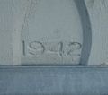
Notes: Here is the first 1942 carved date I've ever seen.
Photos: (by Mapmikey 12/9/06)
 |
 |
 |
Year: 1942
Location:US 11 over Roanoke River, Salem
Notes: Here is an older 3-lane bridge.
Photos: (by Mapmikey 12/11/09)
 |
 |
 |
Year: 1943
Location:US 1, US 17 Bus over Rappahanock River, Falmouth
Notes: From at least 1942-45, Virginia carved the dates instead of using shields. IMO this was to contribute to metal conservation during WW2.
Photos: (by Mapmikey 10/19/05; 1/6/12)
 |
 |
 |
 |
Year: 1945
Location:VA 33 over Mattaponi River, West Point
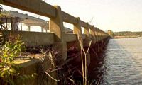
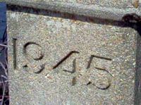
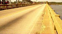
Notes: Another carved date. This is the earliest date for this type of low railing I know of. As you can see, this bridge is being replaced soon.
Photos: (by Mapmikey 10/18/05)
 |
 |
 |
Year: 1945
Location:US 1 overpass at VA 3, Fredericksburg
Notes: This bridge was rehabbed in 2010 but retained its original 1940s look.
Photos: (by Mapmikey 1/7/12)
 |
 |
 |
Year: 1945
Location:US 1 over Hazel Run, Fredericksburg
Notes: This bridge is on the edge of the old Mary Washington Wayside
Photos: (by Mapmikey 1/7/12)
 |
 |
 |
Year: 1947
Location:US 11 Steeles Tavern
Notes: None
Photos: (by Mapmikey 1/26/06)
 |
 |
Year: 1947
Location:US 219 Rich Creek
Notes: This is the first instance of a double shield-shaped date I've seen.
Photos: (by Mapmikey 3/10/07)
 |
 |
 |
Page last modified 24 January 2009