| Virginia Highways
Project Bridges of Virginia 1960 to Present |
Last update (1/13/12): 1970, 1972, 2010 (new entries)
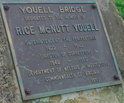
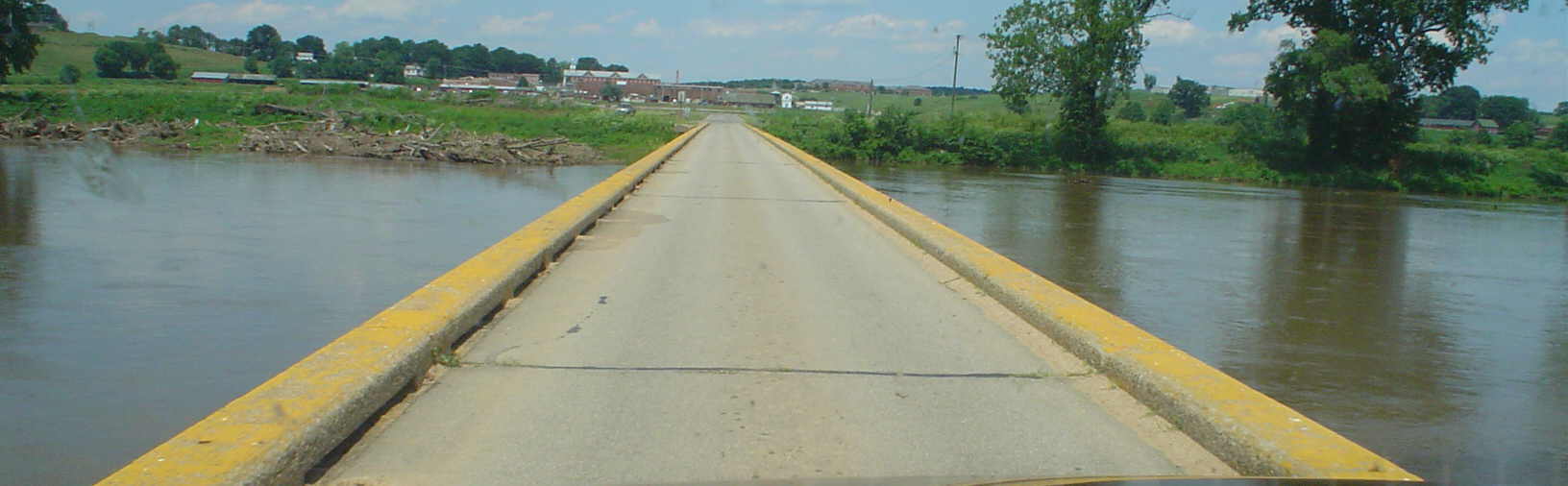
Year: 1960
Location:Connecting road over James River, between the James River Correctional Center to the Powhatan Correctional Center. This is NOT part of VA 310, which serves part of the Powhatan Correctional Center.
Notes: The bridge is one lane wide and uncontrolled. This is only the second example I know of this one-lane low bridge crossing of a major river in Virginia. The other is on SR 624 over the Shenandoah River east of Front Royal.
Photos: (by Chris E summer 2004)
 |
 |
Year: 1962
Location:SR 670 over Robinson River, near Criglersville
Notes: SR 670 was once VA 231 which was supposed to cross the mountain to Page County at one time.
Photos: (by Mapmikey 1/17/07)
 |
 |
 |
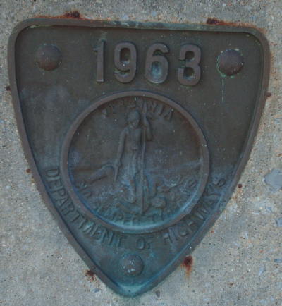
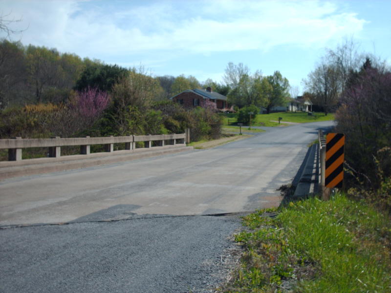
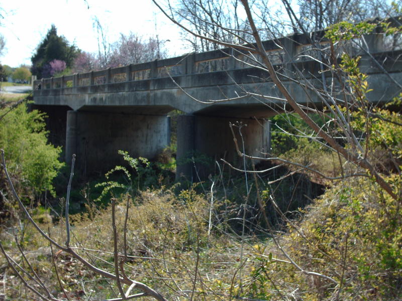
Year: 1963
Location:SR 613 over Folly Mills Creek, near Folly Mills
Notes: SR 613 was once the original route of VA 3 in the early 20s.
Photos: (by Mapmikey 4/24/09)
 |
 |
 |
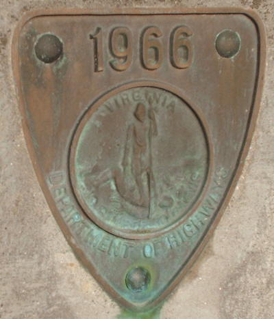
Year: 1966
Location:SR 648 over Rose River, near Syria
Notes: None
Photos: (by Mapmikey 1/17/07)
 |
 |
 |
Year: 1967
Location:SR 626 over railroad tracks, Leeland
Notes: None
Photos: (by Mapmikey 10/19/05)
 |
 |
 |
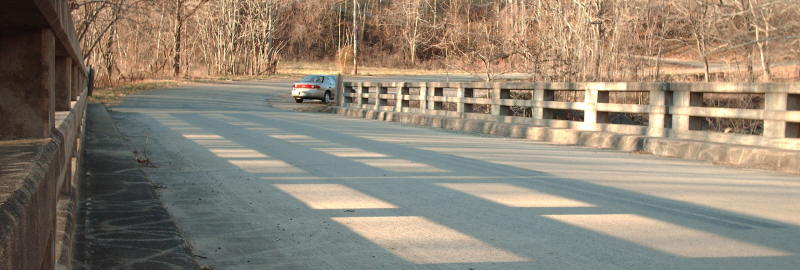
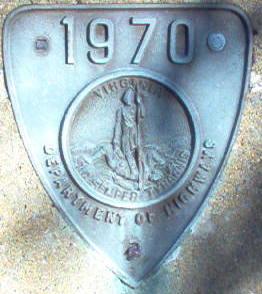
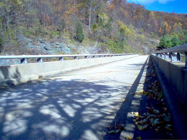
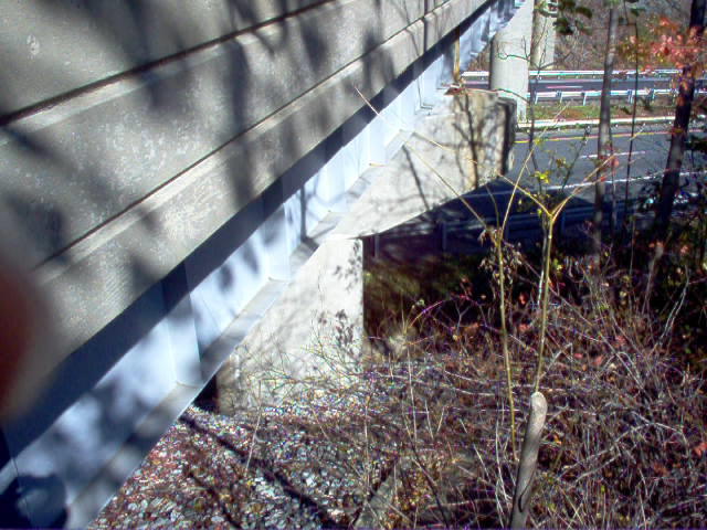
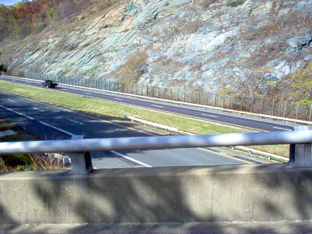
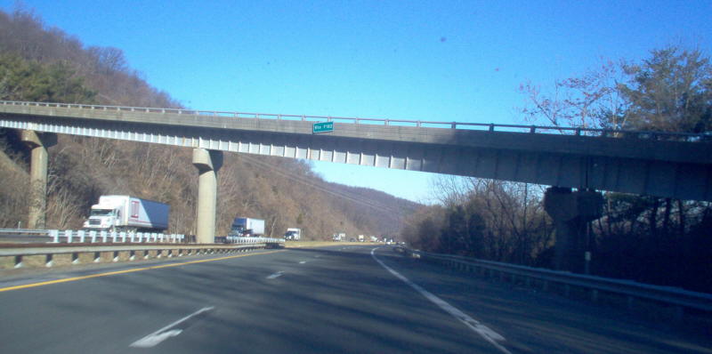
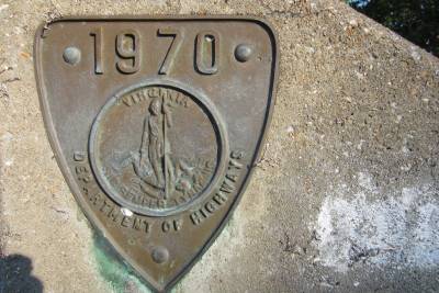
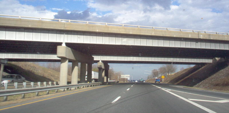
Year: 1970
Location:F-182 bridge over I-64, Afton Mountain
Notes: This is a modern one-lane bridge. F-182 connects US 250 to a private property that was cutoff by the interstate.
Photos: (by Mapmikey 11/10/05; 1/26/06)
 |
 |
 |
 |
 |
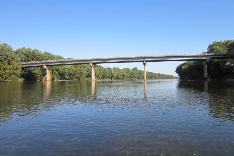
Year: 1970
Location:SR 690 (old VA 27) over James River, Columbia
Notes: Fred Picard noted: The original bridge was destroyed by Hurricane Camille in 1969. A woman in my office lived in Columbia at the time and she vividly remembers the sound of the steel groaning as the river twisted the superstructure and carried the bridge away.
Photos: (by Fred Picard 10/7/11)
 |
 |
 |
 |
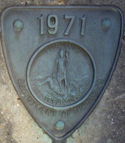
Year: 1971
Location:VA 251 over Colliers Creek, near Colliersville
Notes: None
Photos: (by Mapmikey 1/26/06)
 |
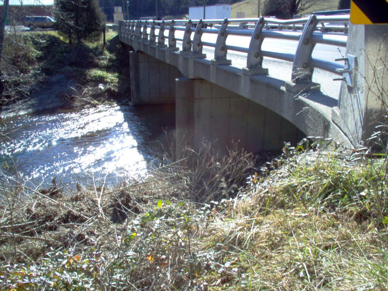 |
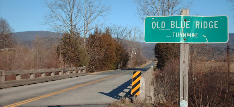
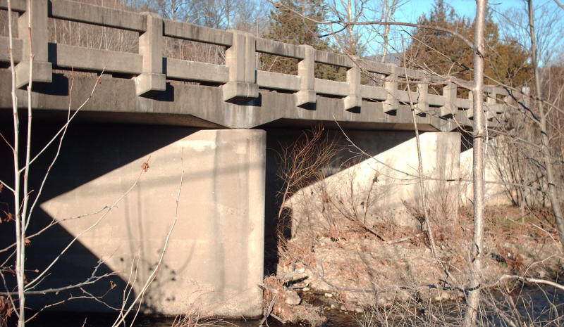
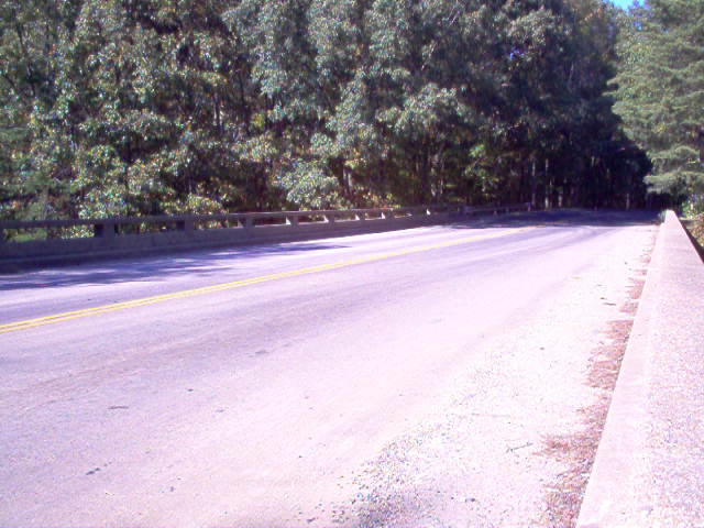
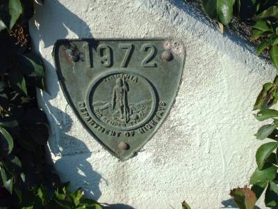
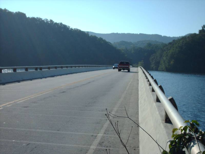
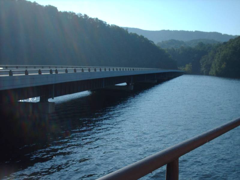
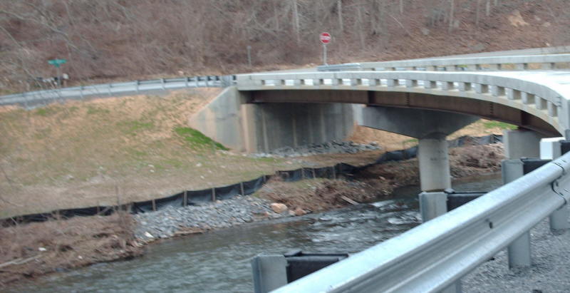
Year: 1972
Location:SR 672 over New River, near McAdam
Notes: A lovely setting. The previous time I had crossed this bridge the river was heavily iced over and I wish I had stopped and taken a picture of that.
Photos: (by Mapmikey 9/3/10)
 |
 |
 |
 |
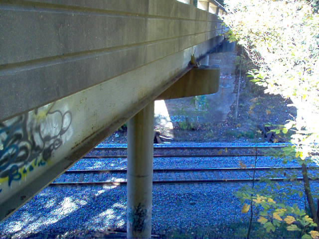
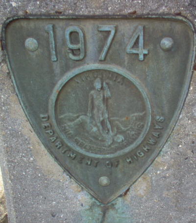
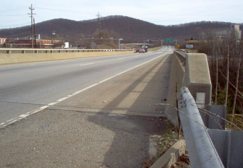
Year: 1974
Location:US 501/VA 128 overpass of railroad, Lynchburg
Notes: None
Photos: (by Mapmikey 1/30/06)
 |
 |
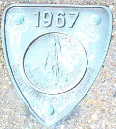
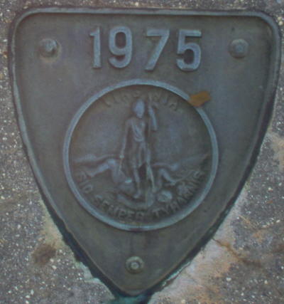
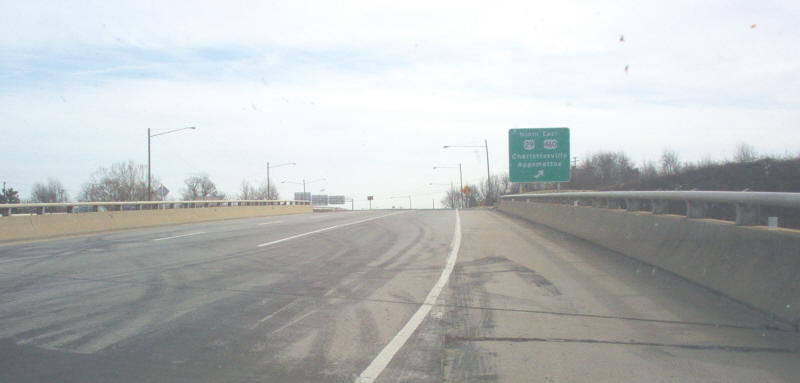
Year: 1975
Location:US 501 overpass of US 29-460 Lynchburg
Notes: 1975 appears to be the last year Virginia used shield-shaped date plates. This date-plate also has no Department of Highways on it...
Photos: (by Mapmikey 1/30/06)
 |
 |
 |
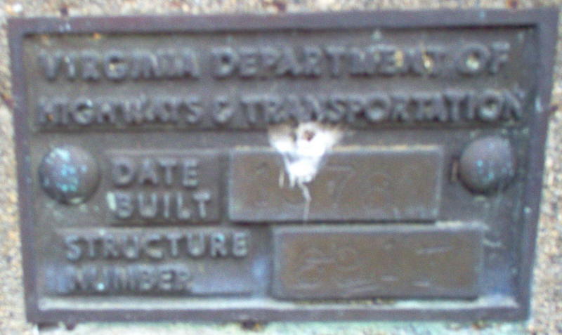
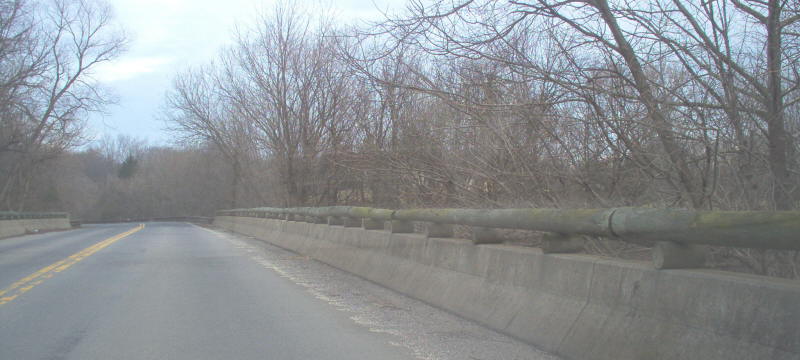
Year: 1976
Location:SR 802 over Rappahanock River, near Jeffersonton
Notes: 1976 appears to be the first year Virginia did not use shield-shaped date plates. The date was very difficult to see in person and the photo reflects this. Also, in the northern half of Virginia, wood log railings exist on many bridges. This is a longer bridge for this style railing.
Photos: (by Mapmikey 2/1/06)
 |
 |
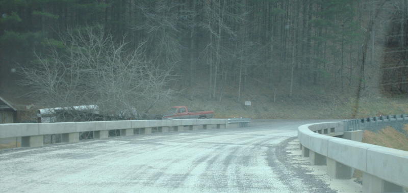
Year: 2006
Location:SR 644 over Wolf Creek, near Round Bottom
Notes: This is a brand new bridge on an extremely minor route (gravel, dead ends shortly) off VA 61. The last picture is the old 1932 bridge stacked alongside VA 61 near SR 644.
Photos: (by Mapmikey 3/10/07)
 |
 |
 |
 |
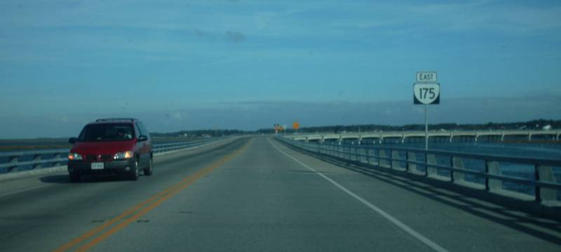
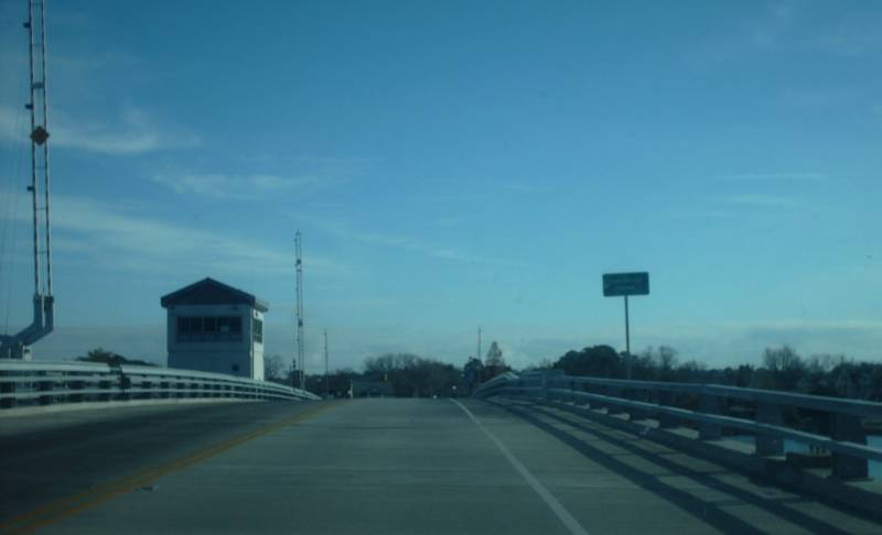
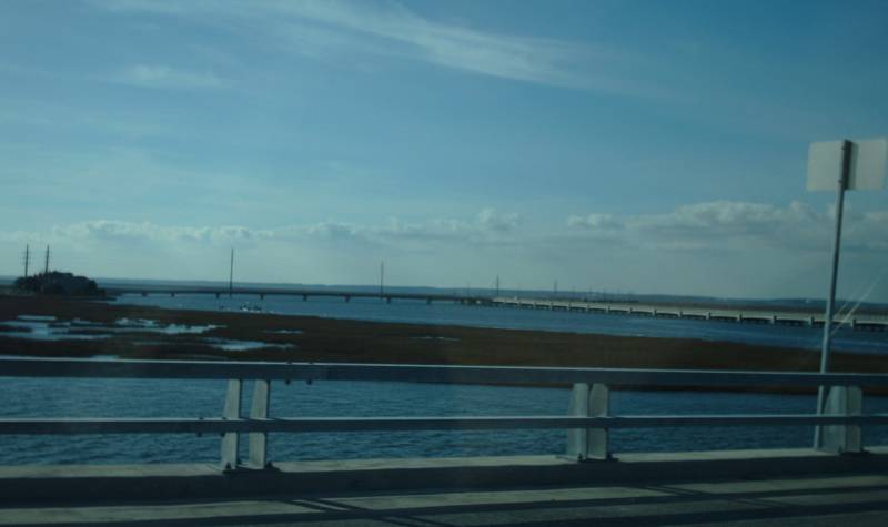
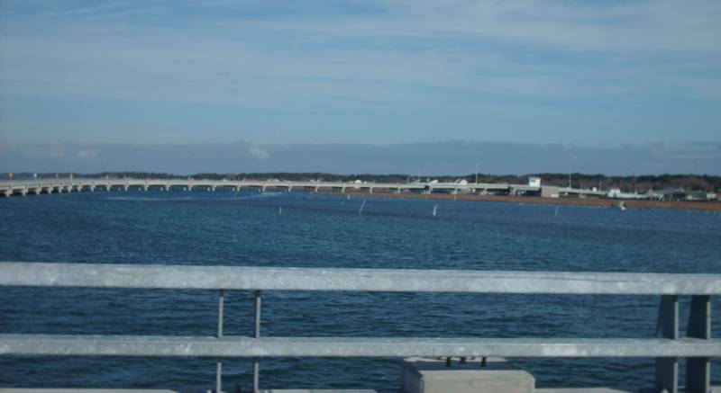
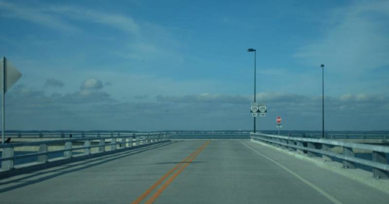
Year: 2010
Location:VA 175 over Chincoteague Channel, Chincoteague
Notes: This is a long S-shaped bridge with a draw span at its eastern end. Near the western end of the bridge there is an intersetcion and a side bridge over to a strip of land with a few house that used to be at the west end of the old VA 175 drawbridge. There was no date plate anywhere that I saw.
Photos: (by Mapmikey 12/3/11)
 |
 |
 |
 |
 |
 |
 |
Page last modified 13 January 2012