N.C. 18
< 17 | Home | 19 >
18-A | 18 Bus
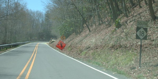
Photo: NC 18 leaving its northern terminus of NC 89 (Mapmikey)
| N.C. 18 148 miles | |||
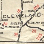
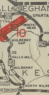
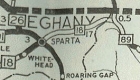
| The Road: | Begins at NC 89 near Low Gap (Alleghany County) and ends at the South Carolina State Line below Shelby (Cleveland County). The route continues another 37 miles as SC 18 to end at US 176/SC 215 Union, SC. | Towns and Attractions: | Surry Co: Blue Ridge Pkwy Alleghany Co: Sparta, Blue Ridge Pkwy Wilkes Co: Mulberry, Fairplains, North Wilkesboro, Wilkesboro, Moravian Falls Caldwell Co: Lenoir, Gamewell Burke Co: Morganton Catawba Co: None Lincoln Co: None Cleveland Co: Fallston, Shelby |
History: |
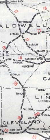
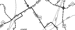
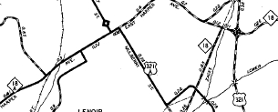
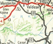
NC 18 is an original state highway that initially ran from NC 20 (now US 74 Bus) Shelby north to Morganton where it crossed its parent NC 10, then northeast through Lenoir and ending at NC 67 (now "Old NC 16-18") Moravian Falls.
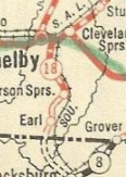
In 1925, NC 18 was extended south to South Carolina as new primary routing. It certainly looks as though it used today's 18 routing. However, the 1926 Official clearly shows a brief duplex with NC 20 east and proceeding south to South Carolina via Patterson Springs and Earl, crossing the state line on Betts Rd.
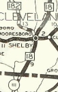
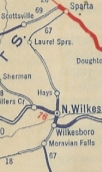
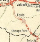
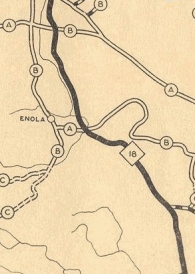
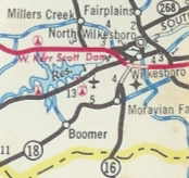
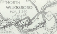
In 1929, NC 18 was rerouted in the Enola area south of Morganton. Orignially, NC 18 followed Enola Rd south of Broughton State Hospital through Enola. Now NC 18 followed "Old NC 18" through Sunnyside on its way southward. Also In 1929, NC 18 was extended north through Wilkesboro and N. Wilkesboro before ending at US 21/NC 26 Sparta. This was a renumbering of a section of NC 67. By 1930, NC 18 was removed from Pleasant Grove Church Rd above Shelby; Wilson Dr in Fallston; Lutz Rd above Fallston In 1930, NC 18 was straightened out south of Shelby to today's routing, leaving behind secondary roads that would later be parts of NC 226 and NC 180. In late 1930, NC 18 was extended northeast as new primary routing to NC 89.
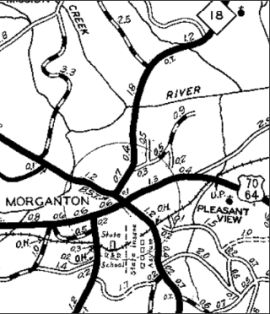
In Cecil Brown's 1931 book describing the development of the North Carolina Highway System, there is a story related to NC 18 south of Shelby. There was a debate whether NC 18 should serve the piece of Cleveland County southwest of Shelby that was south of the Broad River so that those residents would come to Shelby for their commerce instead of going to Gaffney, SC. On the other hand, a direct route south would essentially force South Carolina to build the highway bridge over the Broad River -- a substantial savings to North Carolina. You see which option was eventually chosen... In May 1932 (AASHO), there was a serious movement to get NC 18 redesignated as US 21-W, which AASHO squelched. In 1937 or 1938, NC 18 was rerouted in Morganton from Sterling/Green/Avery to Sterling/College/Union/Green/Avery. Note that some of the Sterling routing above College was using what is now State Rd. Also in 1937 or 1938, NC 18 was removed from the lengthy Hartland Rd between Morganton and Lenoir. Between 1945-49, NC 18 was removed from Cub Creek Church Rd/Herbal Ingenuity Way and Brown's Temple Church Rd loops south of Wilkesboro. In 1948 or 1949, NC 18 was rerouted to bypass central Lenoir. Harper Ave became NC 18-A (now just Harper Ave).
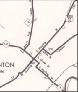
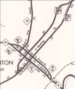
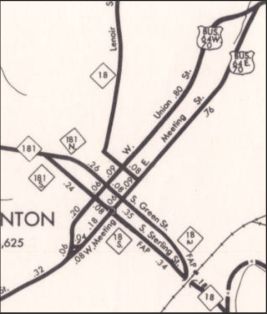
Between 1954-57, NC 18 was rerouted in Morganton from Sterling/College/Union/Green/Avery to Sterling/Concord/Green/Avery.
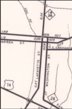
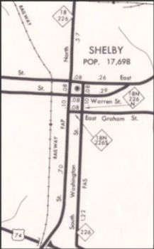
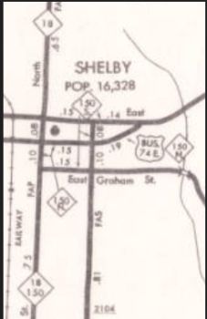
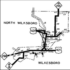
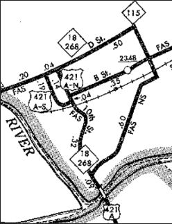
Between 1958-62, NC 18 was placed on one-way pairs in Shelby: SB used the original route on Lafayette St; NB used Graham/Washington/Marion Also between 1958-62, NC 18 was removed from Lower Creek Dr northeast of Lenoir In May 1962 (NCDOT), NC 18 was rerouted in N. Wilkesboro. Originally it used B St. Now, there was a one-way pair with NB using 10th and SB using Forester between Wilkesboro Blvd and D St. NC 18 then used D St east to 6th, then south back to B St. In March 1966 (NCDOT), NC 18 was restored in Shelby to use Lafayette in boyh directions.
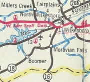
In December 1969 (NCDOT), NC 18 was rerouted through Moravian Falls to the current routing leaving behind "Old NC 16-18", Fletcher St and Corporation St.
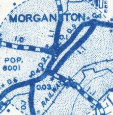
Between 1968-72, NC 18 was rerouted in Morganton from Sterling/College/Union/Green/Avery to one-way pairs. NB used Sterling/Green/Avery and SB used Avery/Sterling. In May 1977 (NCDOT), NC 18 was rerouted in Morganton to a different set of one-way pairs. NB became Sterling/Green/Meeting/Bouchelle/Avery and SB became Avery/Bouchelle/Union/Sterling. In August 1978 (NCDOT), NC 18-268 through N. Wilkesboro formed a "square", using A St, 6th St, D St, and CBD Loop.
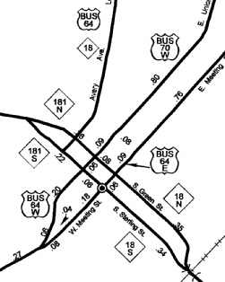
In April 1992 (NCDOT), NC 18 was returned to NB using Sterling/Green/Avery and SB using Avery/Sterling. Eric Calhoun had reported to Matt Steffora in 2001 that NC 18 was rerouted in 1977 in order to get state funding to widen Bouchelle Street.
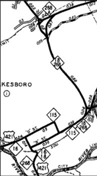
In 1993 (bridge date), NC 18 was moved from Wilkesboro Blvd to Wilkesboro Rd across the Yadkin River. |
Comments: |
There is a signed NC 18 Truck in Shelby that follows NC 150 up to US 74 Business, then continues up DeKalb St to NC 18 Grove St. There is also a signed NC 18 Truck in Morganton that follows US 70 around the south of town, then US 64 around the west of town.
NC 18 is nearly a border to border route but connecting it to today's VA 18 would be too complicated! |
Last Update: 21 March 2025
Previous: N.C. 17 |
Next: N.C. 19
18-A | 18 Bus
Top | NCRoads.com
Home