N.C. 25
< 24 | Home | 26 >
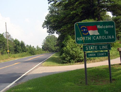
Photo: NC 25's old beginning at the South Carolina Line (Chris Patriarca)
| N.C. 25 dead | ||||||
| Formerly: |
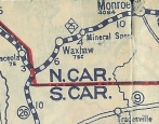
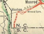
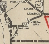
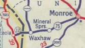
NC 25: An original state highway. 1922 and 1923 Auto Trails Maps show it running from NC 20 Monroe (most likely the junction of Franklin and Charlotte Sts) west to Waxhaw, then west-southwest to the South Carolina State Line where it continued to SC 26 (now US 521) as a secondary road. The 1924 Official Map shows NC 25 heading south from Waxhaw to the Palmetto State to meet then-SC 93 heading for Lancaster, SC. The original NC 25 WSW is Rehobeth Rd. Around 1928 or 1929, NC 25 was rerouted at Waxhaw to continue west to South Carolina, becoming SC 12 which ended very quickly at SC 26 (now US 521). The 1929 Official Map shows both alignments as primary but does not show a second number such as 251. The 1930 map shows only the new routing. The 1928 Standard Drafting Map shows the new routing. The old route south to SC 93 is Rehobeth Rd to Walkup Rd, then used either Walkup or Waxhaw Creek Rd to Tirzah Church Rd. In late 1934, NC 25 was renumbered as NC 75. If NC 25 ever used any parts of Old Waxhaw-Monroe Rd, it stopped doing so by 1926.
| |||||
Last Update: 21 December 2007
Previous: N.C. 24 |
Next: N.C. 26
Top | NCRoads.com
Home