| N.C.
72 34 miles |
|
|
|
|
| The Road: |
|
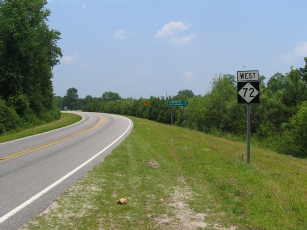
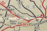
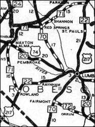
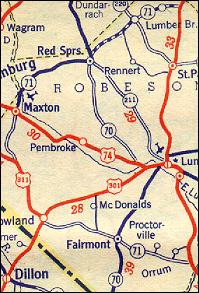
Begins at NC 71-211-710 Red Springs and ends at US 74-NC 130 east of Orrum, all within Robeson County
|
Towns and Attractions: |
|
Robeson Co: Red Springs, Lumberton
|
History: |
|
NC 72 was born in late 1934, replacing NC 70 from Red Springs to US 74 (now NC 711) near Lumberton.
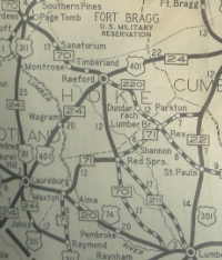 NC 70, Aberdeen to Lumberton
|
 NC 211 and NC 72 replace NC 70
|
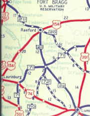
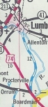
In 1951, NC 72 was extended east to US 74-301 (now SR 2499) replacing a piece of US 74 that was rerouted.
US 74 through Pembroke
|
NC 72 extended over to US 74-301
|
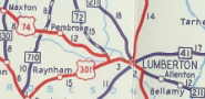
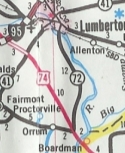
Between 1954-57, NC 72's east end was moved to the current I-95 exit with NC 72-711. The old NC 72 east end became SR 1589 Kenic Rd and Cottonwood Rd (road is cut off by I-95).
In 1983 or 1984, NC 72 was extended east through Lumberton to its current endpoint. This had been secondary for a while but was the route of US 74 for years.
 old US 74, secondary road
|
 NC 72 extended east
|
The first NC 72 appeared in 1930 as new primary highway, running from NC 70 (now NC 41) Fairmont east to US 74/NC 20 near Orrum.
In 1931, NC 72 was renumbered as part of NC 71. Today it is the eastern half of NC 130 Business and NC 130.
NC 72 appears
|
NC 71 extends over NC 72
|
|
Comment: |
|
NC 72's duplex with NC 710 goes back to at least 1944.
|