N.C. 615
< 610 | Home | 630 >
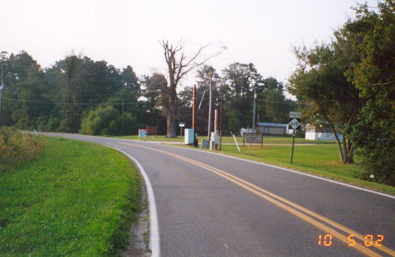
Photo: NC 615 just after the Virginia border (Adam Froehlig)
| N.C. 615 10 land miles | |||
| The Road: | Begins at NC 168 Currituck CH and ends at the Virginia State Line on Knotts Island, all within Currituck County. | Towns and Attractions: | Currituck Co: Currituck CH, Currituck Sound Ferry, Knotts Island |
History: |
NC 615 was born around 1963 running only on the Knotts Island side of the sound.
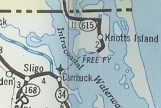
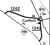
At some point before 2001, NC 615 was assigned to the 0.04 miles between SR 1242 in Currituck and the ferry. The NCDOT mileage tables show no change in Currituck County's paved primary mileage on any of the reports available 2001-2006. I do not have Currituck County in my partial 1982 set of county maps. I do know it was not posted on the mainland the last time I used the ferry, in 1993. In April 2013 (NCDOT), NC 615 was extended northwest from the Currituck side of the ferry replacing SR 1242 to NC 168. Adam Froehlig reports that by Dec 2013 this extension was signed.
|
Comment: |
NC 615 is the northeasternmost route in the state.
Although NC 615 was numbered to match Secondary Route 615 on the Virginia side, Virginia Beach officially ended the numbering of secondary routes about the time NC 615 was born. Not that you can't find a stray SR 615 sign or two... NC 615 is one of just two NC primary routes (the other is NC 128) that do not cross another primary route. It seems silly to have NC 615 on only the ferry ramp and on not one of the legs of SR 1242 out to NC 168. |
Last Update: 20 December 2013
Previous: N.C. 610 |
Next: N.C. 630
Top | NCRoads.com
Home