


Hampton Roads Area Photos
These photos are from various locations around the Hampton Roads region. All photos on this page were taken by Adam Froehlig.
|
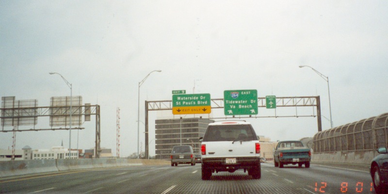
Eastbound I-64 at Exit 273 in Norfolk, where US 60 splits off after duplexing with I-64 across the Hampton Roads Bridge Tunnel. Photo taken December 9, 2001. |
|
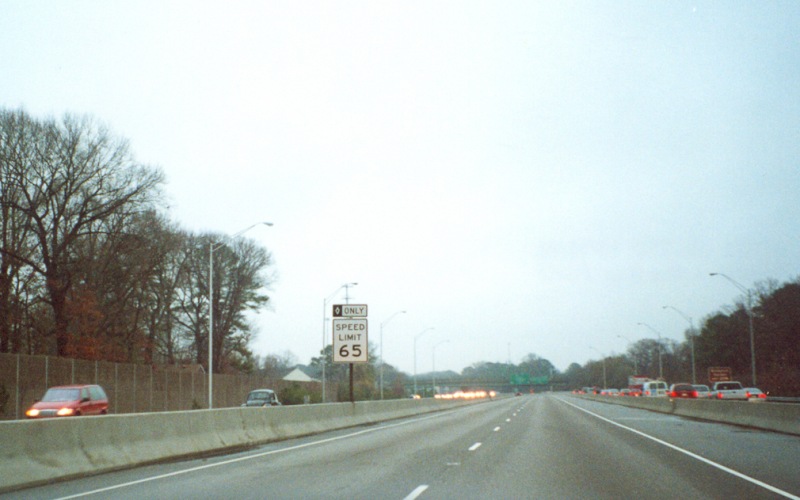
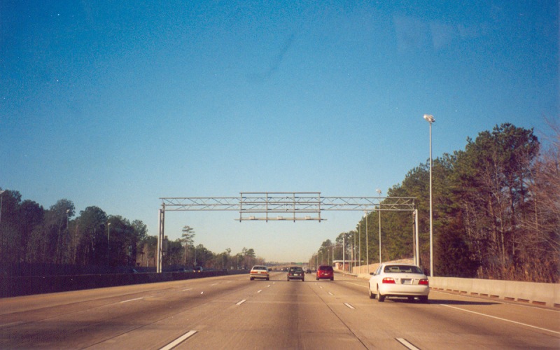
Eastbound on the I-64 Reversible Lanes in Norfolk. The Reversible Lanes have a 65 MPH speed limit, as compared to the 55 MPH limit in the regular lanes. The interchange in the far background is at Norview Ave. Photo taken December 11, 2001. |
|
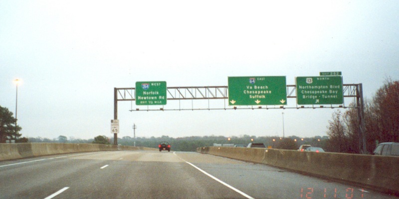
Still in the Reversible Lanes at US 13/Northampton Blvd. Going eastbound, the only exits from the Reversible Lanes are a slip ramp to access I-264 West and Newtown Rd and a flyover to I-264 East. Photo taken December 11, 2001. |
|
|
Also on "Eastbound" I-64 (but actually traveling northwest at this location), approaching I-64's end at the I-64/264/664 interchange at Bower's Hill in Chesapeake. Photo taken December 18, 2001. |
|
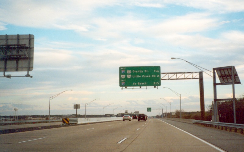
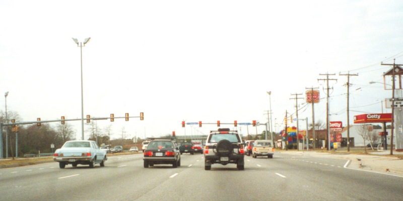
Westbound I-64 in Norfolk, at the VA 168 South ramp. I-564 is about a mile ahead. The missing sign panel in the middle guide sign, part of the Little Creek Rd exit signage, was missing for several months before finally being replaced. Photo taken in January, 2002. |
|
|
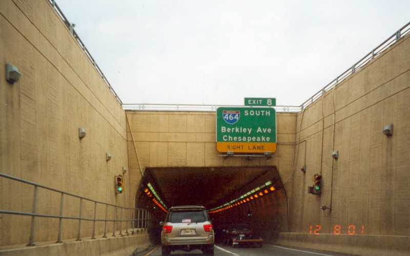
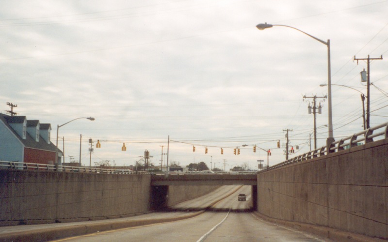
Eastbound I-264 entering the Downtown Tunnel into Norfolk. The I-464 interchange is just on the other side of the tunnel. Photo taken December 8, 2001. |
|
|
Eastbound I-264 on top of the drawspan part of the Berkeley Bridge. Due to a number of factors (including the drawbridge itself), this part of I-264 is heavily congested for several hours each day. Photo taken December 8, 2001. |
|
|
Westbound I-264 in Virginia Beach, between the Rosemont Rd and Independence Blvd interchanges. The abandoned overhead sign was a warning sign for what used to be the mainline toll booth along the former VA 44 "Norfolk-Virginia Beach Toll Road". You can see the location of the paved-over toll booths in the asphalt pavement in the background. The tolls were removed in the mid-1990s, and the route became an extension of I-264 in 1999. Photo taken in early January, 2002. |
|
|
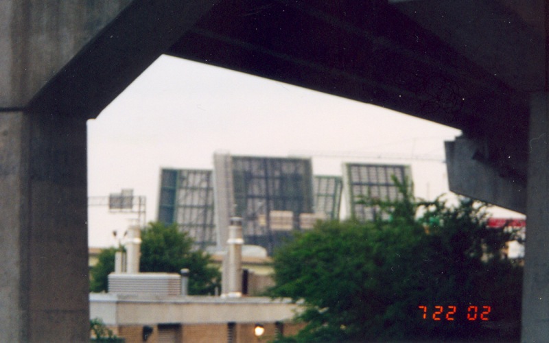
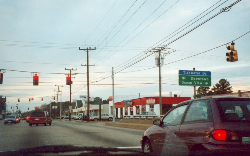
A view of an I-264 Berkeley Bridge raising, as seen from the westbound on-ramp from Tidewater Dr. Photo taken July 22, 2002. |
|
|
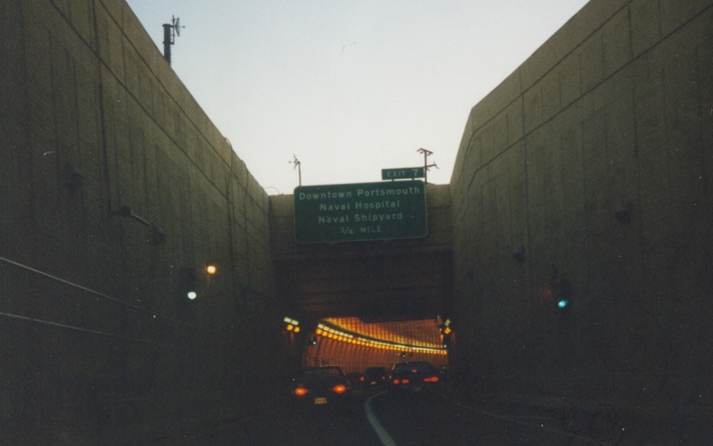
Westbound on I-264, going the other direction into the Downtown Tunnel towards Portsmouth. Photo taken in late November, 1999. |
|
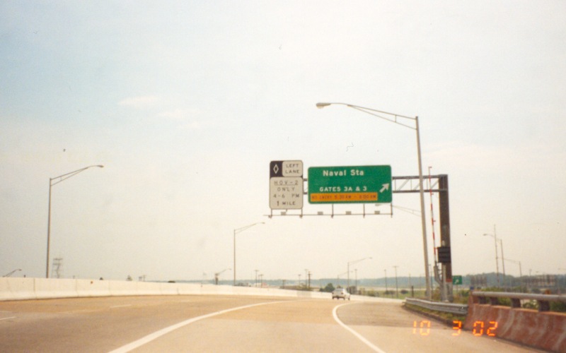
The first exit along eastbound I-564 is an access point to Gates 3/3A at the Norfolk Naval Base. The yellow tab in the guide sign says "NO ENTRY 5:30AM - 8:00 AM", and there is an automatic gate that comes down when the exit is closed. Photo taken October 3, 2002. |
|
|
Distance sign for the three exits along eastbound I-564 in Norfolk. This sign is just south of the underpass under the main runway at NAS Chambers Field, part of the Norfolk Naval Base. Photo taken in mid-December, 2001. |
|
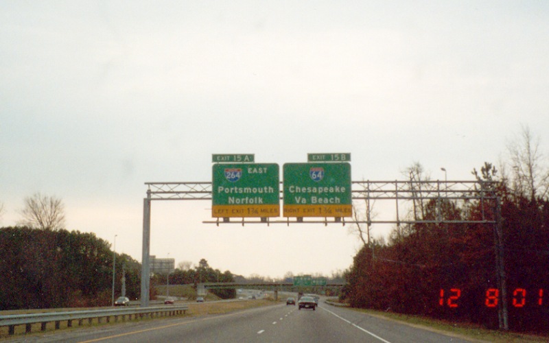
Advance guide signage for the I-64/264/664 interchange at Bower's Hill in Chesapeake. In the background are the VA 191 overpass and the exit ramp to US 13/58/460 West. Photo taken December 8, 2001. |
|
|
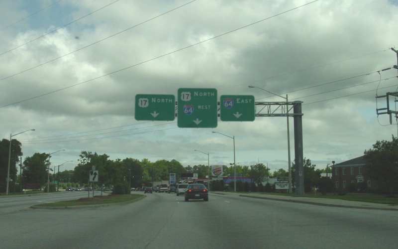
Northbound along US 17/J. Clyde Morris Blvd in Newport News, approaching the interchange with I-64. Photo taken May 26, 2003. |
|
|
"Southbound" US 258 (which is actually going northwest here) in Hampton at what used to be TRUCK VA 351, a way for trucks to avoid a restricted bridge on VA 351 over Hampton Creek. As of July, 2005, this was the only TRUCK VA 351 sign that remained. Photo taken December 9, 2001. |
|
|
Further along "Southbound" US 258 (now going westward) at Seldendale Dr. The bridge in the background is at LaSalle Ave, which used to be VA 167 before that route was decommissioned. Photo taken December 9, 2001. |
|
An old, likely pre-bypass guide sign along westbound Constance Rd (BUS US 13/58/460) in old town Suffolk. Since the Suffolk Bypass was built in the 1970s, what are listed as US 58 and US 460 in the guide signage have been BUSINESS US 58 and BUSINESS US 460 instead. US 13 was previously rerouted sometime in the 1980s before it too was moved to the bypass with the Southwest Suffolk Bypass opened in 2003. Also, both VA 10 and VA 32 go both north and south from the intersection. Photo taken October 23, 2002. |
|
|
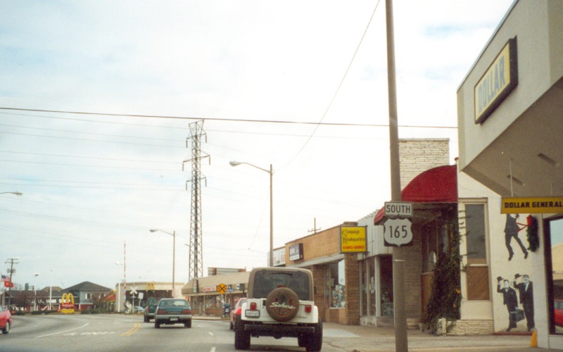
An error "US 165" shield along eastbound Little Creek Rd in the Wards Corner area of Norfolk. This error shield still existed as of July, 2005. Photo taken December 9, 2001. |
|
Two views of the VA 165 (Little Creek Rd) and VA 168 (Tidewater Dr) interchange in Norfolk. The interchange was built in the mid '50s along with most of Tidewater Dr north of this point, the goal being to serve Norfolk traffic going to/from the then-new Hampton Roads Bridge Tunnel. VA 168 has an underpass under VA 165, with access roads along the sides and a single traffic signal on VA 165 creating an ad-hoc SPUI interchange. The first photo is the view from westbound VA 165 with the second photo from along southbound VA 168. Top photo taken in mid-December, 2001, bottom photo taken December 9, 2001. |
|
|
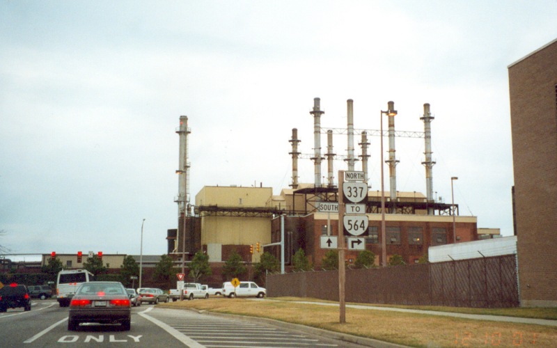
An error VA 564 shield, located on the road coming out of the Navy Exchange/Commissary area near the Norfolk Naval Base. The shield is supposed to be an I-564 shield, as I-564 begins about 300 feet to the right. The missing "South" shield is VA 337. Photo taken December 10, 2001. |
|
The eastern end of Hampton Roads Center Parkway at Armisted Ave. The modern version of 1960s-era plans for a route running from US 60 to VA 278, HRC Pkwy was built to serve commercial development off I-64 in Hampton, and includes one of the few SPUI interchanges in the region, where it crosses VA 134. Photo taken December 15, 2001. |
|
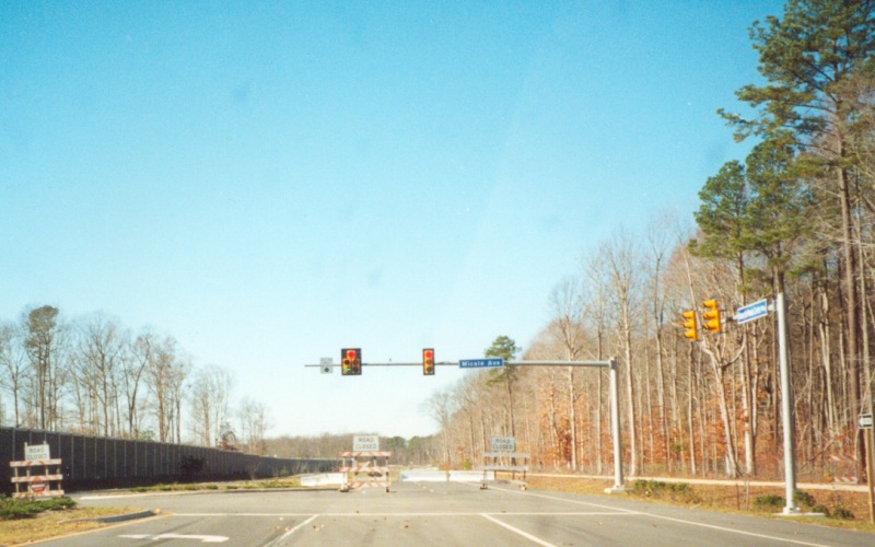
Westbound at Micale Ave at what was then the temporary western end of Hampton Roads Center Parkway. HRC Pkwy was completed to US 17/VA 143/Jefferson Ave sometime in 2002. Photo taken December 15, 2001. |
|
|
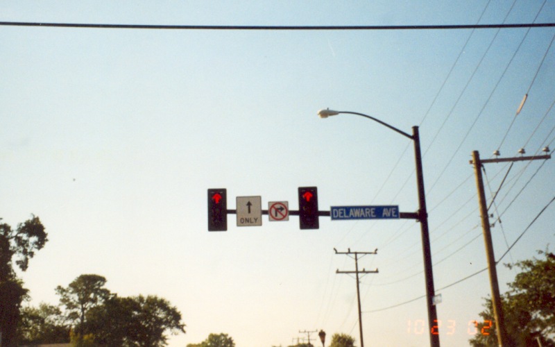
An odd traffic signal, where even the red lights are "straight ahead" arrows, located on southbound Llewellyn Ave at Delaware Ave in Norfolk. Photo taken October 23, 2002. |
Back to Froggie's Virginia Photos
![]()
Page last modified 02 April, 2006
(C) 2006 Adam Froehlig