


Interstate 264 in the Hampton Roads Area of Virginia
These photos detail out I-264 in the Hampton Roads area. All photos on this page were taken by Adam Froehlig.
Skip down to the westbound photos.
Eastbound Photos
|
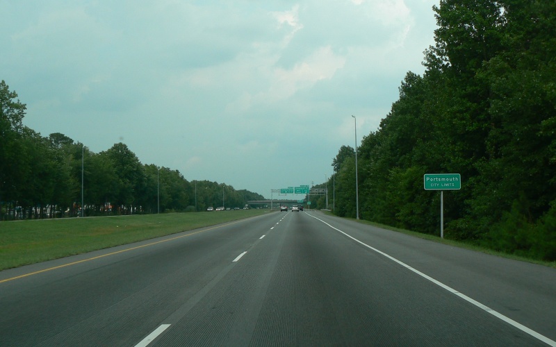
Just short of the Greenwood Dr interchange is the Portsmouth City Limits. Photo taken July 29, 2007. |
|
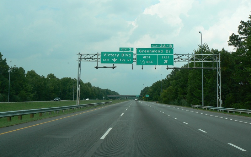
The Greenwood Dr interchange is the first interchange along eastbound I-264, and is for most intents a cloverleaf. Two errors on the overhead signage: first, it's barely 1/4 mile to the Greenwood Dr West ramp, and second, one wants to be in the right lane to get to Victory Blvd, not the left lane. Photo taken July 29, 2007. |
|
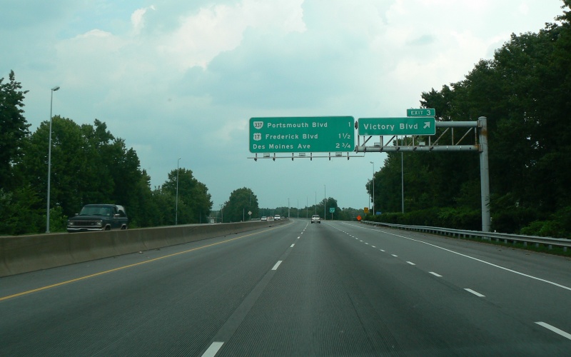
Exit ramp to Victory Blvd. Though unsigned here, Victory Blvd is also VA 239. Also note the grooved pavement that extends through the next few photos. Photo taken July 29, 2007. |
|
|
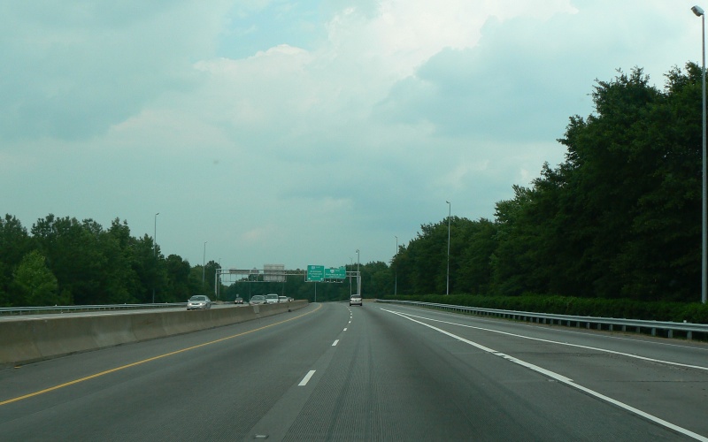
This on-ramp from Victory Blvd begins a short 6-lane section on I-264 that extends to just before the Downtown Tunnel. Photo taken July 29, 2007. |
|
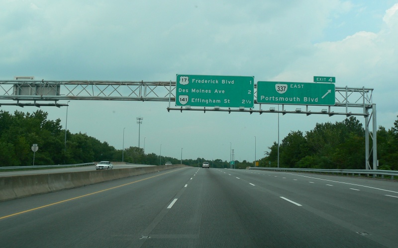
The I-264/VA 337 interchange is only a partial interchange, with EB-EB and WB-WB connections. Note the older-style and black-outlined shields on the "Next 3 Exits" sign. Photo taken July 29, 2007. |
|
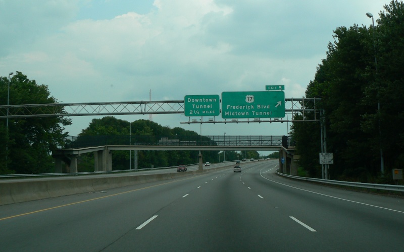
The exit to US 17. Given the lack of a direct connection between I-264 and the Midtown Tunnel, traffic wishing to use the Midtown Tunnel must exit here and use a series of city streets to access that tunnel. Photo taken July 29, 2007. |
|
Guide signage for the upcoming Des Moines Ave exit, as the onramp from US 17 merges in. Just beyond the curve is the general location where a direct connection from I-264 to the Martin Luther King Freeway and the Midtown Tunnel is proposed. Photo taken July 29, 2007. |
|
Exit 6 is a half-interchange to/from the west. Traffic from the Downtown Tunnel will often be congested and "backed up" to here. Photo taken July 29, 2007. |
|
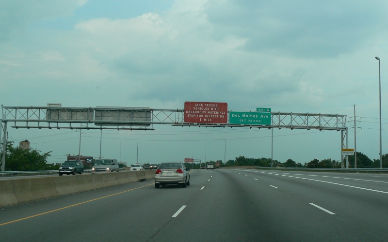
The first of two inspection stations along eastbound I-264, prior to the Downtown Tunnel. Photo taken July 29, 2007. |
|
|
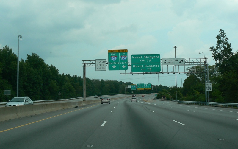
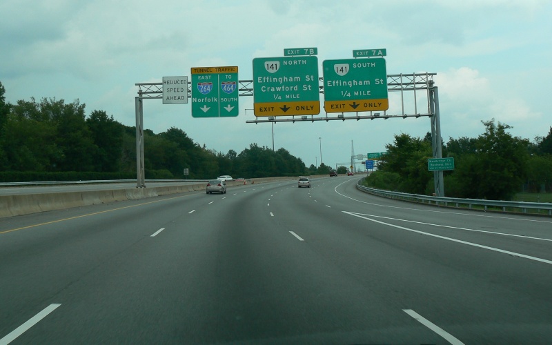
Guide signage noting the exits to VA 141 as well as which lane to be in to catch I-464. Photo taken July 29, 2007. |
|
This overhead signage marks the exit to VA 141 South, just a short distance beyond. Just beyond that is the exit to VA 141 North...the last exit before the Downtown Tunnel. Photo taken July 29, 2007. |
|
This is the last exit before the Downtown Tunnel, with streets leading into downtown Portsmouth. Photo taken July 29, 2007. |
|
The second of the two inspection stations. To the right is a split in the "last exit" from the photo above. Photo taken July 29, 2007. |
|
|
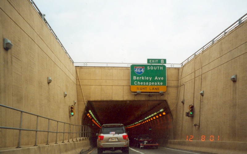
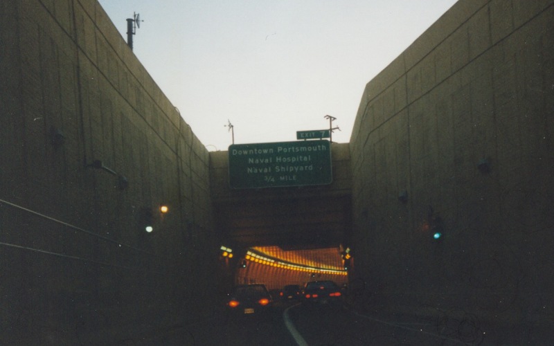
Entering the Downtown Tunnel into Norfolk. The I-464 interchange is just on the other side of the tunnel. Photo taken December 8, 2001. |
|
|
On top of the drawspan part of the Berkeley Bridge. Due to a number of factors (including the drawbridge itself), this part of I-264 is heavily congested for several hours each day. Photo taken December 8, 2001. |
|
Almost off the drawspan and where the right lanes split off to continue as I-264. Photo taken July 29, 2007. |
 |
Westbound I-264 in Virginia Beach, between the Rosemont Rd and Independence Blvd interchanges. The abandoned overhead sign was a warning sign for what used to be the mainline toll booth along the former VA 44 "Norfolk-Virginia Beach Toll Road". You can see the location of the paved-over toll booths in the asphalt pavement in the background. The tolls were removed in the mid-1990s, and the route became an extension of I-264 in 1999. Photo taken in early January, 2002. |
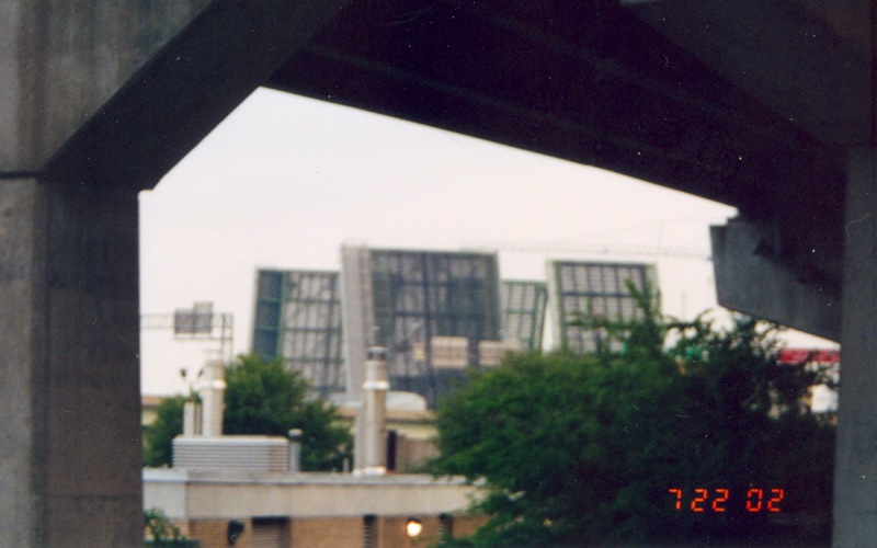 |
A view of an I-264 Berkeley Bridge raising, as seen from the westbound on-ramp from Tidewater Dr. Photo taken July 22, 2002. |
 |
Westbound on I-264, going the other direction into the Downtown Tunnel towards Portsmouth. Photo taken in late November, 1999. |
Back to Top of page
Back to Froggie's Virginia
Photos
![]()
Page last modified 07 August, 2007
(C) 2007 Adam Froehlig