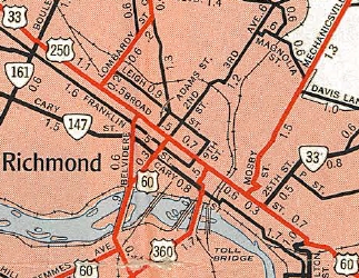
Official Maps 1947-61 not showing much more
1947 Official
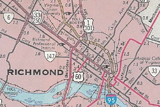
US 33/VA 33 depicted in 1961-74 Officials
1961 Official
US 33/VA 33 Transition (1950s-early 1960s)
Official State Maps
The 1947 Official shows US 33 on Broad west of VA 161, as well as on Staples Mill, and shows VA 33 on 25th/Nine Mile Rd. There are no other shields on Broad. This is shown on every issue through 1959.
Beginning with the 1961 Official, a US 33-250 shield is shown between VA 161 and US 1-301, then a VA 33 shield on 25th/Nine Mile Rd. This is shown on every issue through 1974.
 Official Maps 1947-61 not showing much more 1947 Official |
 US 33/VA 33 depicted in 1961-74 Officials 1961 Official |
VDOT County Maps:
The earliest Henrico County map I have after US 33's birth is from 1945. It explicitly shows US 250 on Broad between US 1 and US 60, but shows neither US 33 nor VA 33 on any part of Broad. This is true through 1957. The only change on the 1958 Henrico County map is that the US 250 shield is removed between US 1 and US 60.
Other Maps:
The 1962 Gen Drafting map shows VA 5-33 on Broad between US 360 and 25th, and no US 33 shield east of US 60, 2nd St.
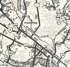 Henrico County maps ignore 33-250 on downtown Broad St 1958 Henrico County |
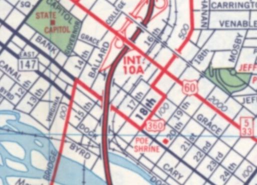 VA 5 and VA 33 shown on Broad St west to at least US 360. 1962 Gen Draft |
VDOT Route Logs:
Route logs up through 1957 do not differentiate US form state in their general listing. However, there is a separate US route listing section. Unfortunately, US 33's endpoint is described as just "Richmond".
By 1979 (next one up that I have), US 33 and VA 33 are both defined to end at US 360 (Broad and 17th). Oddly, US 250's endpoint is described as Broad at 23rd (US 60).
Some official route logs in the 1960s might be very instructive...
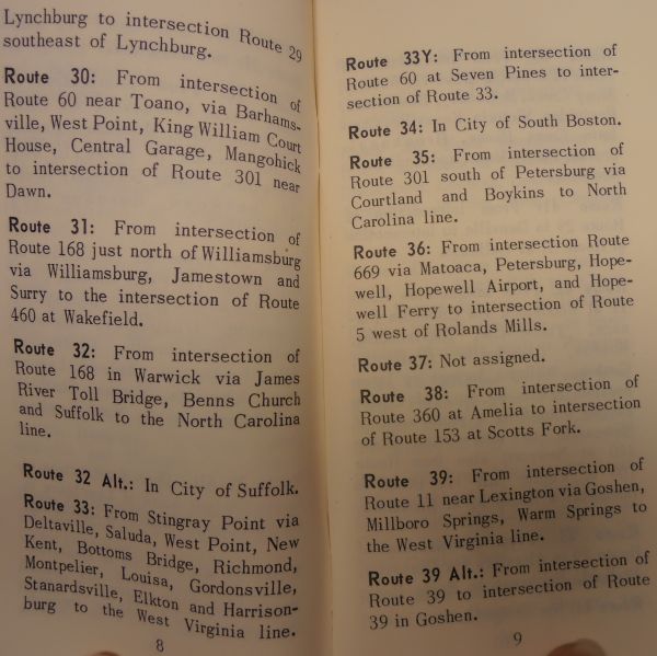 US 33 and VA 33 not differentiated 1957 Route Log |
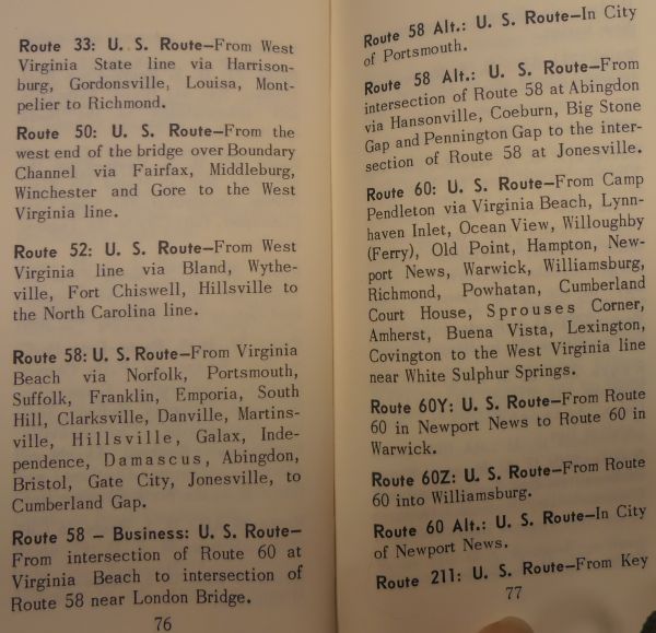 US 33 not specific enough 1957 Route Log |
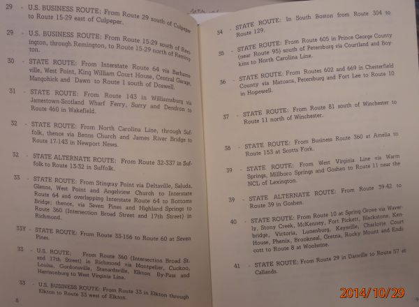 US 33 and VA 33 specifically defined 1979 Route Log |
CTB documents:
The earliest reference that seems to indicate where the transition might be is in the Sept 1959 CTB. While it describes "US and State route 33" in a way that reveals nothing, it does describe US 60 in part "...thence continuing northwesterly on Broad St overlapping State Route 33 from 25th St to 2nd St (end overlap)..."
Postings in the field:
In all the photos and linked photos, there are none I found that are clearly an error of US 33 or VA 33 posting where the other should have been present.
Here are 4 pictures that seem to support the theory that the posted transition was at Broad and Belvidere (where US 1-301 south left Broad) into the 1950s.
![]()
![]()
Page last modified 13 March 2015
(C) 2015-2008 Mike Roberson, Adam Froehlig