US 33/VA 33 depicted in 1961-74 Officials
1961 Official
US 33/VA 33 depicted in 1975-81 Officials
1975 Official
US 33/VA 33 Transition (mid 1960s-1981)
Official State Maps:
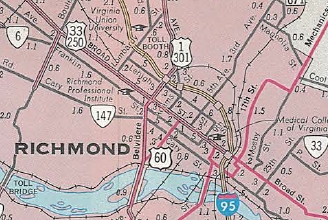
Beginning with the 1961 Official, a US 33-250 shield is shown between VA 161 and US 1-301, then a VA 33 shield on 25th/Nine Mile Rd. This is shown on every issue through 1974.
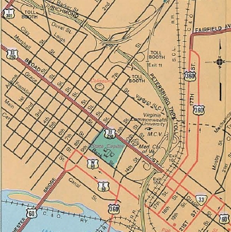
Beginning with the 1975 issue, a downtown inset of richmond was included. A US 33-250 shield is shown on Broad between 9th St and I-95, while a VA 33 shield is shown on Broad between US 360 (18th) and US 60 (21st). This is shown on every issue through 1981.
|
US 33/VA 33 depicted in 1961-74 Officials 1961 Official |
US 33/VA 33 depicted in 1975-81 Officials 1975 Official |
VDOT County Maps:
The 1969 Chesterfield County map shows only US 250 on Broad; the 1969 Henrico County map shows US 33-60-250 on Broad between 5th and 9th and only US 33-60 immediately west of I-95.
The 1975 Henrico County map shows a US 33-250 shield on Broad immediately west of I-95.
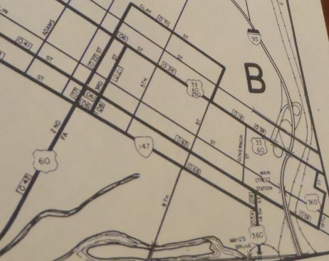 US 33-60-250 overlay shown 1969 Henrico County |
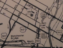 US 33-250 on Broad St near I-95. 1975 Henrico County |
VDOT Route Logs:
Route logs up through 1957 do not differentiate US form state in their general listing. However, there is a separate US route listing section. Unfortunately, US 33's endpoint is described as just "Richmond".
By 1979 (next one up that I have), US 33 and VA 33 are both defined to end at US 360 (Broad and 17th). Oddly, US 250's endpoint is described as Broad at 23rd (US 60).
 US 33 and VA 33 not differentiated 1957 Route Log |
 US 33 not specific enough 1957 Route Log |
 US 33 and VA 33 specifically defined 1979 Route Log |
CTB documents:
There are no CTB documents in this time period that give any indication where the transition point was. Based on county maps and changes in postings, the transition point appears to have been moved eastward to US 360, although postings show it to actually be at 25th St (VA 5-33 jct).
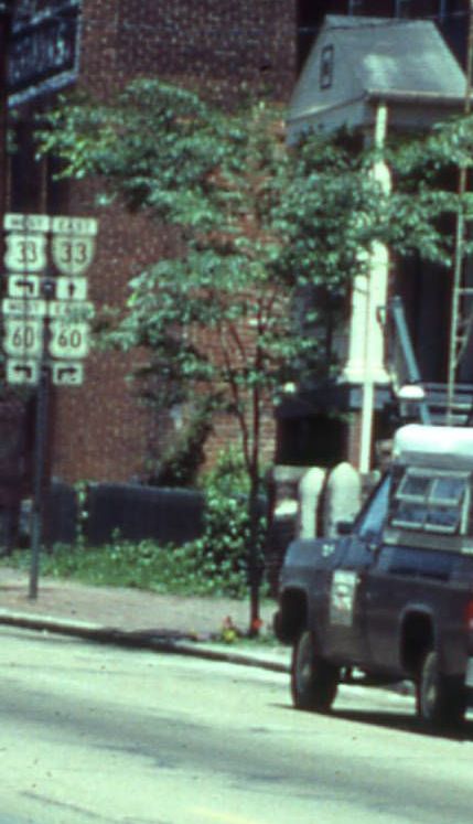
Postings in the field:
The field postings of the transition do not match the officially designated location of the transition:
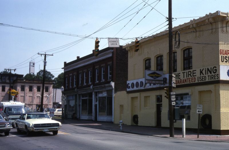
Here are two pictures of a posted US 33-VA 33 transition at 25th and Broad from the 1970s
 VA 5 on 25th St north approaching Broad St in 1979. photo courtesy of Virginia Commonwealth University Libraries |
 US 60 on Broad St west approaching 25th St in 1975. photo courtesy of Virginia Commonwealth University Libraries |
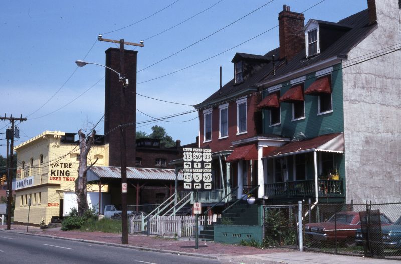 18th St north approaching Broad St in 1979. photo courtesy of Virginia Commonwealth University Libraries |
 Broad St east at 18th St in 1975. photo courtesy of Virginia Commonwealth University Libraries |
 Broad St west leaving US 360 in 1972. photo courtesy VDOT |
 Broad St east at 10th St in 1975. Despite the TO US 250 overhead, there is a US 250 west shield under the US 33-60 assembly. This is the furthest east I've seen a US 250 shield on Broad St photo courtesy of Virginia Commonwealth University Libraries |
This 1961 photo from the Richmond-Times Dispatch shows Franklin St east at 18th. The overheads show VA 33 which is consistent with the 1960 picture of 25th and Broad showing VA 33 continuing onto Broad from 25th.
 Franklin St at 18th in 1978. No route 33 shield is present at this point... photo courtesy of Virginia Commonwealth University Libraries |
 Franklin St at 15th in 1972. I-95 is directly behind this shot and it is no longer possible to drive under the railroad trestle today. photo courtesy VDOT |
![]()
![]()
Page last modified 24 March 2022
(C) 2022-2008 Mike Roberson, Adam Froehlig