 |
From:  Rock Hill (York County) Rock Hill (York County)
To: S-46-654 east Rock Hill (York County)
Total Length: 6.3 miles
|
|
|
|
|
ROUTE LOG
SC 72: 0 - 0
US 21, SC 121: 2.7 - 2.7
I-77 (exit 79): 1.4 - 4.1
END SC 122: 1.6 - 5.7
|
|
Creation: SC 122 appeared in 1975 as new primary routing, running from I-77 west to SC 72 Bus (now SC 72) Rock Hill. This is the 2nd SC 122.
Adjustments: In 2001, SC 122 was extended east as new primary routing to its current end at S-46-654 Waterford Park Dr.
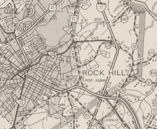
SC 122 from I-77 to downtown Rock Hill
1976 York County
|
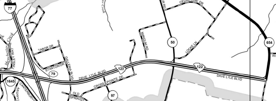
SC 122 extended east to S-46-654
2013 City of Rock Hill
|
Improvements: Paved and multilaned upon designation;
Comment: SC 122 provides a direct link from I-77 to downtown Rock Hill.
The SCDOT website has shown in the past future plans to extend SC 122 east to US 521.
|
| Previous SC 122's:
1947 ROUTE LOG
SC 2: 0 - 0
US 1, US 21, SC 2, SC 5, SC 43, SC 215: 1.4 - 1.4
|
|
SC 122 #1: Appeared in 1942, running as new primary routing from SC 2 Cayce northeast to US 1-21/SC 2-5-43-215 at the Congaree River Bridge.
In 1947, SC 122 was downgraded to S-32-56. Today it is S-32-182 Clark St; S-32-140 Lorick St; S-32-56 Axtell Dr/Alexander Rd
|
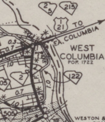
SC 122 out of Cayce
1942 Lexington County
|
|