< 720 to 759 | Home | 780 to 799 >
|
|
|
| ROUTE LOG |
US 76, US 378, SC 16: 0 - 0 I-77 (exit 10): 1.1 - 1.1 FT JACKSON GATE: 0.1 - 1.2
|
Creation: Opened as new state route in 1939. Originally ran from US 76 east along the northern boundary of Fort Jackson at that time, out to 8 miles.
| Adjustments: In 1940, SC 760 east was truncated to run just 4 miles. The easternmost 4 miles became part of an extended SC 12. SC 760 was truncated back to the expanded Fort Jackson boundary where it is today in 1953. Improvements: Fully paved since 1940; Multilane by 1964. Comment: SC 760 is Fort Jackson Blvd, a main thoroughfare to reach the Army post.  |
|||||||||
| SC 761 not currently assigned | ||||||||||||||||
| Previous SC 761's: |
SC 761: Appeared in 1940 as new primary routing. Ran from US 276 (current SC 14) west of Laurens to US 221 Watts Mill.
In 1941 or 1942, SC 761 was extended north from US 221 to end at SC 308, making a total length of 6 miles. In 1948, SC 761 was downgraded to S-30-24 and S-30-31. | 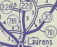 |
||||||||||||||
| SC 762 not currently assigned | ||||||||||||||||
| Previous VA 762's: |
SC 762: Appeared in 1940 as new primary routing. Ran from US 76 to SC 7 (current SC 72) southwest of Clinton.
In 1941 or 1942, SC 762 was extended at its US 76 end by making a loop west back around to US 76 about halfway between Clinton and Laurens. The 7 miles of SC 762 were downgraded in 1948 to parts of 3 secondary routes: S-30-35, S-30-43, and S-30-46. |  |
||||||||||||||
|
|
|
| ROUTE LOG |
SC 261: 0 - 0 SC 441: 8 - 8 SC 120 SB: 0.3 - 8.3 SC 120 NB: 0.7 - 9 US 15-521 CONN: 0.8 - 9.8 US 76 Bus WB, US 521: 0.9 - 10.7 US 15: 0.5 - 11.2 US 76 Bus EB: 0.5 - 11.7 US 378: 2.2 - 13.9
|
Creation: Appeared in 1928. Originally ran from US 76 Sumter northeast via Elliott and Lamar to SC 34-35 (current SC 34-151) Darlington. This was a renumbering of the original SC 412.
| Adjustments: In 1940, SC 763 west was extended to SC 261 Wedgefield as new primary routing. This brought SC 763 to a maximum length of 50 miles. In 1954, all of SC 763 east of US 76 Bus-US 521 was renumbered as US 15 ALT (today this is US 401). Sometime after 1973 (Sumter insets disappeared from official maps in the 1970's), SC 763 east was extended out to its current end at US 378, replacing what had been US 378 Business through Sumter. Improvements: Fully paved since 1939. Mulitlaned in Sumter. Comment: SC 763 was the highest number in use when created in 1928 until SC 901 came along. 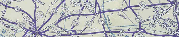
|
|||||||||
|
|
|
| ROUTE LOG |
US 601: 0 - 0 SC 263: 2 - 2 US 76, US 378: 7.2 - 9.2
|
Creation: Appeared in 1941 or 1942. Ran as it does today. From Westover south to US 601 had been part of SC 263 (and SC 26 and SC 52 before that), the rest was new primary routing.
| Adjustments: None Improvements: Fully paved upon creation. Comment: SC 764 cutsoff a few miles between US 76-378 and US 601, but not many people would be making that general movement anyway (would use SC 48 instead). |
|||||||||
| SC 765 not currently assigned | ||||||||||||||||
| Previous SC 765's: |
SC 765: Appeared in 1941 or 1942 as new primary routing. Ran from US 76 near the North Rabon Creek bridge north 6 miles to SC 101 near Gray Court.
In 1948, SC 765 was downgraded to S-30-32. |  |
||||||||||||||
| SC 766 not currently assigned | ||||||||||||||||
| Previous SC 766's: |
SC 766: Appeared in 1941 or 1942 as new routing. Ran from US 221 Laurens in a S-E 'L' 4 miles towards SC 762 (current S-30-43).
In 1948, SC 766 was downgraded to S-30-42 and S-30-37. |  |
||||||||||||||
| SC 767 not currently assigned | ||||||||||||||||
| Previous SC 767's: |
SC 767: Appeared in 1941 or 1942 as new primary routing. Ran from US 76 west of Mullins east into Mullins, then jogged north with SC 57 (current SC 41-917) a bit, then east 3 miles to today's S-33-60/309 jct. for a total of 5 miles.
In 1948, SC 767 was downgraded to part of S-33-41 and S-33-60. | 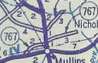 |
||||||||||||||
|
|
|
| ROUTE LOG |
SC 48: 0 - 0 I-77 (exit 6): 1.8 - 1.8 US 76, US 378: 3.3 - 5.1
|
Creation: Appeared between 1980-82 as upgraded routing. Ran as it does today. This is the 2nd SC 768.
| Adjustments: None Improvements: Fully paved and multilane at creation Comment: SC 768 is one large zig-zag using S. Belt Blvd., Shop Rd, and Pineview Rd. SC 768 is the highest number in S.C. to have been used twice. | Previous SC 768's: |
SC 768 #1: Appeared in 1941 or 1942 as new primary routing. Was a spur off US 76 (right at SC 576 split) west of Marion, running south for 4 miles into the Pitch Pot Swamp.
In 1948, SC 768 was downgraded to S-33-25. |  |
||||||
|
|
|
| ROUTE LOG |
SC 48: 0 - 0 US 76, US 378: 9.7 - 9.7
|
Creation: Appeared in 1949 as resurrected primary routing. Ran as it does today.
| Adjustments: SC 769 originally appeared in 1941 or 1942 as new primary routing, also running as it does today. In 1948, SC 769 was downgraded to secondary status. Improvements: Fully paved back to original creation. Comment: SC 769 is a rare instance of a paved primary route being downgraded in the 1948 denumbering.  |
||||||
| SC 771 not currently assigned | |||||||||||||
| Previous SC 771's: |
SC 771: Appeared in 1941 or 1942 as new routing. Ran as a 3 mile cutoff between SC 432 (current S-35-21) and SC 43 (current US 378) in eastern McCormick County.
In 1948, SC 771 was downgraded to S-35-42, half of which remains unpaved today... |  |
|||||||||||
| SC 772 not currently assigned | |||||||||||||
| Previous SC 772's: |
SC 772: Appeared in 1941 or 1942 as new primary routing. Ran from SC 9 (curr. SC 9-912 jct) north to SC 77 (current SC 177).
In 1948, the 7 miles of SC 772 were downgraded to S-34-30. Note that today SC 772 ended at today's SC 177 jct with S-34-37. S-34-30 cuts west a half mile or so short of this location today, leaving an unnumbered dirt road where SC 772 went. |  |
|||||||||||
|
|
|
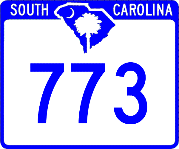
| ROUTE LOG |
US 76: 0 - 0 I-26 (exit 82): 2.1 - 2.1 US 176: 3.4 - 5.5
|
Creation: Resurrected as a state route in 1951 or 1952, running as it does today.
| Adjustments: Originally appeared in 1941 or 1942 as new primary routing. Ran as it does today, plus 4 more miles east to end at SC 329 (current S-36-28). In 1948, all of SC 773 was downgraded, presumably to S-36-33. Improvements: Fully paved since resurrection. Oddly, the part that remained secondary was paved in 1942 while the other half was not. Comment: SC 773 is the best method to get from I-26 to Prosperity. Also, the second largest Jockey Lot in SC is at the exit.  |
||||||
| SC 774 not currently assigned | |||
| Previous SC 774's: |
SC 774: Appeared in 1941 or 1942 as new primary routing in northeast Pickens County. Ran from SC 186 to the Saluda River (Greenville County Line), a distance of 4 miles.
It is unclear if SC 774 was extended the short distance north to SC 288 before it was downgraded in 1948, to S-39-26. |  |
|
Last Update: 25 December 2004
Previous: SC 720 - 759 |
Next: SC 780 - 799
Top | South Carolina Hwy Index
Home