< US 45W | Home | US 51 Bus | US 51 Byp | US 58 >
| |||||||||||||
| ROUTE LOG MS STATE LINE: 0 - 0 TN 175: 1.8 - 1.8 I-55 (exit 5): 2.9 - 4.7 US 78, TN 4: 4.6 - 9.3 US 64 EB, US 70 EB, US 72, US 79 NB, TN 23: 0.6 - 9.9 I-240 (exit 30): 0.2 - 10.1 US 64 WB, US 70 WB, US 79 SB, TN 1 WB, TN 3 NB, TN 4 EB: 1.3 - 11.4 I-40 (exit 1): 0.8 - 12.2 TN 1 EB: 0.4 - 12.6 TN 14: 0.05 - 12.65 TN 3 SB, TN 4 END: 0.55 - 13.2 TN 300: 2.5 - 15.7 TN 388: 2.9 - 18.6 TN 385: 8.4 - 27.0 TN 205: 1.0 - 28.0 Tipton-Shelby Line: 4.8 - 32.8 TN 178: 2.7 - 35.5 TN 206: 2.3 - 37.8 TN 59 EB: 9.5 - 47.3 TN 54, TN 59 WB: 2.0 - 49.3 TN 384: 1.1 - 50.4 Lauderdale-Tipton Line: 4.4 - 54.8 TN 209: 1.7 - 56.5 TN 87: 1.5 - 58.0 TN 19 EB: 3.9 - 61.9 TN 19 WB: 1.7 - 63.6 TN 208: 0.9 - 64.5 TN 180: 7.4 - 71.9 TN 88: 3.2 - 75.1 Dyer-Lauderdale Line: 4.7 - 79.8 US 51 Bus, TN 211: 4.4 - 84.2 TN 104: 2.3 - 86.5 TN 78: 1.9 - 88.4 US 51 Bus, TN 211: 1.7 - 90.1 US 412 EB, TN 20: 1.6 - 91.7 I-155 (exit 15), US 412 WB: 0.5 - 92.2 TN 77: 5.0 - 97.2 TN 105: 7.2 - 104.4 Obion-Dyer Line: 0 - 104.4 TN 183: 4.0 - 108.4 TN 183: 5.1 - 113.5 TN 21 SB: 1.2 - 114.7 TN 21 NB: 0.4 - 115.1 TN 690: 4.6 - 119.7 TN 184 WB: 2.1 - 121.8 TN 184 EB, TN 431: 0.2 - 122.0 TN 5, TN 22 NB: 0.8 - 122.8 TN 21: 2.6 - 125.4 US 45W SB, TN 22 SB: 1.8 - 127.2 TN 690: 2.3 - 129.5 TN 214: 4.9 - 134.4 US 45 SB, US 45E, US 45W END, TN 3 NB, TN 215 SB: 0.3 - 134.7 KY STATE LINE: 0.2 - 134.9 |
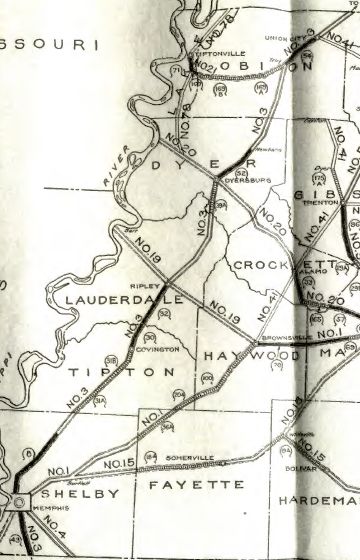
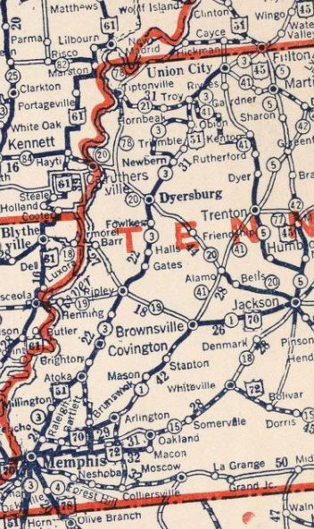
Creation: An original US route, which in late 1926 ran generally as it does now. US 51 was added to the entirety of TN 3.
Adjustments: About 1927 (bridge date), US 51 was removed from Kerrville-Rosemark Rd into Kerrville; Old Tipton Rd/Merritt Rd/Meade Lake Rd to Atoka; Main St out of Atoka In 1928, US 51 was given a direct routing over the Obion River from Trimble to Obion. The original route used Lanes Ferry Rd out of Newbern; Millsfield Hwy/Cloverdale Rd to Elbridge; Obion Rd/current TN 183 to Obion.
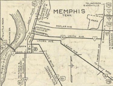
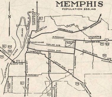
About 1933 (bridge date), US 51 was removed from Millington Rd through Frayser, Overton which no longer connects to Old Millington Rd through Woodstock to nearly Millington. In 1935 (bridge date), US 51 was removed from 2nd St/Whitney Ave north out of Memphis and moved to Chelsea Ave and current US 51 across the Wolf River. Not long after TN 3A's creation in 1935-36, US 51 was rerouted in Memphis from about Graceland northward. It was added to TN 3A on Elvis Presley Blvd/Bellevue Blvd, then followed US 78 west on Lamar Blvd, Somerville St (now Dr. King Blvd) and Linden Blvd back to 2nd St downtown. The old routing remained part of TN 3 until it was from the state highway system around 1940. Today it is Old Hernando Rd below I-55/Brooks; Hernando Rd/abandoned between I-55 and I-240; Hernando Rd along east side of I-55 until a little past Person Ave, then Mississippi Ave and Butler Ave. Although most maps are vague about this move, photos from the 1930s-50s show US 51 duplexed with US 78.
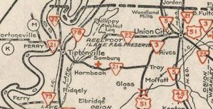
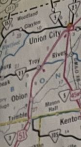
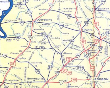
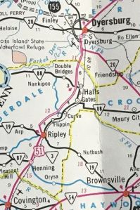
It is unclear when US 51 was removed from Fisher Rd and Jack Crutcher Rd at the Hatchie River (no crossing there now), but it was by 1938. About 1938, US 51 was placed on a newly constructed alignment from Henning to Ripley (along today's TN 209). The old road is mostly abandoned alignments except the disconnected Jefferson St alignments approaching Ripley, plus a bit of Highland and Main within Ripley. About 1960, US 51 was removed from Main St into Troy; today's TN 184 from Troy to Union City
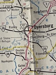
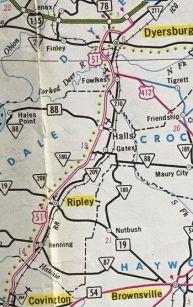
About 1964, US 51 was removed from today's TN 210 from Halls north through Fowlkes. TN 3 used TN 88 between the old and new alignments. About 1965 (bridge date), US 51 was removed from Old Highway 51 through Brighton. In the mid 1960s, US 51 was removed from today's TN 209 from Ripley to Gates; TN 88 Gates to current US 51. US 51 was now using today's TN 208 between old and new alignments. In response to the 1968 Federal Highway Act, Tennessee requested an interstate corridor along US 51 from Memphis to S. Fulton. This was not approved. Between 1965-71, US 51 was rerouted in Memphis to stay on Bellevue past US 78 to US 64-70-79 Union, then Union to Thomas Blvd north out of town. The old routing is US 78, a bit of TN 14 and TN 3. Around 1970, US 51 was placed onto the original Union City TN 3 bypass around the south and east. The old route through Union City was TN 21 and today's TN 214. About 1973, US 51 was removed from today's TN 209 from Henning to Ripley and today's TN 208.
About 1980, US 51 was removed from today's TN 211 from northern Dyersburg to Trimble; Old State Hwy 3; now-abandoned causeway over the Obion River; 7th St in Obion; Today's TN 183 north to Troy. Also about 1980, US 51 was removed from today's TN 214 between Union City and South Fulton. It is unclear when but by 1983, US 51 was placed on the TN 3 Dyersburg Bypass, leaving behind US 51 Bus. Also by 1983, US 51 was placed on its current Union City routing, leaving behind TN 184. In June 1989 (AASHO), US 51 was rerouted at S. Fulton to bypass around the west, replacing US 51 Byp. The road northeast to Fulton KY remains part of US 45. Posting: Fully posted Secret TN Route Overlay: TN 3 I (11.4 mi) TN 4 (1.8 mi) TN 3 II (121.5 mi) TN 215 (0.2 mi) Comment: US 51 is the main artery up the Tennessee side of the Mississippi River to Dyersburg, then an important corridor northeast of that. If I-69 ever gets fully built in Tennessee this will change all that. US 51 runs right by Graceland, home of Elvis Presley. | ||||||||||||
Previous: US 45W |
Next: US 51 Bus | US 51 Byp | US 58
Top | Tennessee Hwy Index
Home
Page last modified 24 November 2024
