N.C. 49
< 48 | Home | 49-A | 50 >
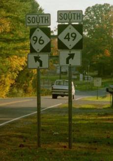
Photo: NC 49 beginning, with a quick separation from NC 96 (Jimmy Storey)
| N.C. 49 174 miles | |||
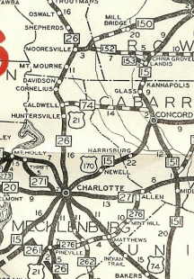
| The Road: | Begins at the South Carolina State Line at Lake Wylie (Mecklenburg County) and ends at the Virginia State Line at Virgilina (Granville County). The route continues 77 miles as SC 49 ending at US 221 Watts Mills, SC and 65 miles north as VA 49 ending at US 360 Jennings Ordinary, VA. | Towns and Attractions: | Mecklenburg Co.: Lake Wylie, Charlotte, UNC-Charlotte
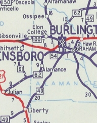
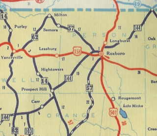
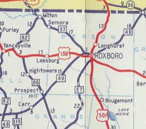
Cabarrus Co.: Harrisburg, Mt. Pleasant Stanly Co.: Richfield Davidson Co.: None Randolph Co.: Asheboro, Ramseur, Liberty Alamance Co.: Graham, Haw River Orange Co.: None Person Co.: Roxboro Granville Co.: None |
History: |
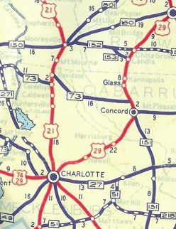
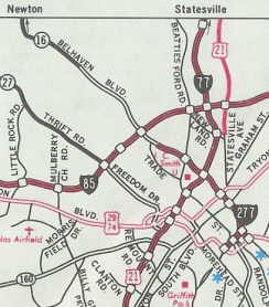
NC 49 was born in late 1934 as a renumbering of NC 15 southwest of Charlotte. NC 49 began at Tryon at Morehead where it met US 21-29-74 and NC 27, heading southwest out of town on Tryon St.
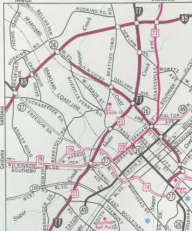
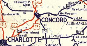
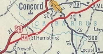
NC 49 (still with US 29) used Old Concord Rd through Newell, then Old Charlotte Rd into Concord. From Concord NC 49 left US 29 and duplexed with NC 73 east to Mt. Pleasant. In 1953, NC 49 was given its modern routing bypassing Concord and avoiding NC 73 altogether. Additionally, NC 49 was given its current bypass routing of Newell.
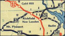
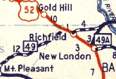
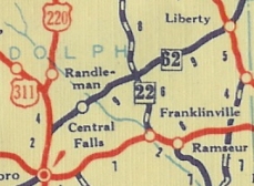
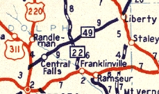
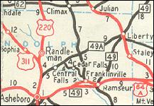
NC 49 then replaced NC 62 essentially along today's NC 49 to US 52, then duplexed with US 52 east to Richfield, then north on Main St back to today's 49 across the Yadkin River. About 1947, NC 49 was taken off the US 52 duplex in Richfield onto today's 49 routing.
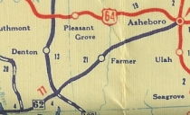
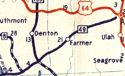
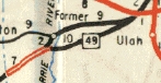
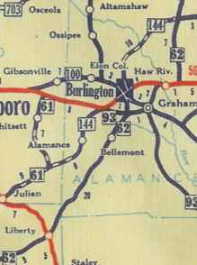
NC 49 replaced NC 62 from Liberty through Graham and Haw River and up to Pleasant Grove. It appears NC 49 used today's 49 for all of this, except right at Pleasant Grove NC 49 actually intersected NC 62 instead of the near miss that both routes exhibit today. The first official map to show this change was between 1991 and 1993 but I'm just about positive it was already changed when I drove NC 49 end-to-end in 1988, so I really can't say when it was altered.
NC 49 replaced NC 144 from Pleasant Grove through Roxboro to Virgilina. It used today's 49 except when it got to US 158 in Roxboro it crossed it, using Morgan St through town, then hooking up with US 158-501 (via Reames St) which was still using Main St. NC 49 seems to have used today's 49 from Roxboro to Virginia. In 1949, NC 49 did not go to Main St but instead cut north on the new Madison Blvd. It looks like NC 49 stopped using Morgan St and instead duplex with US 158 east to Madison between 1961-62.
|
Comments: |
NC 49 is one of three NC state highways that involve three states (along with NC 16 and NC 28). NC 49 is a major through route from Charlotte to Asheboro and is multilaned along some of that stretch. NC 49 is the last route I ever saw a diamond cutout in person, in the late 80's SB at I-77. Of course the only other one I ever saw was on NC 226-A. |


Last Update: 6 March 2008
Previous: N.C. 48 | N.C. 49-A
Next: N.C. 50
Top | NCRoads.com
Home