N.C. 60
< 59 | Home | 61 >
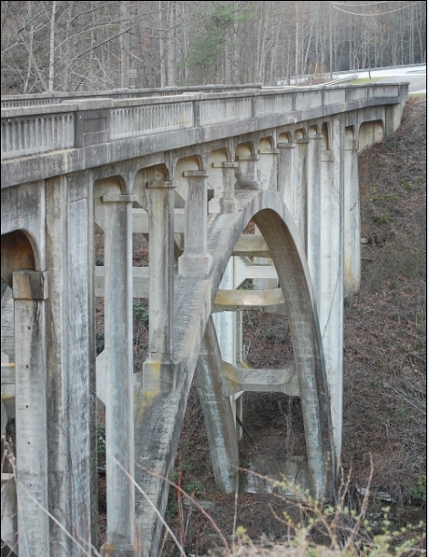
Photo: A well-preserved bridge from 1930 on an old piece of NC 60 (James A Roberson)
| N.C. 60 5 miles | |||
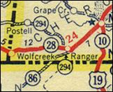
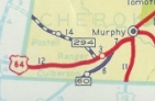
| The Road: | Begins at US 64-74 near Ranger and ends at the Georgia State Line at Culberson, all within Cherokee County. The route continues 8 more miles as GA 60 SPUR to end at GA 60 Mineral Bluff, GA. | Towns and Attractions: | Cherokee Co.: Nantahala National Forest | History: |
NC 60 was born as part of the great renumbering in late 1934 as a renumbering of a piece of NC 294. Since the majority of 294 remained numbered as such, it is unclear why this renumbering was undertaken as the Georgia side was GA 86.
Between 1945-49, NC 60 was extended from Die Bend Rd to its current endpoint, as US 64 was rebuilt through here. NC 60 really hasn't changed any further except it was multilaned in 2000.
The first NC 60 was an original state highway running from NC 40 (current US 117) Castle Hayne all the way to the Tennessee State Line northwest of Boone. In 1930 NC 60 picked up US 421 from Boone to Greensboro and in 1931 US 421 picked up NC 60 all the way to Castle Hayne. West of Boone NC 60 picked up US 321 in 1930 as well.
NC 60 began at the Tennessee Line at Zionville in Watauga County, and proceeded on "old US 421" south through Mabel, Mast and Amantha before using US 321 south from Sugar Grove. NC 60 then used current US 321-421 over to Boone.
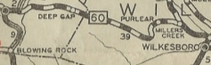
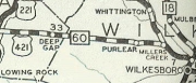
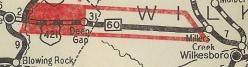
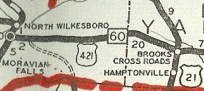
After picking up NC 16, NC 60 followed today's "Old US 421" (Boone Trail) to Cricket, then Forrest Ave east into North Wilkesboro. NC 60 then headed south on today's NC 18-268 to Wilkesboro, then used Main St-Old US 421 to exit town to the east.
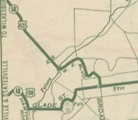
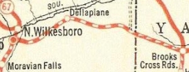
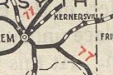
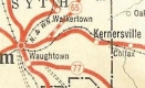
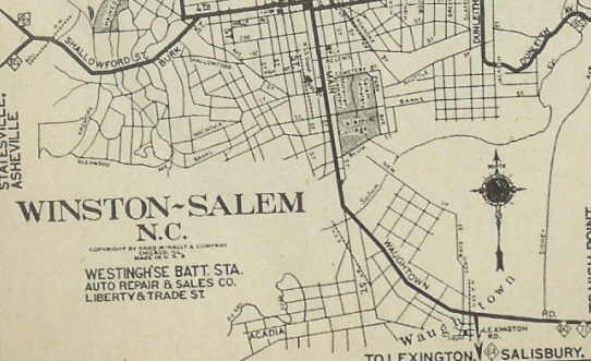
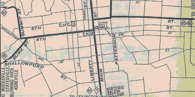
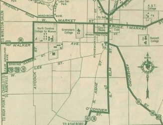
From Brooks Crossroads (NC 26 then), NC 60 followed Main St through Brooks Crossroads and Branon, then continuing on Main St through Yadkinville. From there, NC 60 followed East Main St which becomes Yadkinville Rd all through Yadkin County, crossing the Yadkin River after passing through Enon. In Forsyth County the road continues as Yadkinville Rd until it meets today's NC 67 near Old Town. NC 60 originally entered Winston-Salem via Reynolda Rd then cut south on Stratford Rd NW over to 1st St. NC 60 then angled northwest on Burke St to 4th St which NC 60 followed east to Main St, which NC 60 followed south. NC 60 then followed Waughtown Rd east to Kernersville Rd to go to Kernersville. In 1926, NC 60 was rerouted to follow Reynolda Rd to Summit St south to 4th, then to Main St where it went north to 5th (which had been NC 65 up to then) and followed 5th out of town. NC 60 then followed Old Greensboro Rd, then Mountain Rd through Guthrie to Talleys Crossing. From there, NC 60 followed today's NC 66 to Kernersville. The old route to Kernersville became part of NC 77; Kernersville Rd became secondary, although was later NC 771.
By 1932, NC 60 moved off Summit to 4th and instead used West End Blvd, then Broad St, then looped east to 5th St.
NC 60 altered in western W-S 1932 Texaco
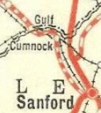
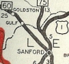
NC 60 followed today's Liberty Rd to Julian, then continued southeast on "Old 421 Road". Near Liberty, it followed Greensboro Rd and S. Fayetteville St, before exiting to the southeast on yet another "Old 421 Rd." NC 60 went through Staley and Siler City on this road. Just before this road meets back up with modern US 421, NC 60 headed out on "Old US 421" to the communities of Bonlee and Bear Creek. NC 60 continued to Main St through Goldston, then Murchison St through Gulf. It then picked up R. Jordan Rd east to cross the Deep River on Cumnock Rd which it followed back to modern US 421. NC 60 moved to the modern US 421 corridor to cross the Deep River about 1930.
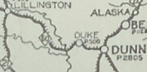
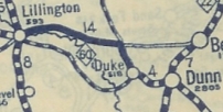
NC 60 followed modern US 421 into Sanford on Horner Blvd. NC 60 veered onto S. Lee St to go to Jonesboro Heights, then followed today's NC 78 and NC 42 east to Broadway Rd. NC 60 headed east on Broadway Road to Main St through Broadway, which turns into Seminole Rd at the Harnett County Line. NC 60 picked up modern 421 again until the settlement of Ryes, where it veered south on "old US 421" to Arlington and Mamers. It appears this route met up with today's NC 27 to enter Lillington, then followed Main St north over the Cape Fear River. NC 60 followed US 421 to Buies Creek and used Leslie Campbell/Marshbanks through Buies Creek. NC 60 used modern 421 to Erwin, then Erwin Rd to get to Dunn. The 1922 Auto-trails Map shows NC 60 staying south of the Cape Fear River along Ross Rd, Titan Roberts Rd and Bunn-Level-Erwin Rd and using NC 217 into Erwin.
From Dunn, NC 60 more or less followed today's 421 through Spiveys Corner and down towards Clinton, except a short old US 421 loop near the Sampson-Harnett Line and Kitty Fork Rd through Kitty Fork. NC 60 used McKay Rd and Lisbon Av to go through Clinton, then followed today's US 701 Bus back down to today's US 421.
|
Comments: |
NC 60 today is posted as the way to get from Asheville to Atlanta via US 74 and NC 60, in a corridor that uses US 76, GA 5, and I-575 in Georgia. The original NC 60 was shown on the '29 Official as 333 miles long. |
Last Update: 21 October 2025
Previous: N.C. 59
Next: N.C. 61
Top | NCRoads.com
Home