N.C. 75
< 74 | Home | 77 >
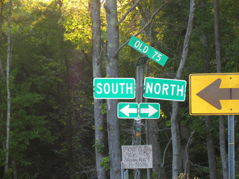
Photo: Old NC 75 is prominently posted, even 85 years after it stopped being NC 75 (Adam Prince)
| N.C. 75 13 miles | |||
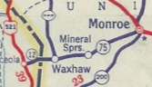
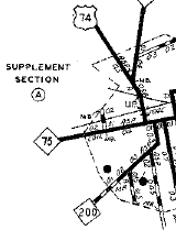
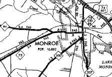
| The Road: | Begins at NC 200 west of Monroe and ends at the South Carolina line west of Waxhaw, all within Union County. The route continues several miles as SC 75 to end at SC 5 at the Catawba River. | Towns and Attractions: | Union Co: Waxhaw, Monroe |
History: |
NC 75 was born in late 1934 as a renumbering of NC 25. It ran from Monroe to South Carolina as it does now. Initially, the east end was at US 74/NC 151 at the intersection of Charlotte Av and Franklin (as it ends now).
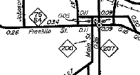
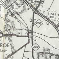
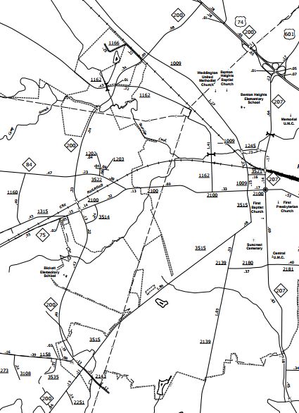
In December 1978 (NCDOT), NC 75 was truncated back to Franklin/Charlotte intersection in Monroe. In August 2011 (NCDOT), NC 75 was supposed to have been extended north on Charlotte St and east on Church St, replacing NC 200 to NC 207. However, it appears what happened instead is that NC 75 east was truncated back to the newly designated NC 200 along Martin Luther King Jr Blvd west of Monroe. Franklin St is now SR 2100; Charlotte St is SR 1009; Church St is SR 3521.
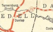
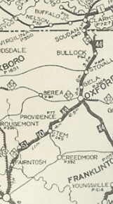
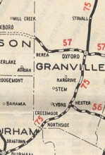
Also about 1926 (per NCDOT annual reports, though shown starting with the 1924 Official Map), NC 75 was rerouted between Durham and Oxford on a brand new road via Creedmoor. The old route remained NC 13 (now US 501 Bus) north to Braggtown; used SR 1004 Old Oxford Rd to Oxford, utilizing Hillsboro St (except: a substantial abandoned segment to the west from about the Little River to Tenaka Pkwy; Old Flat River Bridge and the SR SR 1774 access road; abandoned segment from FCI-2 Butner entrance through the center of FCI-1 to about where the development center is; in Stem it used SR 1132 W Talley Ho Rd and the fully removed Church St which was just past Main St; SR 1136 Tally Ho Rd, SR 1138 Culbreth Rd, abandoned routing, Mabel Ln, abandoned routing; abandoned routing/SR 1168 Hallie Burnette Rd)
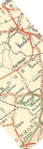
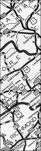
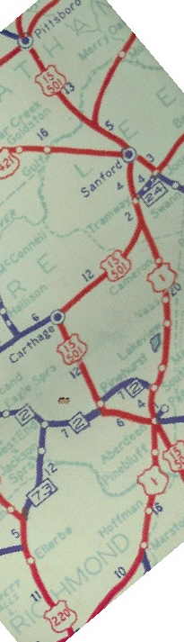
In December 1926, US 15 was assigned to NC 75 from Pittsboro to the Virginia line. Additionally, NC 75 was rerouted at Pittsboro to follow US 15 south to Sanford (replacing NC 53); duplex with US 1/NC 50; replacing NC 74 to Carthage; replace NC 702 to Pinehurst; duplex with US 311/NC 70 to West End; replace NC 512 to Ellerbe; replace NC 51 to US 15's south end at US 1-74/NC 20-50 (now Hancock at Washington) Rockingham. The former NC 75 from Pittsboro out to Lenoir was renumbered as NC 90. That route used by NC 75 is US 64 except the following (from Lenoir): Harper Ave; SR 1565 Lower Creek Dr and a bit of SR 1564 Taylorsville Rd; SR 1789 Log Cabin Pl and SR 1348 Old NC 90 between Lenoir and Taylorsville; Front St west of Newton Dr in Statesville; Wilkesboro St, Salisbury St, Depot St. through Mocksville; SR 1602 Juhn Crotts Rd; SR 1605 Garwood Rd/abandoned/Sheridan Ln/most of SR 1694 Hawthorne Rd; most of SR 1607 Aubrey Merrel Rd; SR 1611 Fork Bixby Rd, SR 1612 Fulton Rd, NC 801, abandoned Fulton Ferry across the Yadkin River; unmarked gravel road and SR 1194 Yadkin College Rd through Yadkin College NC 75 used SR 1192 Old US 64 east of Yadkin River to Lexington (except around the NC 150 area - NC 75 used abandoned route north of SR 1192 and crossed NC 150 south of Reeds Baptist Church Rd); SR 1192 becomes 5th Ave; Main St then E Center St out of Lexington; SR 2205 Raleigh Rd/SR 1344 Old Hwy 64, except NC 75 used SR 2259 Old Hwy 75 east of Lexington; SR 2273 Valley Mine Rd to Cid; SR 2416 Old Hwy 109, SR 2318 Cid Rd and SR 2270 Jarrell Rd back to Pleasant Grove; SR 1390 Gallimore Town Rd; SR 1335 Rush Mtn Rd; abandoed bridge over Uhwarrie River; SR 1382 Tabernacle School Rd; SR 1333 Robbins Cir/Old Road Dr; SR 1416/1004 Old Lexington Rd which becomes Salisbury St in Asheboro; NC 42/SR 2237 on Salisbury St (except used Martin Luther King Dr); US 64 Business east of Asheboro and SR 2713 Trogdon Hill Rd; SR 2235 Andrew Hunter Rd to Franklinville and NC 22 to Ramseur; SR 1169 Graham Moore Rd, SR 1370 Benjie Williams Rd, SR 1107 3rd St through Siler City; SR 1503 Stage Coach Rd, SR 2234 Stage Coach Trail, SR 1503 Harold Hart Rd, lengthy abandoned loops, a bit of SR 1506 Pleasant Hill Church Rd, more lengthy abandoned loops, Harlands Creek Dr, SR 1648 Wagon Trace, SR 1564 Old Siler City Rd; US 64 Business to Pittsboro.
 1922 Auto Trails
 1929 Official Between 1931-36, the route at West End was changed from SR 1133 Knox Ln/Mode Rd to NC 73's current route. So NC 75 may have been rerouted... In late 1934, NC 75 was: Renumbered to US 220 from Rockingham to Ellerbe. Today this is SR 1400 Washington St and SR 1405 Lee St out of Rockingham; SR 1335 Ellerbe St; US 220; SR 1336 Billy Covington Rd; US 220 (including I-73/74 ROW) Renumbered to NC 73 from Ellerbe to West End. Renumbered to NC 2 from West End to Pinehurst. Today this is NC 211 and NC 5. Dropped from US 15 from Pinehurst to Virginia. The route left NC 5 a little past old NC 2/Cherokee Rd; went through the golf course to Palmetto Rd; SR 1208 Page Rd; US 15 to Carthage except: SR 1844 Campground Rd, SR 1285 Lea Rd, SR 1233 Boggs Rd, SR 1835 Blues Siding Rd, SR 1252 Shady Lane Rd/SR 1254 Legion Hut Rd/NC 22; US 15 to Pittsboro except: NC 24-27 east, SR 1804 Union Church Rd/Stage Rd, SR 1237 Cathage St, US 1 Business through Sanford, SR 1465 Gaines Rd, Hawkins Ave, SR 2214/2217 Walter Bright Rd/SR 2215 Minow Johnson Rd, SR 2218 Center Grove Church Rd, Screech Owl, SR 2219 Old Sanford Rd, SR 1999 Sanford Rd into Pittsboro; US 15 to Virginia except: SR 2552 Hillsboro St out of Pittsboro; SR 1713 Bynum Rd; Karen Calhoun Rd; Turtle Pond Farm Ln/abandoned/Allendale Dr/abandoned; NC 86 into Chapel Hill; SR 1010 Franklin St out of Chapel Hill; SR 1740/1157 Old Durham-Chapel Hill Rd, NC 751, SR 1127 Chapel Hill Rd/Morehead Dr/Chapel Hill St, US 15 Bus Magnum St, SR 1670 Geer St out of Durham to its dead end; I-85 ROW across Falls Lake; US 15 to Virginia except NC 75 used SR 1500 Old Hwy 15 to enter Virginia.
|
Comment: |
NC 75 today carries no particular importance. When routed from Lenoir to Virginia, NC 75 was about 255 miles long. |
Last Update: 15 November 2025
Previous: N.C. 74 |
Next: N.C. 77
Top | NCRoads.com
Home