N.C. 90
< 89 | Home 90-A | 91 >
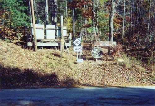
Photo: NC 90's only posting on its unpaved portion (Matt Craig)
| N.C. 90 75 miles | |||
| The Road: | Begins at US 21-64 Statesville (Iredell County) and ends at SR 1420 Edgemont (Caldwell County). | Towns and Attractions: |
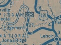
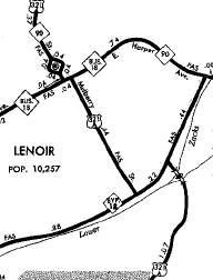
Iredell Co: Statesville Alexander Co: Stony Point, Taylorsville Caldwell Co: Lenoir, Valmead, Pisgah National Forest |
History: |
NC 90 is an original state highway. Initially it ran from NC 50 (now Person Stat New Bern Ave) Raleigh east through Nashville, Rocky Mount, Tarboro, Williamston and Plymouth to end at Columbia.
NC 90 in 1922 1922 Auto Trails In 1922 (bridge date), NC 90 was removed from SR 1336 Northwoods Country Rd near Heartsease.
Also about 1925 (NCDOT), NC 90 was removed from SR 1600 N Ridgewood road out of Princeville; removed from SR 1138 Broad St, SR 1407 Barnhill Rd/Old Williamston Rd, and SR 1409 Wildcat Rd between Parmele and Williamston; removed from SR 1504 Islands Rd/SR 1503 Old No. 90 cutoff east of Williamston; removed from SR 1562 Poplar Church Rd, SR 1561 Elijah Lee Rd, abandoned routing, and SR 1563 Grey Farm Rd between Jamesville and Dardens About 1926, NC 90 was given a more direct route from Scuppernong to Columbia, leaving behind SR 1304 Benson Rd, SR 1142 Back Rd/Meadow Ln/Main through Creswell, SR 1159 1st St, SR 1158 St Davis Rd, SR 1115/1114 Chapel Hill Rd and SR 1113 Travis Rd. It is unclear if NC 90 used today's NC 94 where it dips from the closed causeway or if it used SR 1110 Travis Rd (Old Columbia Rd on some maps). Also in 1927, NC 90 was extended west through Raleigh with NC 50 through Cary to Apex, then west as new primary routing to Pittsboro. NC 90 then replaced NC 75 west through Asheboro, Lexington, Mocksville, Statesville, and Taylorsville to end either at NC 18 (now Lower Creek Dr at Taylorsville Rd) or followed NC 18 to end at the NC 17-18 junction (Harper Ave at Mulberry St) in central Lenoir. About 1928 (NCDOT), NC 90 was rerouted away from Yadkin College via a new bridge over the Yadkin River. The original route is SR 1194 Yadkin College Rd until 1.7 miles past Yadkin College, then veers right on an unmarked gravel road for another half mile or so to the abandoned Fulton Ferry area; NC 801, then SR 1612 Fulton Rd and SR 1611 Fork Bixby Rd In 1929, NC 90 was rerouted east of Statesville to use modern US 64 to NC 901. The route from Mocksville to Statesville changed multiple times in the 1920s per official maps. It appears the last route before this used US 21 to Dunlap, then Dunlap Gate Rd to Old Mocksville Rd over to NC 901
 1922 Auto Trails
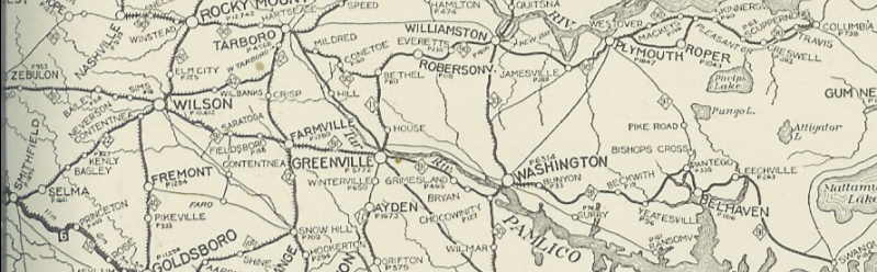
 1929 Official Also in 1929, NC 90 was extended east as new primary routing from Columbia, using Road St to hug Albermarle Sound around to end at Fort Landing.
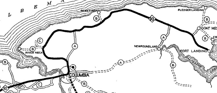 1930 Tyrrell County Also in 1929 (bridge date), NC 90 was removed from SR 1243 E Center St in Lexington. It appears this is also when NC 90 was removed from SR 2259 Old Hwy 75 east of town and SR 2273 Valley Mine Rd to Cid; SR 2416 Old Hwy 109, SR 2318 Cid Rd and SR 2270 Jarrell Rd back to Pleasant Grove By 1930, NC 90 was removed from Hill St and Milburne Rd east out of Raleigh.
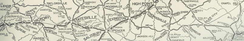
In 1932, US 64 was assigned to NC 90 from Statesville east to Fort Landing. Also in 1932, NC 90 was put on rebuilt routing from Mocksville to Fork. Surviving segments: Depot St out of Mocksville; SR 1602 Juhn Crotts Rd; SR 1605 Garwood Rd/abandoned/Sheridan Ln/most of SR 1694 Hawthorne Rd; most of SR 1607 Aubrey Merrel Rd. Also in 1932, NC 90 was put on a new direct route between Pittsboro and where B. Everett Jordan lake is now. The old route was: SR 1943 Hanks Chapel Rd (used SR 1945 Hanks Loop Rd), then abandoned routing across the Haw River, then used the E-W portion of SR 1941 Seaforth Rd across Pea Ridge Rd, then northeast on abandoned routing across across Parkers Creek and across the Seaford Beach land access, then picked up abandoned routing to the north of the current main Jordan Lake bridge to the pre-Jordan Lake routing of US 64. Special thanks to Lukas Salay for identifying this early NC 90 routing.
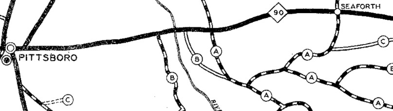
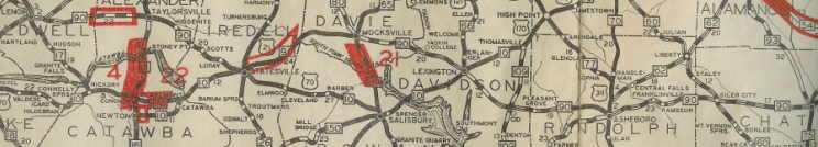
This map shows the 1927 routing of NC 90...notice the intersections around the Haw River crossing and where they are on the 1938 map 1930 Chatham County
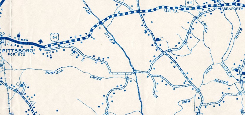
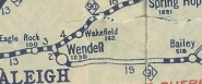
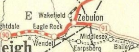
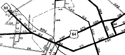
US 64 on direct routing...as you can see, the 1930 map is poorly drawn 1938 Chatham County NC 90 may have been removed from Martin Luther King Dr in eastern Asheboro, which was bypassed by Salisbury St between 1931-36. NC 90 may have also been removed from SR 1601 Jenks Rd and SR 1611 Old Jenks Rd north of Apex, which was bypassed by the current US 64 alignment St between 1931-36. NC 90 may have been removed from St Andrews St/Phillips St/Main St through Tarboro, which was bypassed by a new alignment that curved directly to Main St between 1931-36. In late 1934, NC 90 east was dropped from US 64 and therefore truncated to end at US 64-70 (now Front St at Newton St) Statesville. The route today is still US 64 except: Wilkesboro St, Salisbury St, Depot St and Main St to Lexington Rd in Mocksville; SR 1192 Old US 64 east of Yadkin River to Lexington (except around the NC 150 area - NC 90 used abandoned route north of SR 1192 and crossed NC 150 south of Reeds Baptist Church Rd); SR 1192 becomes 5th Ave; Main St through Lexington; SR 2205 Raleigh Rd (Davidson County) and SR 1344 Old Hwy 64 (Randolph County); SR 1390 Gallimore Town Rd; SR 1335 Rush Mtn Rd; abandoed bridge over Uhwarrie River; SR 1382 Tabernacle School Rd; SR 1333 Robbins Cir/Old Road Dr; SR 1416/1004 Old Lexington Rd which becomes Salisbury St in Asheboro; NC 42/SR 2237 on Salisbury St; US 64 Business east of Asheboro and SR 2713 Trogdon Hill Rd; SR 2235 Andrew Hunter Rd to Franklinville and NC 22 to Ramseur; SR 1169 Graham Moore Rd, SR 1370 Benjie Williams Rd, SR 1107 3rd St through Siler City; SR 1503 Stage Coach Rd, SR 2234 Stage Coach Trail, SR 1503 Harold Hart Rd, lengthy abandoned loops, a bit of SR 1506 Pleasant Hill Church Rd, more lengthy abandoned loops, Harlands Creek Dr, SR 1648 Wagon Trace, SR 1564 Old Siler City Rd; US 64 Business through Pittsboro except SR 1701 Thompson St and a bit of SR 2552 Hillsboro St, plus SR 1991 Foxfire Trace; at B. Everett Jordan Lake, abandoned routing north of the current one, angling up to about 1000 feet away and most of it underwater NC 90 used US 64 except: SR 5878 N. Salem St and SR 1011 Old Apex Rd into Apex; SR 1011 Chatham St to Cary; SR 1011 Hillsborough St/Western Blvd into Raleigh; Salisbury St/Edenton St/E. East St/New Bern Avenue through Raleigh; US 64 Business through Eagle Rock and Wendell to Zebulon (except SR 2946 Farmwell Rd); SR 2406 Shepard School Rd out of Zebulon, SR 1770 Old Hwy US 64, NC 98, US 64-A (except SR 1331 Quiet Waters Rd over the Tar River (bridge is closed) and SR 1331 Webbs Mill Rd into Spring Hope. Adam Prince has a feature on the old Tar River Bridge here.), US 64 Business through Nashville, SR 1770 Eastern/Sunset east to Rocky Mount; US 64 Business (EB alignment) through Rocky Mount; NC 90 was then extended west replacing NC 171 to Edgemont.
Between 1939-44, NC 90 was extended east to its current ending, replacing what had been US 64's routing through town.
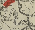
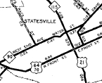
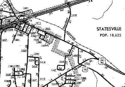
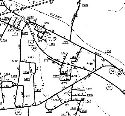
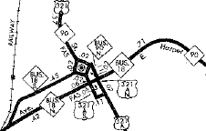
Between 1958-62, NC 90 was removed from SR 1565 Lower Creek Dr and a bit of SR 1564 Taylorsville Rd northeast of Lenoir In June 1964 (NCDOT), NC 90 was rerouted in Lenoir. Originally it used Harper St west to Main St north. Now NC 90 WB left Harper via Mulberry, then used W St to the courthouse and Main St. NC 90 EB still used Main to Harper. In 1966 (bridge dates), NC 90 was removed from SR 1789 Log Cabin Pl and SR 1348 Old NC 90 between Lenoir and Taylorsville. Between 1980-82, NC 90 was rerouted in Lenoir again where NC 90 WB left Harper on Ridge St to W Ave. In Aug 1992 (NCDOT), US 64/NC 90 was removed from Front St west of Newton Dr and instead uses Newton Dr and Carner Bagnal Blvd in western Statesville.
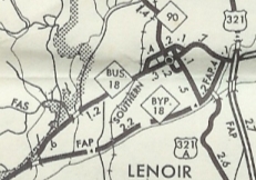
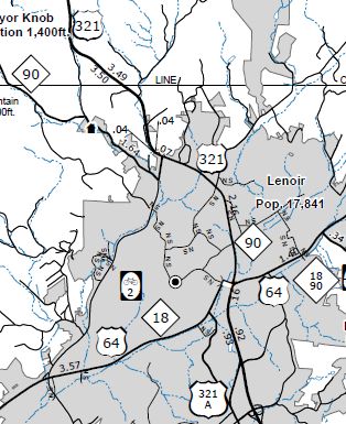
In May 2005 (NCDOT) then reaffirmed in Dec 2012 (NCDOT), NC 90 was removed from central Lenoir. NC 90 was moved onto US 321 around the north of town to Valmead, then south on what had just been US 321-A to get back to its route heading west to Edgemont.
|
Comment: |
NC 90's westernmost miles are still mostly unpaved and poorly marked. Adam Prince profiles this part of NC here. I personally drove the unpaved section at night in 1988 and can't give much personal testimony. Original NC 90 was 367 miles long in 1934. |
Last Update: 12 November 2025
Previous: N.C. 89 |
Next: 90-A | N.C. 91
Top | NCRoads.com
Home