N.C. 128
< 127 | Home | 130 >
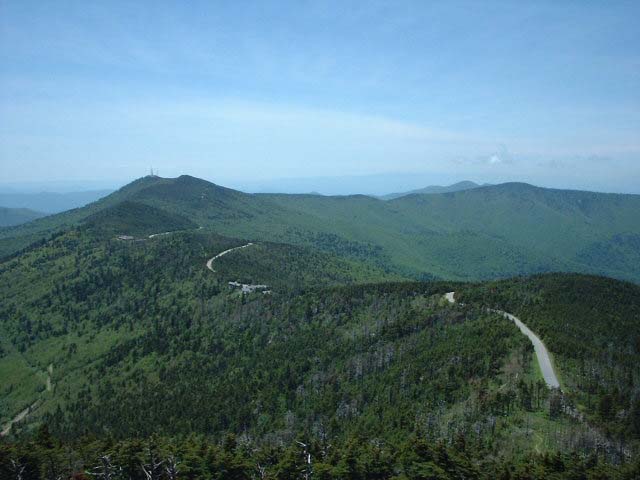
Photo: NC 128 as seen from the observation tower on Mt. Mitchell (Adam Prince)
| N.C. 128 5 miles | |||
| The Road: | Begins at the Blue Ridge Pkwy and ends at Mount Mitchell State Park, all within Yancey County | Towns and Attractions: | Yancey Co: Blue Ridge Pkwy, Mt. Mitchell State Park |
History: |
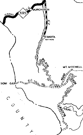
The earliest map I have showing NC 128 explicitly is the 1947 General Drafting. The 1936 County Atlas shows a toll road used to run from today's NC 197 Murchison to Mt. Mitchell including NC 128's location.
|
Comment: |
NC 128 not only does not cross any primary routes, it does not cross any secondary ones either.
NC 128 has a single shield leaving the parkway and is not posted anywhere else. NC 128 reaches an elevation of at least 6400 ft. |
Last Update: 26 November 2009
Previous: N.C. 127 |
Next: N.C. 130
Top | NCRoads.com
Home