N.C. 143
< 142 | Home | < 143 Bus | 144 >
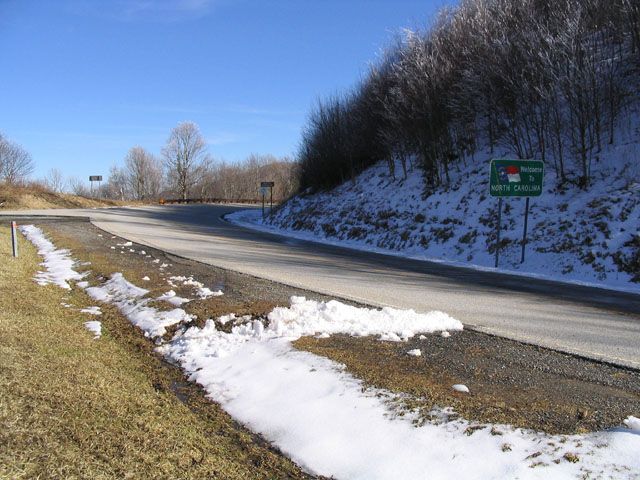
Photo: NC 143 at the state line (Matthew Sadler)
| N.C. 143 29 miles | |||
| The Road: |
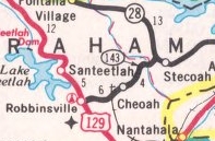
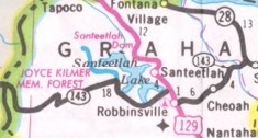
Begins at NC 28 near Stecoah and ends at the Tennessee State Line, all within Graham County.
The route continues a ways as TN 165 to end at TN 68 in Tellico Plains, TN. |
Towns and Attractions: |
Graham Co: Nantahala Nat'l Forest, Robbinsville, Joyce Kilmer Memorial Forest, Santeelah Lake, Cherohala Skyway |
History: |
NC 143 appeared as new primary routing in 1979, replacing most of SRs 1211 and 1212.
In Aug 2000 (NCDOT), NC 179 was rerouted to its current routing (replacing more SR 1163), leaving behind SR 1172 (a year later it became NC 179 bus). In Oct 1996 (per Steffora), NC 143 was extended west with US 129 around Robbinsville, then replaced SRs 1116 and 1127 for a while, then veered off at Santeelah Gap as new construction as the Cherohala Skyway through unspoiled areas of Graham County to Tennessee. The projected path shows up as a dotted Federal Aid Secondary (FAS) line on the 1987 Graham County map.
|
Comment: |
NC 143 never used the routing of NC 143 Business through Robbinsville, per the NCDOT change directive for creating NC 143 Business.
The Cherohala Skyway came along after my ability to travel to this part of North Carolina, so I will let Matt Steffora's comments about NC 143 speak for the road: The Skyway can be best thought of as a baby brother to the Blue Ridge Parkway. Its primary purpose is as a scenic drive, rather than to serve any populated areas. Secondarily, the road can be used to access backcountry areas. But not all backcountry enthusiasts are entirely happy about this. From Allen De Hart's North Carolina Hiking Trails: "The road has mutilated and scarred the mountain areas with some artifical walls where grass and trees can never grow, and where the wilderness qualities are destroyed forever. Conservationists tried for many years to prevent its construction." Well, the road doesn't seem that terrible once you drive it. Heading west from Santeelah Gap, the Skyway wastes no time rising to 4000 feet, and it stays at least that high until it's well into Tennessee. Small brown signs indicate every 1000 feet in elevation. Also, most of the overlooks are named with similar signs. |
Last Update: 8 March 2010
Previous: N.C. 142 |
Next: N.C. 143 Bus | N.C. 144
Top | NCRoads.com
Home