N.C. 151
< 150 | Home | 152 >
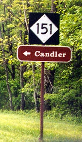
Photo: NC 151 from the Blue Ridge Pkwy (Carter Buchanan)
| N.C. 151 12 miles | |||
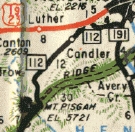
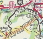
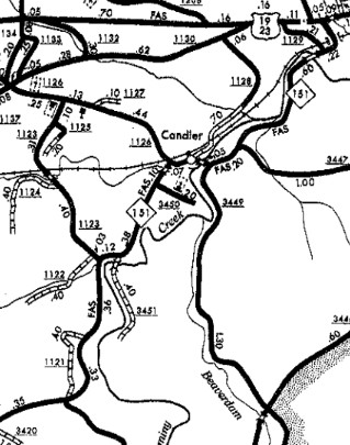
| The Road: | Begins at US 19-23 above Candler and ends at the Blue Ridge Parkway near Mt. Pisgah, all within Buncombe County. | Towns and Attractions: |
Buncombe Co: Candler, Blue Ridge Pkwy |
History: |
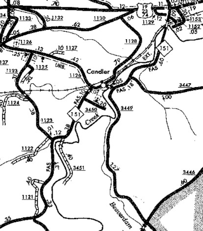
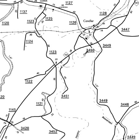
NC 151 was born in December 1961 (NCDOT) as a renumbering of NC 112, running generally the way it does now.
In 1984 (bridge date), NC 151 was removed from abandoned/SR 1153 Old Pisgah Hwy near its northern end. In 2000 (bridge date), NC 151 was removed from SR 3652 Carolina Mountain Dr; abandoned/SR 3451 Hominy Creek Dr; SR 1156 Old Candler Town Rd
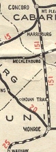
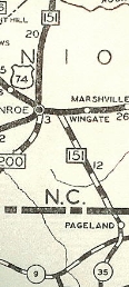
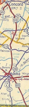
The first NC 151 was born in 1925, running from NC 15 (now Cabarrus Ave) Concord southeast to NC 20 (now Charlotte Ave) near Monroe In 1929, NC 151 was extended through Monroe with US 74/NC 20, then southeast as new routing to the South Carolina line where the road continued as SC 35 to Darlington, SC. Between 1931-36, NC 151 north was truncated to a rerouted US 29 Wilshire Ave. In September 1950 (AASHO), NC 151 was renumbered as US 601. It is still US 601 except: Franklin St/Skyway Dr through Monroe; SR 1150 Old Monroe Cir and SR 2631 Fairbluff Rd south of Faggerts; a bit of NC 3, then Union St in Concord.
|
Comment: | NC 151 provides a direct access to the Blue Ridge Pkwy, reaching an elevation of nearly 4200 feet. |
Last Update: 26 November 2025
Previous: N.C. 150 |
Next: N.C. 152
Top | NCRoads.com
Home