N.C. 181
< 180 | Home | 182 >
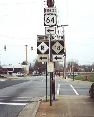
Photo: NC 181 from US 64 Business and NC 18 (Mark Clifton)
| N.C. 181 40 miles | |||
| The Road: | Begins at US 64-70 Bus/NC 18 Morganton (Burke County) and ends at NC 194 Newland (Avery County) | Towns and Attractions: |
Burke Co: Morganton, Pisgah Nat'l Forest Avery Co: Blue Ridge Pkwy, Linville, Newland |
History: |
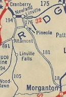
NC 181 appeared about 1928 as new primary routing, running from NC 18 Morganton to Pineola, then west to end at NC 194.
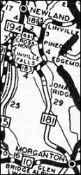
In 1929, NC 181 was extended southwest as new primary routing to end at NC 19 (now Old US 221) Ruth. In 1930, NC 181 was rerouted at Pineola to replace NC 176 to Linville, then replace NC 175 to Newland. Pineola west to NC 194 became NC 691 (now mostly SRs 1503/1504 with a little US 221).
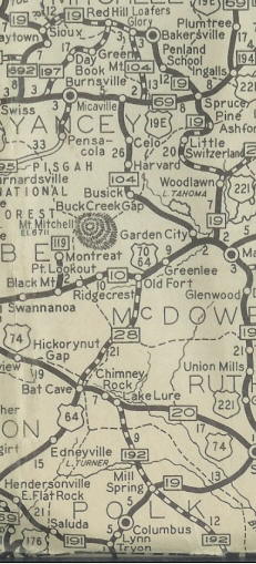
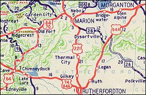
In late 1934, NC 181 was extended southwest replacing NC 19 to end at US 176 Tryon. In 1940, NC 181 from Tryon to Rutherfordton became NC 108. THe route through Rutherfordton had been Ridgecrest north to Pine to Mitchell to W. Court east to then-US 74 N. Washington St.
Also in 1940, NC 181 from Rutherfordton to Morganton was renumbered as US 64-A (now US 64 and US 64 Bus). The highway was also removed from Salem Rd below Morganton around this time.
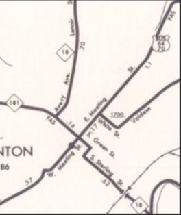
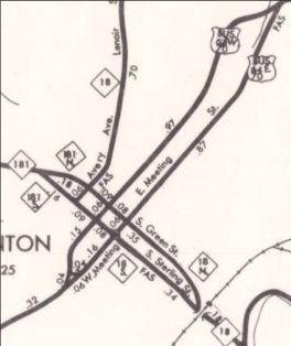
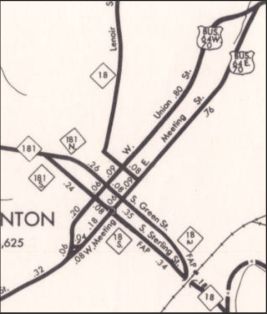
Between 1968-72, NC 181 was split into one-way streets in Morganton - NB used the original route on Green St while SB used Sterling St In May 1977 (NCDOT), NC 181 one-way pair was exteded south replacing NC 18 to end at US 64-70 Bus/NC 18. NC 181 in Morganton was cut back to rerouted NC 18 Green St.
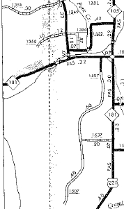
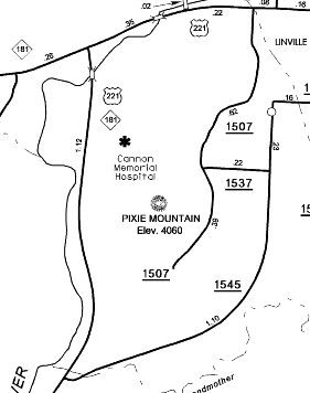
In September 1991 (NCDOT), NC 181 was rerouted to the west of Linville, leaving behind Linville Av and a rerouted US 221.
|
Comment: |
Matt Steffora reported on this route:
From a hard-driving standpoint, 181 is an excellent hillclimb road. First, it's quite long. The ascent's about 15 miles, with a couple of brief descents thrown in before the road resumes its climb. The curves themselves range from sweeping to moderately tight, but there's nothing nasty and there are (or should be) no harsh surprises. Unless you've got a Testarossa or something you won't be straying too far from the speed limit, always a plus. While 181 is no BRP, the visibility and scenery on 181 are superb, with Grandfather Mountain always looming in the distance -- this isn't one of those secluded mountain roads with all switchbacks and little scenery. Best of all, the extra hillclimb (and hill-descent) lanes allow plenty of opportunities to politely blow by the slower folk. And once you get to the top, you have plenty more entertainment options: Linville Falls, The Parkway, Grandfather Mountain, Boone, Blowing Rock. Your call. I have driven the NC 181 descent and it is pretty hard on your brakes with the long continuous decline |
Last Update: 21 March 2025
Previous: N.C. 180 |
Next: N.C. 182
Top | NCRoads.com
Home