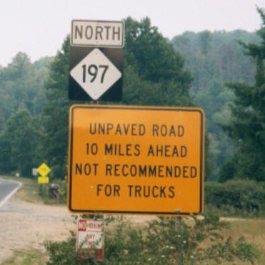
N.C. 197
< 195 | Home | 198 >
Photo: NC 197 leaving I-26/US 19-23 (Jimmy Storey)
| N.C. 197 66 miles | |||
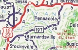
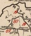
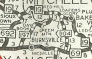
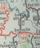
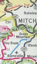
| The Road: | Begins at I-26/US 19-23 Flat Creek (Buncombe County) and ends at the Tennessee line in northwestern Mitchell County. The road continues as TN 395 to Erwin, TN | Towns and Attractions: | Buncombe Co: Barnardsville Yancey Co: Pisgah Nat'l Forest, Burnsville Mitchell Co: Red Hill |
History: |
NC 197 is an original NC route, which started out running from NC 69 (now US 19E) Riverside to NC 19 (now NC 226-261 jct) Bakersville.
About 1929, NC 197 north was truncated to Red Hill as NC 19 was re-extended west of Bakersville. About 1940, NC 197 south was extended by heading east with US 19E to Burnsville, then replacing NC 695 southwest to US 19-23.
About 1948, NC 197 was rerouted in Yancey County to run from Red Hill to Burnsville via Toledo. The old route to Riverside via Day Brook became SR 1336 Jacks Creek Rd and SR 1338 Green Mtn Rd.
|
Comment: |
NC 197 is still unpaved around the Buncombe-Yancey Line where it reaches about 4200 feet in elevation.
NC 197 is pretty long but not a through route for anybody, really. |

Last Update: 20 January 2010
Previous: N.C. 195 |
Next: N.C. 198
Top | NCRoads.com
Home