| N.C.
211 166 land miles |
|
|
|
|
| The Road: |
|
Begins at US 220 ALT Candor (Montgomery County) and ends at US 421 at the Fort Fisher Ferry landing south of Carolina Beach (New Hanover County)
|
Towns and Attractions: |
|
Montgomery Co: Candor
Moore Co: Eagle Springs, Seven Lakes, West End, Pinehurst, Southern Pines, Aberdeen
Hoke Co: Raeford
Robeson Co: Red Springs, Lumberton
Bladen Co: Bladenboro, Clarkton
Columbus Co: Bolton
Brunswick Co: Supply, Southport
New Hanover Co: Ft. Fisher Ferry
|
History: |
|
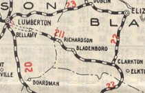
NC 211 is an original state highway, that initially ran from NC 20 (now NC 72) E. Lumberton over to NC 23 (now US 701 Bus) Clarkton.
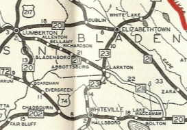
In 1930, NC 211 was extended east as new routing to end at US 17/NC 20 (now NC 214) Bolton.
 NC 211 original routing
|
 NC 211 extended to Bolton
|
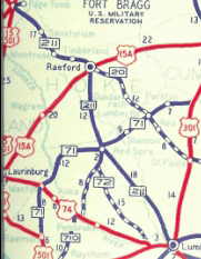
In 1932, NC 211 was extended west with NC 20 through Lumberton and as new routing northwest to end at NC 70 (now NC 72) Red Springs.
In late 1934, NC 211 was extended west, replacing NC 70 from Red Springs to Aberdeen, ending at US 15-501 (now Glasgow St). It is unclear if NC 70 had already been moved off Main St or not.
 NC 211 extended to Red Springs
|
 NC 211 replaces NC 70 to Aberdeen
|
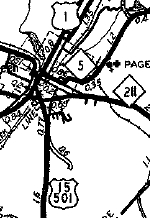
In 1940, NC 211 was extended with US 15-501 to Pinehurst, then replaced NC 2 to Candor.
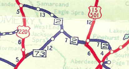 Candor to Southern Pines, 1936
|
 Candor to Southern Pines, 1940
|
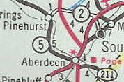
Between 1945-49, NC 211 was moved from South St in Aberdeen to its current routing. Some of this became part of NC 5.
 NC 211 on South St
|
 NC 211 bypasses Aberdeen
|
Between 1950-53, NC 211 was extended west past US 220 and looped back around to US 220. This replaced what had been US 220's route north of NC 211.
About 1955, NC 211 was placed on a newly constructed road bypassing Eagle Springs and Samarcand, leaving behind SR 1138.
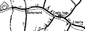
NC 211 through Eagle Springs
|
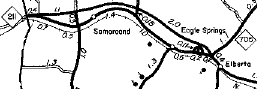
NC 211 bypasses Eagle Springs
|
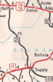
About 1956, NC 211 was rerouted at Bolton off of SR 1805, and instead extended southeast as new primary routing to US 17/NC 130 Supply.
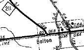
NC 211 initial Bolton ending
|
NC 211 shifted southeast
|
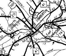
In 1956 or 1957, NC 211 was given its current Lumberton routing, a northeast bypass. The 1957 Robeson County map implies some of the old path (2nd St west to Elm St north) became unnumbered, but the 1958 Official implies it remained primary and would've been the 2nd NC 211-A.
NC 211 through Lumberton
|
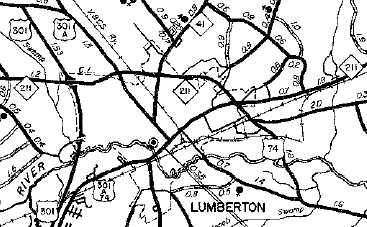
NC 211 bypasses Lumberton
|
In 1957, NC 211 was extended east over NC 130 to Southport.
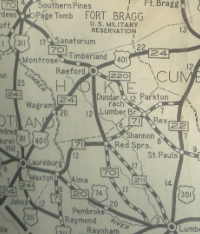
Between 1958-62, NC 211 was given its current routing at Antioch and Hodgins Pond in Hoke County, leaving behind SRs 1105/1549. Also in this timeframe, NC 211 was removed from SR 1135 Dead Mans Curve Rd near Elberta.
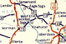
About 1961, NC 211 was rerouted to its current path between Aberdeen and Pinehurst, following US 15-501 to the traffic circle, then west as new routing to avoid central Pinehurst. The old path became part of NC 5.
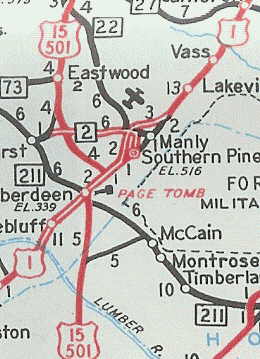 NC 211 Aberdeen to Pinehurst
|
 NC 5 replaces NC 211
|
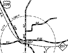
Between 1963-68, NC 211 in Candor was truncated back to its original and current endpoint at today's US 220-A. The loop west and north to US 220 became SR 1579.
NC 211 ending at Main St
|
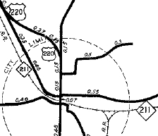
NC 211 extended past Main St
|
NC 211 truncated to Main St
|
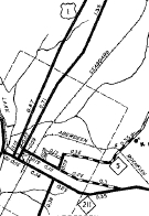
Between 1969-85, NC 211 was removed from "Old NC 211" in McCain.
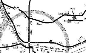
In 1973, NC 211 was placed on a new bypass north of Clarkton. The old route was secondary for a while but is now NC 211 Business.
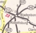
NC 211 through Bladenboro
|
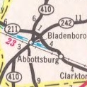
NC 211 nothing through Bladenboro
|
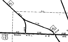
Around 1990, NC 211 was extended east to the ferry, upgrading SRs 1528/1540.
NC 211 extended to Supply (1956-57)
|
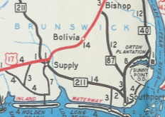
NC 211 extended to Southport (1958-90)
|
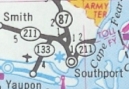
NC 211 extended to Ferry (since 1990)
|
In June 2013 (NCDOT), NC 211 was extended acros the Ft. Fisher Ferry to end at US 421.
|
Comments: |
|
 Check out
this 1935 General Drafting map which shows US 74 and NC 211 swapping routes. Not sure what is happening here...the 1934 and 1936 General Drafting maps show them as they are today. The 1935 Official map does not show the routes swapped either. Check out
this 1935 General Drafting map which shows US 74 and NC 211 swapping routes. Not sure what is happening here...the 1934 and 1936 General Drafting maps show them as they are today. The 1935 Official map does not show the routes swapped either.
NC 211 is a pretty long route but I am only familiar with a small portion of it. |
|