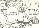
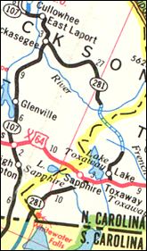
N.C. 281
< 280 | Home | 282 >
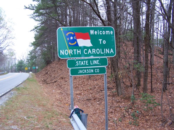
Photo: NC 281 entering North Carolina (Brian Powell)
| N.C. 281 40 miles | |||
| The Road: | Begins at NC 107 Tuckasegee (Jackson County) and ends at the South Carolina Line below Whitewater Falls (Jackson County). The route continues as SC 130 to end at SC 59 Seneca, SC. | Towns and Attractions: | Jackson Co: Nantahala National Forest Transylvania Co: Pisgah National Forest, Lake Toxaway Jackson Co: Whitewater Falls |
History: |
NC 281 was born in 1930 as new primary routing. It ran from NC 106 (now NC 107) southeast to NC 28 (current US 64) Lake Toxaway.
About 1982, NC 281 was extended west on US 64 3 miles, then south replacing Transylvania SR 1149 and Jackson SR 1177.
|
Comment: |
NC 281 was very slow to get paved. In 1968 the middle third was still unpaved. By the late 1980's, there was still a substantial portion without asphalt. Although the 2008 Official shows a small bit unpaved near the Jackson-Transylvania line, both current on-line county maps show the entire route paved now. NC 281 between S.C. and US 64 runs near several waterfalls. The most accessible and the highest is Upper Whitewater Falls, whose parking lot is off NC 281 just north of the state line. A short but fairly steep trail carries you to the bottom or you can walk the old alignment of SR 1149 over towards the top. Other waterfalls that 281 goes near are Laurel Falls and High Falls. I drove NC 281's unpaved portion in 1988. It was rutted in many places and looked like the movie Deliverance was ready to be acted out around every turn. My wife was with me then and still remembers the horrors of this mountain road. The portion below US 64 was modernized and an easy drive, as the state did some work to this section - the 1968 Transylvania County map shows the corridor as unpaved and quite twisty. NC 281 is the only route to change numbers at a South Carolina crossing. At the time of the extension, SC 281 still existed in the Beaufort area (since renumbered), so SC 130 was extended north up S-39-171. NC 281 hovers around 3000 feet or higher almost everywhere. The descent of the mountains southbound occurs on the South Carolina side. |
Last Update: 6 November 2008
Previous: N.C. 280 |
Next: N.C. 282
Top | NCRoads.com
Home