
The Virginia Placenames Page - County Lines - N-Y
This sub-page shows county line signs for counties beginning with N through Y. Photos are arranged alphabetically by county name, then in numerical order by route number as needed. Click on a thumbnail for a larger image.
|
|
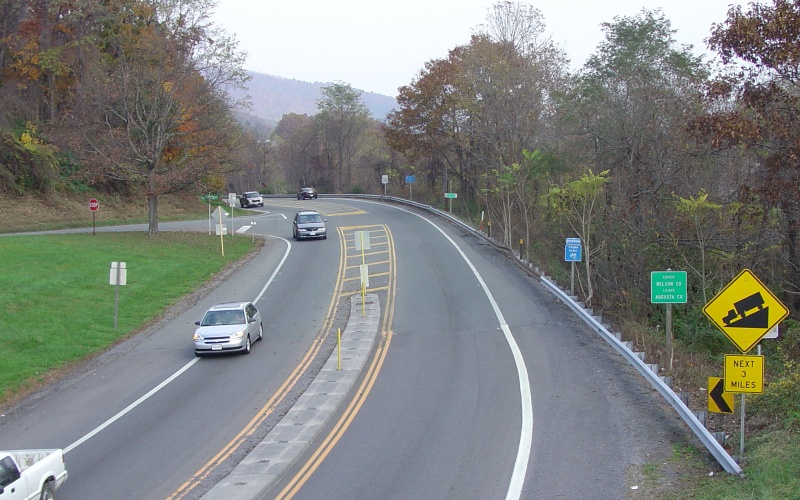
Eastbound I-64 at Rockfish Gap, entering Nelson County. Viewed from the Blue Ridge Parkway overpass. Photo by Adam Froehlig, taken October 30, 2004. |
|
|
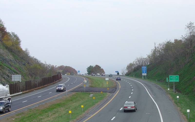
Eastbound US 250 at Rockfish Gap, entering Nelson County. Viewed from the Blue Ridge Parkway overpass. Photo by Adam Froehlig, taken October 30, 2004. |
|
|
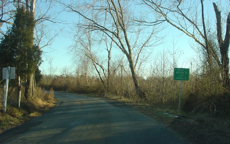
Eastbound SR 616 north of Bottoms Bridge, entering New Kent County. Photo by Adam Froehlig, taken February 8, 2004. |
|
|
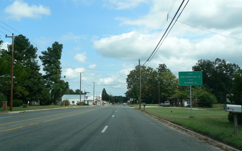
Eastbound US 360 at Village, entering Northumberland County. Photo by Adam Froehlig, taken September 11, 2008. |
|
|
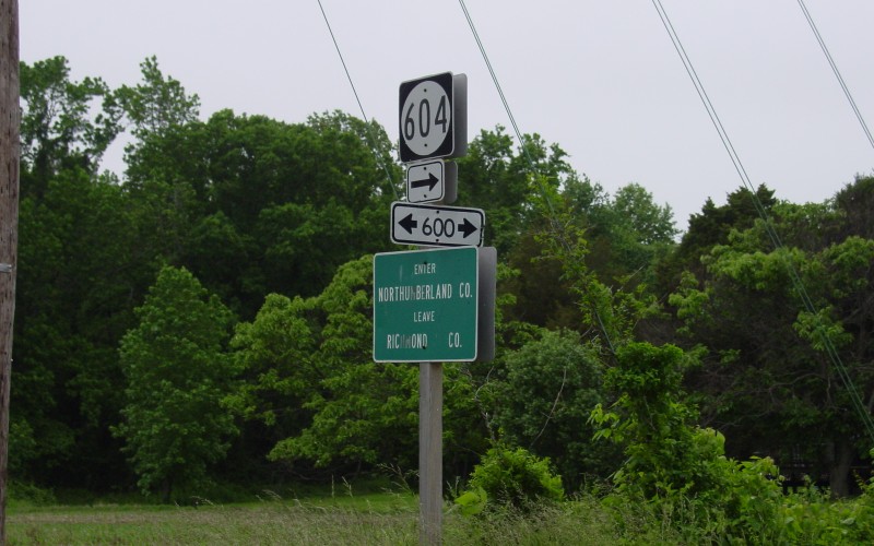
At the SR 600/SR 604 junction southwest of Heathsville. Though SR 600 generally follows the Northumberland/Richland County line in this area, VDOT chose to post a sign here. Photo by Adam Froehlig, taken May 17, 2003. |
|
|
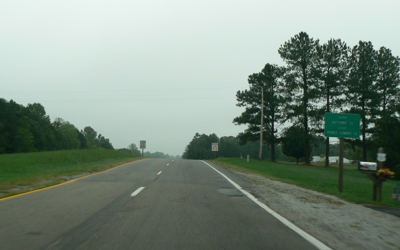
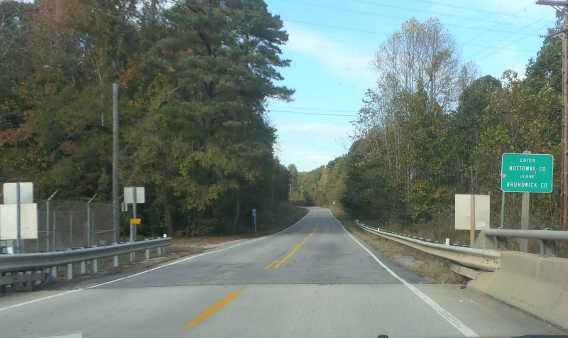
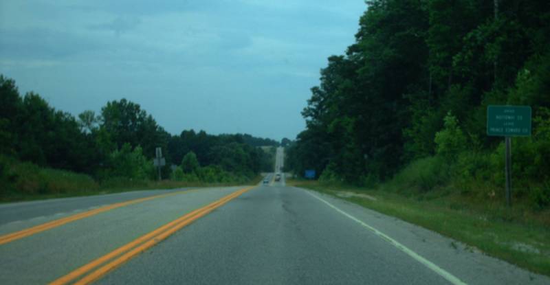
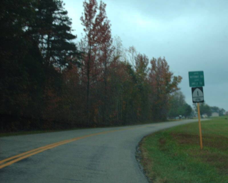
Eastbound US 460 northwest of Burkeville, entering Nottoway County. Photo by Adam Froehlig, taken September 11, 2008. |
|
|
|
|
|
|
|
|
|
|
|
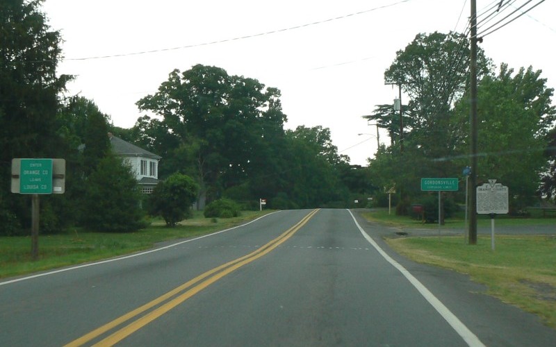
Northbound US 15/US 33 entering Orange County and Gordonsville. Photo by Adam Froehlig, taken May 31, 2008. |
|
|
|
|
|
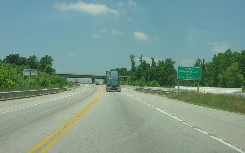
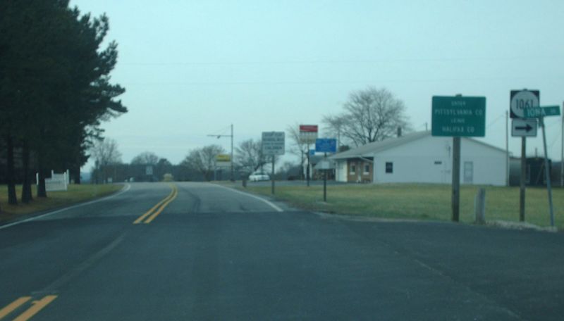
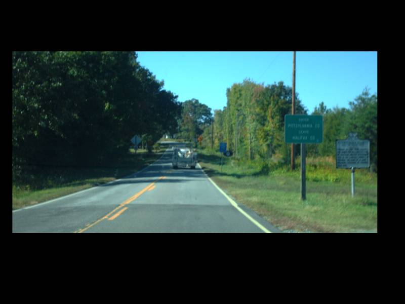
Northbound US 29 in Danville, entering Pittsylvania County. Photo by Adam Froehlig, taken May 29, 2004. |
|
|
|
|
|
|
|
|
|
|
|
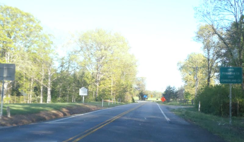
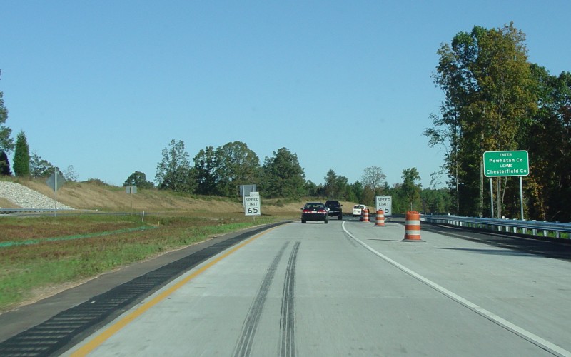
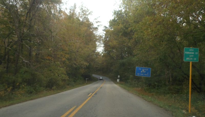
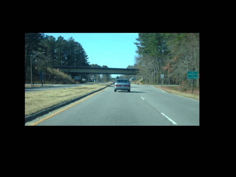
Northbound VA 288 west of Richmond, entering Powhatan County. Photo by Adam Froehlig, taken October 30, 2004. |
|
|
|
|
|
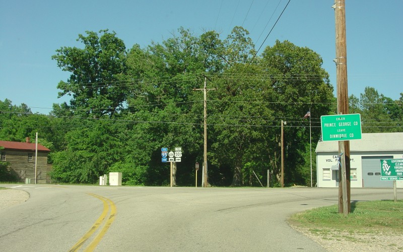
Eastbound SR 703 at SR 604 in Carson, entering Prince George County. Photo by Adam Froehlig, taken May 29, 2004. |
|
|
|
|
|
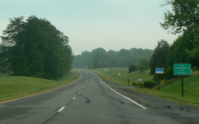
Westbound US 211 west of Warrenton, entering Rappahannock County. Photo by Adam Froehlig, taken June 4, 2008. |
|
|
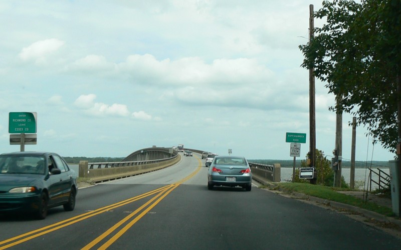
Eastbound US 360 crossing the Rappahannock River into Richmond County. Photo by Adam Froehlig, taken September 11, 2008. |
|
|
Northbound US 221 south of Salem, entering Roanoke County. Photo by Adam Froehlig, taken August 7, 2008. |
|
|
|
|
|
|
|
|
|
|
|
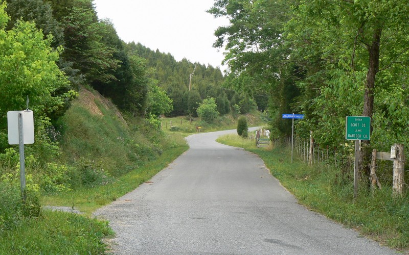
Northbound SR 629 west of Gate City, entering Scott County from Hancock County, TN. Photo by Adam Froehlig, taken June 4, 2008. |
|
|
|
|
|
|
|
|
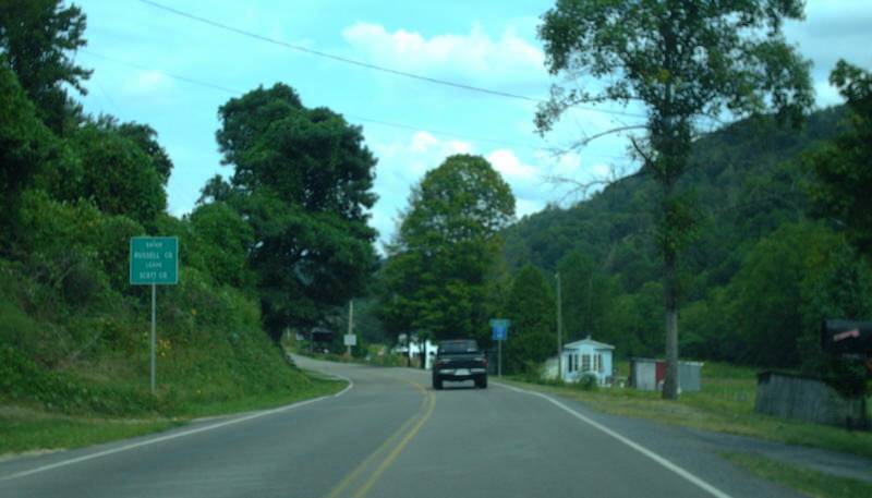
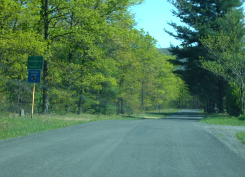
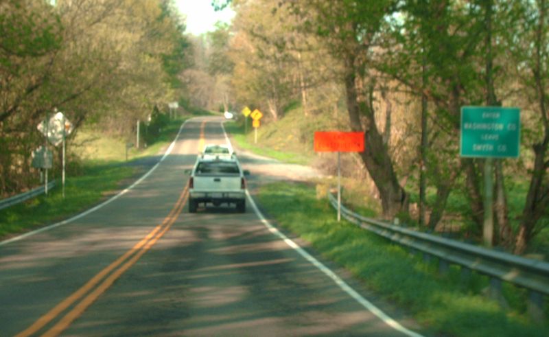
Northbound VA 16 south of Marion, entering Smyth County. Photo by Adam Froehlig, taken September 1, 2007. |
|
|
|
|
|
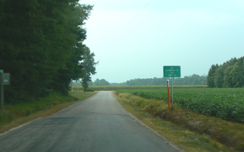
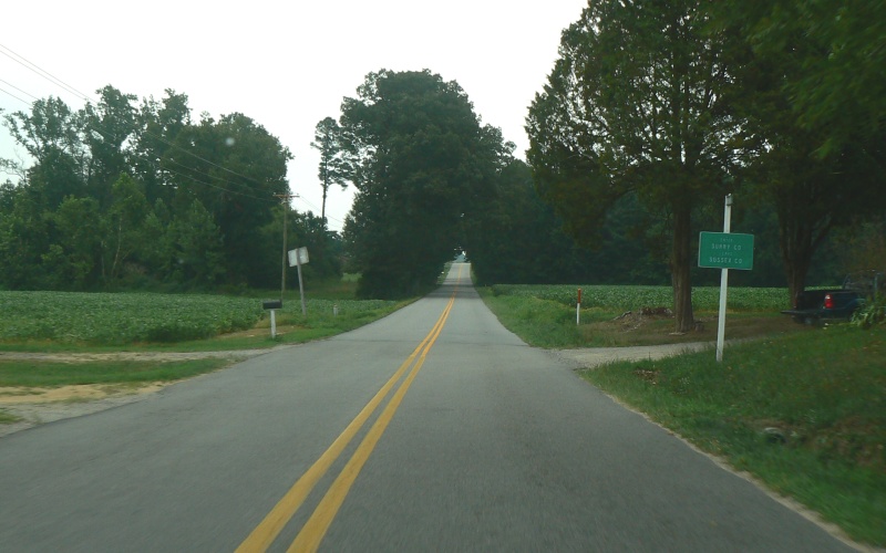
Eastbound SR 624 (Southampton Rd in Surry County, Tintop Rd in Southampton County) east of Wakefield, entering Southampton County. Photo by Adam Froehlig, taken July 28, 2007. |
|
|
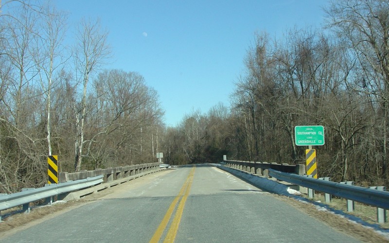
Eastbound SR 730 (Low Ground Rd in Greensville County, Little Texas Rd in Southampton County) west of Branchville, entering Southampton County. Photo by Adam Froehlig, taken February 1, 2004. |
|
|
Southbound VA 31, entering Surry County from the Jamestown-Scotland Ferry. Photo by Adam Froehlig, taken May 26, 2003. |
|
|
Eastbound SR 617 (White Marsh Rd) near Wakefield, entering Surry County. Photo by Adam Froehlig, taken July 28, 2007. |
|
|
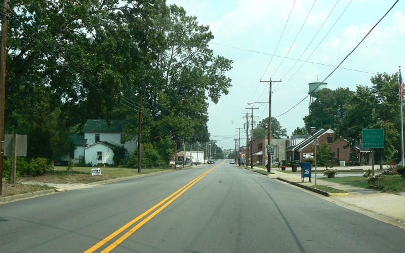
Eastbound VA 139 in Jarratt, entering Sussex County. Photo by Adam Froehlig, taken July 28, 2007. |
|
|
|
|
|
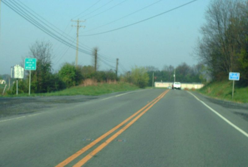
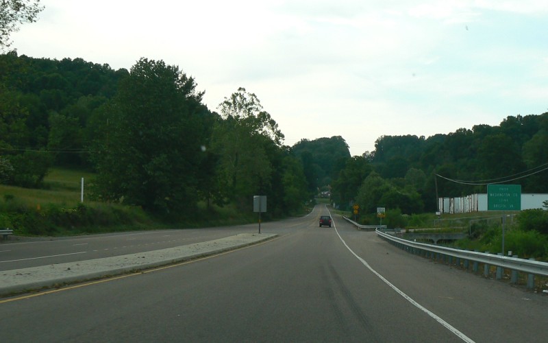
Westbound US 58/US 421 near Bristol, entering Washington County. Photo by Adam Froehlig, taken June 4, 2008. |
|
|
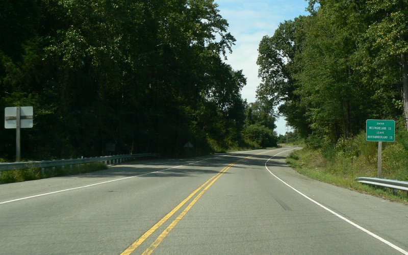
Northbound VA 202 north of Callao, entering Westmoreland County. Photo by Adam Froehlig, taken September 11, 2008. |
|
|
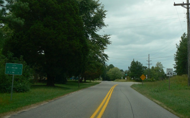
Westbound SR 624 near Foneswood, entering Westmoreland County. Photo by Adam Froehlig, taken September 11, 2008. |
|
|
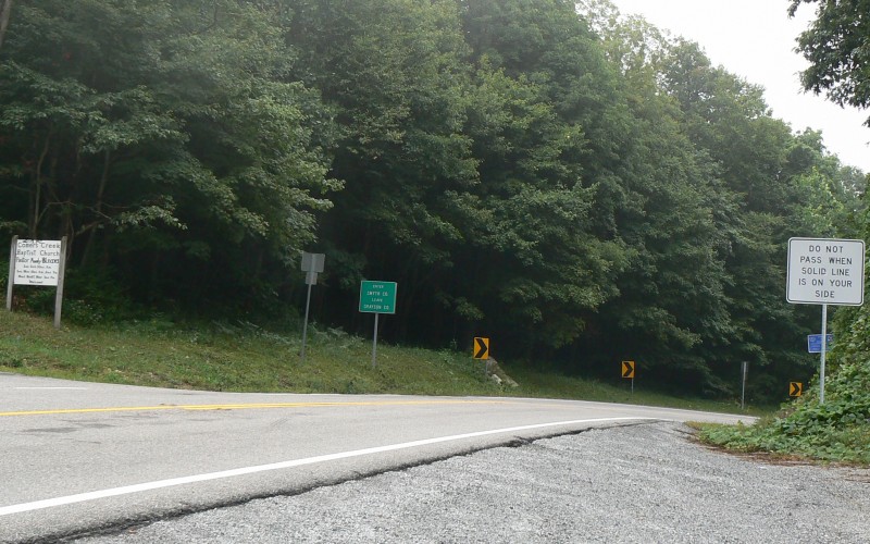
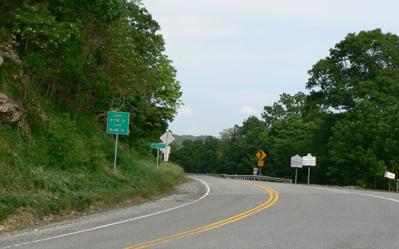
Southbound US 52 on Big Walker Mountain, entering Wythe County. Photo by Adam Froehlig, taken June 4, 2008. |
|
|
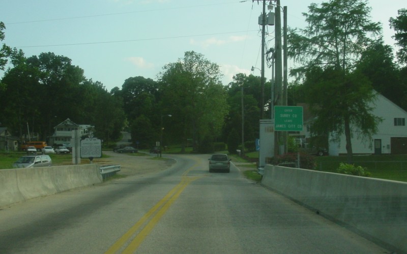
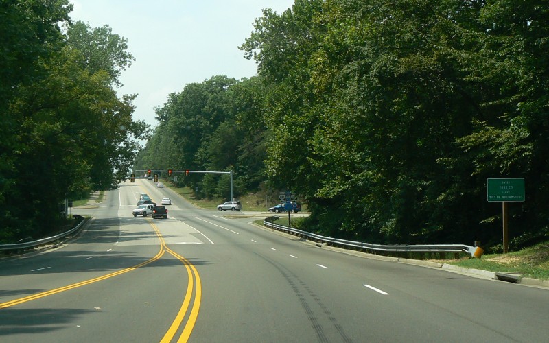
Westbound US 60, entering York County from Williamsburg. Photo by Adam Froehlig, taken July 29, 2007. |
|
|
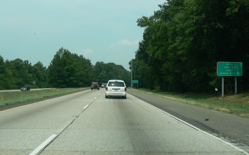
Westbound I-64 near Williamsburg, entering southern York County. Photo by Adam Froehlig, taken July 29, 2007. |
|
|
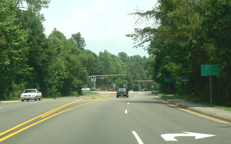
Northbound VA 132, entering York County from Williamsburg. Photo by Adam Froehlig, taken July 29, 2007. |
|
|
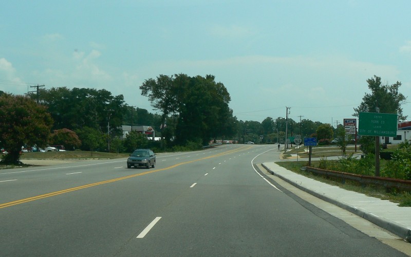
Eastbound VA 162, entering York County from Williamsburg. This is also the eastbound beginning of VA 162. Photo by Adam Froehlig, taken July 29, 2007. |
Go to A-M
Back to County Lines
Back to the Virginia
Placenames
Page
Page last modified 20 December 2013
(C) 2010-2014 Adam Froehlig and Mike Roberson