< I-81 | Home | I-87 >
I-385 | I-785
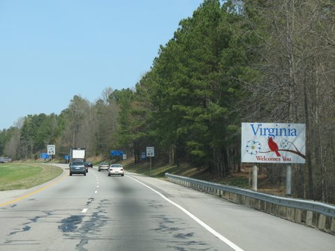
Photo: I-85 entering Virginia (photo by Bobby Hidy)
|
|
|
| ROUTE LOG |
NC STATE LINE: 0 - 0 EXIT 4 (old 1) - SR 903: 4.59 - 4.59 EXIT 12 (old 2) - US 58: 8.18 - 12.77 EXIT 15 (old 3) - US 1: 2.72 - 15.49 Brunswick-Mecklenburg Line: 4.03 - 19.52 EXIT 24 (old 4) - SR 644: 5.21 - 24.73 [NB only] EXIT 27 (old 5) - VA 46: 2.54 - 27.27 EXIT 28 (old 6) - US 1: 1.66 - 28.93 EXIT 34 (old 7) - SR 630: 6.26 - 35.19 EXIT 39 (old 8) - SR 712: 4.86 - 40.05 Dinwiddie-Brunswick Line: 0.24 - 40.29 EXIT 42 (old 9) - VA 40: 2.78 - 43.07 EXIT 48 (old 10) - SR 650: 5.95 - 49.02 EXIT 53 (old 11) - SR 703: 4.95 - 53.97 EXIT 61 (old 12) - US 460 WB, US 460 Bus: 8.36 - 62.33 EXIT 63 (old 13, old 1) - US 1, US 460 Bus: 1.83 - 64.16 Petersburg-Dinwiddie Line: 0.81 - 64.97 EXIT 65 - Squirrel Level Rd: 1.25 - 66.22 EXIT 68 (old 14, old 2) - I-95 (exit 51), US 460 EB: 2.23 - 68.45 [NB only] EXIT 69 (old 15, old 3) - US 301, US 460 Bus: 0.40 - 68.85
|
Creation: The first segment to open was the from US 1-460 north 4 miles to I-95 as part of the Richmond-Petersburg tpk in August 1958 (opening dates are from Scott Kozel's website). The 1961 Official was the first to actually label this as I-85.
| Adjustments:In Nov 1965, I-85 opened from the NC Line to US 1 north of South Hill. In Aug 1969, I-85 opened from VA 40 to US 1-460 Petersburg. In Oct 1970, I-85 was opened from US 1 South Hill to VA 40, completing I-85 in Virginia. The Squirrel Hill Rd interchange was added in 1988.
In May 1977 (CTB), the portion of I-85 on the Richmond-Petersburg tpk was placed into the primary system. operational authority for the Turnpike was transferred to VDOT in June 1973. Improvements: I-85 was built as 4-lane interstate everywhere, as it remains today. Posted: Fully posted; Only 1 known state-name shield is known to exist (Downtown Petersburg) Multiplexes: US 460 (6.12 mi) Legislative names: Dr. Arthur T Hart memorial bridge over Lake Gaston (after 2003). Other names: None Scenic Byway: No segments Comments: When the I-295 Richmond Beltway was redesigned to also bypass Petersburg in the mid 1970s, the plan also included building an interstate freeway west from the current south end of I-295 to I-85. Then I-85 would be re-routed onto this new freeway segment. Current I-85 north to Petersburg would have become I-385. I-295 would become I-95 and the original I-95 north to Petersburg would become I-795. I-385 and I-795 would have ended at the same interchange while the Richmond-Petersburg Tpk became a state route up to I-64 in Richmond. Although project numbers for I-295's completion heading southward all referenced I-95, when the new freeway reached I-95 it was continued to be signed as I-295. Virginia never did build the freeway segment west back to I-85 and I have not seen any maps showing I-85 on dotted lines. I-85 is often thought of as the Main St through the South, but by the time it reaches Virginia it is pretty quiet. Lined with pine trees from nearly one end to the other, there is not much to see. I-85 blows off the following primary routes in its travels: US 1 (near US 460 exit), VA 319, VA 142, and US 301 ALT. The 1959 Official Map labels the NC stretch of I-85 in the Henderson area as US 293. What's up with that? I-85 still has some of its original concrete in a few places. I-95 is erroneoulsly labeled on the 1959 topo to include the part that I-85 occupies. However, there is an Apr 1960 CTB item that also refers to the US 1 Dinwiddie County interchange with the Richmond-Petersburg Tpk as being with "Route 95" - was 95 briefly signed over to US 1? | |||||||||
Previous: I-81 |
Next: I-87
I-385 | I-785
Top | Virginia Hwy Index
Home
Page last modified 27 February 2015
