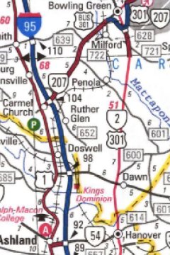
2004 Map Scan


 Virginia Highway Index
Part of the Virginia Highways Project
 
3/1/22: Welcome to the Virginia Highways pages!  Originally created by Dave Strong in 1998, these route pages are now part of the Virginia Highways Project, celebrating nearly 25 years on the internet!

Questions, Comments, or Corrections? Contact us at the e-mail addresses at the bottom of this page

Recent Updates
Updates (1/6/24):
New page for VA 460; updates to I-381, US 1, US 50, US 121, US 211, VA 6Y, VA 7; split the VA 6, VA 7 and VA 300 families, plus the VA 261-280 and VA 421-499 groups into separate pages with more mapscans;
Updates (1/19/23):
VA 317 and VA 372 have been decommissioned; a new VA 372 was put into the system
Updates (9/17/22):
New info regarding US 321; US 11 was slightly rerouted; VA 386 and VA 392 have been decommissioned; I-66 has new Express lanes; VA 341-349 and VA 361-380 pages broken into indivdual pages with more mapscans and info
Updates (3/27/22):
The AASHO database of documents released in 2020 have been poured through in detail to learn about the early years of the US route system! A draft of the 1933 route changes exists!; New routes documented: I-395 #1, I-895 #1, US 5, US 9 #1, US 9 #2, US 9 #3, US 13-A, US 13Y, US 17W, US 23E, US 33 #1, US 33 #2, US 33E, US 33W, US 58 ALT #8, US 60E, US 62, US 86, US 119, US 129, US 150, US 168, US 217, US 319, US 401 #1, US 441, US 460 ALT #5, mystery US Hwy corridors, VA 9 #2, VA 40 #2, VA 61 #1, VA 86 #1, VA 109 #3, VA 351Y; All US route families broken into separate pages, some with more info and scans; VA 321-336 and VA 338-340 pages broken into indivdual pages with more mapscans and info
Updates (5/9/20):
Route expanded: VA 318; VA 301-320 pages broken into indivdual pages with more mapscans and info

Previous Updates
 
 
Route Pages:
 
Interstates:
64 - 164 - 264 - 364 - 464 - 564 - 664 - 864 | 66 - 66N - 266 | 68 | 73 | 74 | 77 | 79 | 81 - 381 - 581 | 85 - 385 - 785 | 87 | 95 - 195 - 295 - 395 - 495 - 595 - 795 - 895 | 99
I-495 Vintage 1960s Photo Gallery
  Virginia Parkways:
Blue Ridge Pkwy | Skyline Drive | Colonial Pkwy | George Washington Pkwy
   
U.S. Highways:
1 - 1 ALT - 1 Bus | 5 | 9 | 11 - 11 ALT - 11 Bus - 11Y | 11E | 11W | 13 - 13 ALT - 13 Bus - 13Y | 13-A | 15 - 15 ALT - 15 Bus | 17 - 17 ALT - 17 Bus | 17-1 | 17W | 19 - 19 ALT - 19 Bus | 21 | 23 - 23 ALT - 23 Bus | 23E | 25E | 29 - 29 ALT - 29 Bus | 33 - 33 Bus | 33E | 33W | 48 | 50 | 52 | 58 - 58 ALT - 58 Bus | 60 - 60 ALT - 60 Bus - 60 Spur - 60Y - 60Z | 60E | 62 | 86 | 117 | 119 | 121 | 129 | 150 | 158 | 168 | 170 | 211 - 211 ALT - 211 Bus | 217 | 219 | 220 - 220 ALT - 220 Bus - 220Y | 221 - 221 Bus | 240 | 250 - 250 ALT - 250 Bus | 258 - 258 Bus | 301 - 301 ALT - 301 Bus | 311 | 319 | 321 | 340 - 340 ALT - 340 Bus | 360 - 360 ALT - 360 Bus - 360Y | 401 | 411 | 421 - 421 Bus | 441 | 460 - 460 ALT - 460 Bus - 460-Y | 501 - 501 ALT - 501 Bus - 501Y | 511 | 522 - 522 Bus | Mystery Corridors
US 33-VA 33 transition gallery
Other Virginia Routes:
Secondary Routes (6xx- Series) | School Routes | F-Routes | US Bike Routes | Forest Routes
   
State Highways:
1 | 2 | 3 | 4 | 5 | 6 - 6Y | 7 - 7 Bus - 7 SPUR - 7X - 7Y | 8 | 9 | 10 | 11 | 12 | 13 | 14 | 15 | 16 | 17 | 18 | 19 | 20 | 21 | 22 | 23 | 24 | 25 | 26 | 27 | 28 | 29 | 30 | 31 | 32 | 33 | 34 | 35 | 36 | 37 | 38 | 39 | 40 | 41 | 42 | 43 | 44 | 45 | 46 | 47 | 48 | 49 | 50 | 51 | 52 | 53 | 54 | 55 | 56 | 57 | 58 | 59 | 61 to 70 | 71 to 80 | 81 to 100 | 101 to 120 | 121 to 140 | 141 to 160 | 161 | 162 | 163 | 164 | 165 - 165Y | 166 - 166Y | 167 | 168 - 168 Bus - 168Y | 169 | 170 | 171 | 172 | 173 | 174 | 175 - 175Y | 176 | 177 | 178 | 179 | 180 - 180Y | 181 to 200 | 201 to ALT220 | 221 to 240 | 241 to 260 | 261 | 262 | 263 | 264 | 265 | 266 | 267 | 268 | 269 | 270 | 271 | 272 | 273 | 274 | 275 - 275Y | 276 | 277 | 278 | 279 | 280 | 281 | 282 | 283 | 284 | 285 | 286 | 287 | 288 | 289 | 290 | 291 | 292 | 293 | 294 | 295 | 296 | 297 - 297 Bus | 298 | 299 | 300 - 300Y | 301 - 301 ALT | 302 | 303 | 304 - 304Y | 305 | 306 | 307 - 307Y | 308 | 309 | 310 | 311 | 312 | 313 | 314 | 315 | 316 | 317 | 318 | 319 | 320 | 321 | 322 | 323 | 324 | 325 | 326 | 327 | 328 | 329 | 330 | 331 | 332 | 333 | 334 | 335 | 336 | 337 - 337 ALT | 338 | 339 | 340 - 340Y | 341 | 342 | 343 | 344 | 345 | 346 | 347 | 348 | 349 | 350 | 351 - 351Y | 352 | 353 | 354 | 355 | 356 | 357 | 358 | 359 | 360 | 361 | 362 | 363 | 364 | 365 | 366 | 367 | 368 | 369 | 370 | 371 | 372 | 373 | 374 | 375 | 376 | 377 | 378 | 379 | 380 | 381 | 382 | 383 | 384 | 385 | 386 | 387 | 388 | 389 | 390 | 391 | 392 | 393 | 394 | 395 | 396 | 397 | 398 | 399 | 400 | 401 to 420 | 421 | 422 | 423 | 424 | 425 | 426 | 427 | 428 | 429 | 430 | 431 | 432 | 433 | 434 | 435 | 436 | 437 | 438 | 439 | 440 | 441 | 442 | 443 | 444 | 445 | 457 | 460 | 464 | 500 to 525 | 526 to 599 | 600 to 699 | 700 to 799 | 800 to 825 | 826 to 90005
Previous Route Logs: (asterisk denotes pdf file)
1918 | 1926* | 1931 | 1933 draft* | 1933 final | 1935 | 1941 | 1949 | 1951 | 1957 | 1979 | 1984 | 1987 | 1993 | 1996 | 1999 | 2001* | 2003*


Explanation:

Each route page lists a considerable amount of information on that route or series of routes.  This information includes termini points, mileage, if any Business Routes exist along that route, a history of the route (including adjustments/extensions/truncations), status of route posting (i.e. route signs), and any additional comments from the authors or that were E-mailed to the authors.  1st-person comments (including driving comments) come from Mapmikey unless otherwise noted.  In addition, several route pages have links to other websites and, in particular, to any route termini photos for that route.  If the "From" and/or "To" headings for a route are hyperlinked, there are termini photos available for that route as part of Virginia Highway Ends.  If a Business Route location is hyperlinked, then termini photos are available for that business route location, also as part of Virginia Highway Ends.


The compilation of this material is original. Scanned maps are copyrighted by their publishers. This site uses small portions of these maps for research and educational purposes, which constitute fair uses. All other images (including photographs) were created by the authors unless otherwise specified. Do not present any of the information here on another Web site without first receiving permission from the author.  For more information about sources, see the sources page.

Disclaimer:
These are personal web pages and are not connected to the Virginia Department of Transportation or the Commonwealth of Virginia in any way.
To get to the official VDOT web page, click here.


Page last modified 6 January 2024

(C) 2024-2005, Adam Froehlig and Mike Roberson