< VA 173 | Home | VA 175 >
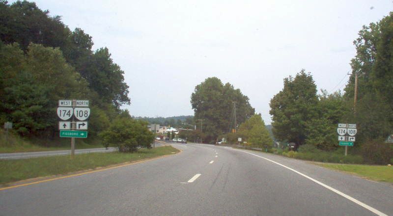
Photo: VA 174 west approaching VA 108 (photo by Mapmikey 9/3/06)
| ||||||
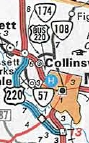
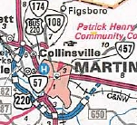
| ROUTE LOG US 220 Bus: 0 - 0 VA 108: 2.57 - 2.57 Martinsville-Henry Line: 1.72 - 4.29 VA 457: 1.29 - 5.58 |
Creation: Appeared in Dec 1978 (CTB) as an upgrade to SR 882, running from US 220 Business to VA 108.
This is the 2nd VA 174. Adjustments: In Nov 1990 (CTB), VA 174 was extended south to VA 57 (now VA 457), replacing part of VA 108. Improvements: Paved and multilaned upon inception Posting: Fully posted; Multiplexes: None Legislative names: None Other names: Kings Mountain Rd (Henry Co); Liberty St (Martinsville) Scenic Byway: no segments Comment: An alternative to downtown Martinsville from US 220 north of the city.
| |||||
| Previous VA 174's:
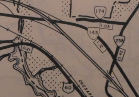
1965 ROUTE LOG US 60: 0 - 0 VA 143: 0.45 - 0.45 VA 238: 0.67 - 1.12 |
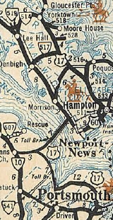
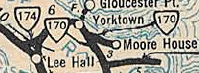
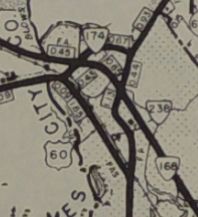
VA 174 #1: Appeared in July 1933 as a renumbering of VA 519, running from US 60 to VA 170 (now VA 238) in the Lebanon Church area near Lee Hall.
In Aug 1952 (CTB), a court decision awarded ownership of the land that included VA 174 from VA 168 (current VA 143) to the Naval Mine Depot at Lebanon Church belonged to the federal government who claimed it was needed for military purposes. The CTB then ordered all signs/markers removed from this portion of VA 174 and that it would no longer include that segment on any maps. You can see below that the maps thing didn't work out. In Oct 1966 (CTB), VA 174 was officially decommissioned. US 60 to VA 143 was obliterated by I-64 (and may have physically been gone sooner than this), while VA 143 to VA 238 became the responsibility of Yorktown Naval Weapons Station. However, VA 174 remained on county maps in a reduced form through at least 1969. VA 174 disappeared from the main side of official maps and insets from 1944-59.
|
|||||
Previous: VA 173 |
Next: VA 175
Top | Virginia Hwy Index
Home
Page last modified 24 January 2020