< VA 241-260 | Home | VA 262 >
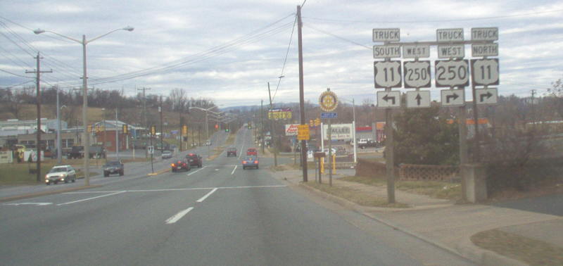
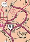
Photo: US 250 at what is now unposted VA 261 (Mapmikey, Jan 2006)
| |||||||||||||||||
| ROUTE LOG US 11: 0 - 0 US 250: 0.84 - 0.84 VA 254: 0.78 - 1.62 US 11: 0.14 - 1.76 END VA 261: 0.45 - 2.21 |
Creation: Appeared in 1981 as new primary routing. Ran as it does today. This is the 3rd VA 261.
Adjustments: None Improvements: Paved upon inception; 4-lane divided since inception. Posted: Was fully posted everywhere until 1999. Since then, VA 261 is posted as US 11 TRUCK and US 250 TRUCK. Multiplexes: NONE Legislative names: NONE Other names: Statler Blvd Scenic Byway: No segments Comment: It is presumed VA 261 still exists, as the last (2003) route log and the 2021 traffic log still shows it. Statler Blvd serves as another bypass option for US 11 and all but the last 0.45 miles is posted as US 11 TRUCK. It is also posted as US 250 TRUCK north of US 250. |
 2006 Official |
|||||||||||||||
| Previous VA 261's:
1940 ROUTE LOG WV LINE: 0 - 0 VA 260: 12.10 - 12.10 US 11 SB: 5.35 - 17.45 US 11 NB: 0.85 - 18.30 Forest Rd 108: 4.90 - 23.2 1951 ROUTE LOG US 522: 0 - 0 WV LINE: 6.9 - 6.9 |
VA 261 #1: Appeared in July 1933 as renumbering of VA 824.
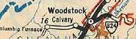
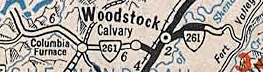
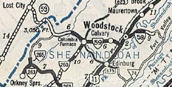
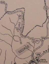
Ran from the West Virginia line at old WV 59 southeast to Liberty
Furnace and Columbia Furnace, then east to Woodstock and continued east
to near Woodstock Gap where it ended at Forest Rd 108.
In Sept 1940, VA 261 was renumbered as VA 59.
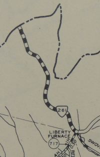
Today, the route used by VA 261 is from west to east: A 4wd trail from the WV Line south to Forest Rd 252 (the gravel road that currently runs from old WV 59 over to SR 675 was NOT VA 261 but was VA 59 later - see scans below); Forest Rd 252 south to SR 691; SR 691 to Liberty Furnace; SR 717 east to SR 675; SR 675 east to Columbia Furnace; SR 623 and SR 768 over to VA 42; VA 42 east to the I-81 area; Fairground Rd to US 11; US 11 Main St to Court St; Court St east to Water St; Water St north to Cemetery Rd; Cemetery Rd east out of Woodstock, becomes SR 758 which VA 261 followed up the mountain to its endpoint at forest road 108. The part west of SR 717 and the SR 758 ascent up the mountain are both still unpaved. The SR 758 section has several steep, sharp switchbacks.
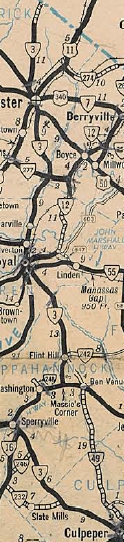
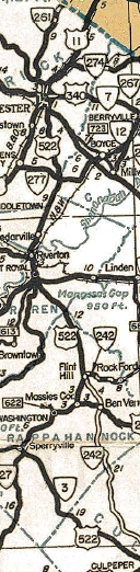
VA 261 #2: Appeared in the Sept 1940 renumbering, running from US 522 (just east of today's VA 37 interchange) north to the West Virginia State Line. This was a renumbering of a piece of VA 3. VA 261 was downgraded to SR 739 in April 1951 (CTB Minutes). VA 37 cuts off the route near its south end today.
Previous: VA 241-260 |
Next: VA 262
Page last modified 8 April 2023 | ||||||||||||||||