< VA 287 | Home | VA 289 >
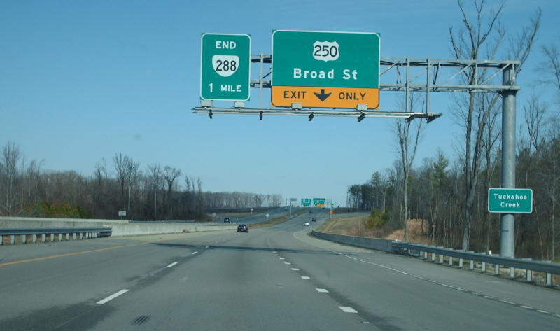
Photo: VA 288 ending at I-64 ahead (Mapmikey, Feb 2007)
|
|
|
| ROUTE LOG |
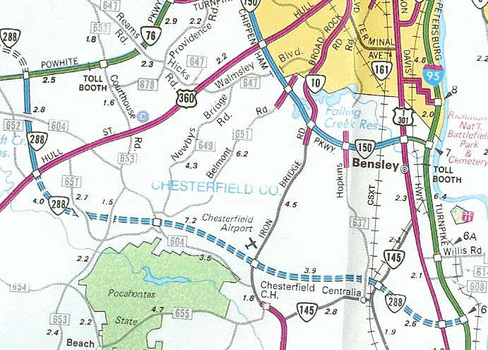
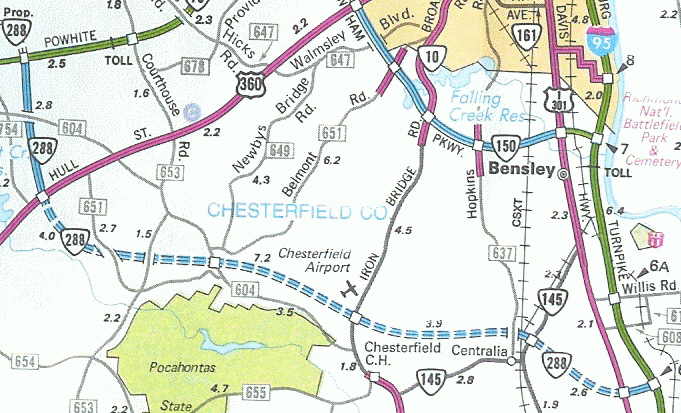
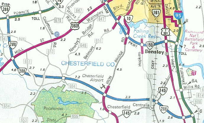
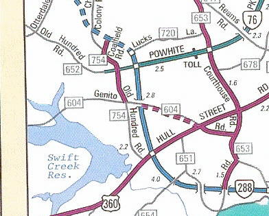
I-95 (exit 62): 0 - 0 US 1, US 301: 1.11 - 1.11 VA 145: 1.53 - 2.64 VA 10: 3.88 - 6.52 US 360: 7.04 - 13.56 VA 76: 2.79 - 16.35 US 60: 3.88 - 20.23 Powhatan-Chesterfield Line: 1.60 - 21.83 Goochland-Powhatan Line: 3.41 - 25.24 VA 6: 0.64 - 25.88 US 250: 3.47 - 29.35 I-64 (exit 175): 0.85 - 30.20
|
Creation: Appeared as dotted lines around 1988, although mentioned by name in CTB Minutes back to December 1967. Ran from I-95 to VA 76 only. This is the 2nd VA 288.
|
Adjustments: The first piece to be shown as open was between US 360 and VA 76, in 1989. The 1990 Official Map shows VA 288 also open between US 1-301 and I-95. The 1991 Official Map shows VA 288 open between VA 76 and I-95 The three scans below illustrate the progress from 1989-91 (click to see larger view).
The piece between West Creek Pkwy near VA 6 to US 250 opened as a super 2 about late 1997. In 2002, VA 288 was extended north from VA 76 to Lucks Lane
On 12/22/03, VA 288 was opened from US 250 to I-64. In spring 2004, VA 288 was opened between VA 6 and US 250 as the full freeway. On August 27, 2004 VA 288 was extended south from VA 6 to US 60. The final segment of VA 288 between Lucks Lane and US 60 opened Nov. 19, 2004. Improvements: Paved upon inception; 4-lane freeway in all sections, except I-64 to US 250 is 6-laned. Posted: Fully posted Multiplexes: NONE Legislative names: World War II Veterans Memorial Highway, designated 3/16/03 (entire route). The bridge over the James River is also separately named legislatively the same name. Other names: NONE Scenic Byway: No segments Comment: Now completed, VA 288 provides a western bypass of Richmond and allows access to US 60 and US 360 from either direction of I-95 without using the tolled Powhite Pkwy. Virginia requested VA 288 become an interstate in 1968 to form the western half of a Richmond Beltway and I-295 would meet it where it connects to I-95. Interstate status was denied and in 1977, the City of Richmond petitioned the CTB to drop the idea of a western interstate connection entirely. See Scott Kozel's site for a more detailed look into VA 288's history. | Previous VA 288's:
1941 ROUTE LOG US 13: 0 - 0 SR 695: 1.4 - 1.4 |
VA 288 #1: Appeared August 1933 (CTB Minutes) as new routing. Was a spur west off US 13 Temperanceville. Ran only as far as the railroad tracks.
VA 288 was downgraded to SR 695 in June 1947 (CTB Minutes). |
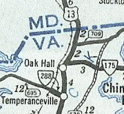
VA 288 in Accomack County 1941-42 Official |
||||||||||||