|
Virginia Commonwealth University (Medical College Campus), City of Richmond
Total Length: 0.38 miles
|
|
|
|
|
ROUTE LOG
8th St: 0 - 0
13th St: 0.38 - 0.38
|
|
Creation: Appeared sometime after 1973 (can't find any CTB references), running on Duval St between 8th and 13th Sts on the MCV campus at VCU. This appears to be the 2nd VA 353.
Adjustments: None
Improvements: Paved upon inception; no multilane segments
Posting: Fully posted with a shield at 13th St and a white rectangle at 8th St
Multiplexes: None
Legislative names: None
Other names: Duval St
Scenic Byway: No segments
Comments: VA 353 passes underneath the VA 33 Martin Luther King Bridge and runs alongside I-95.
VA 353 does not appear on any maps.
|
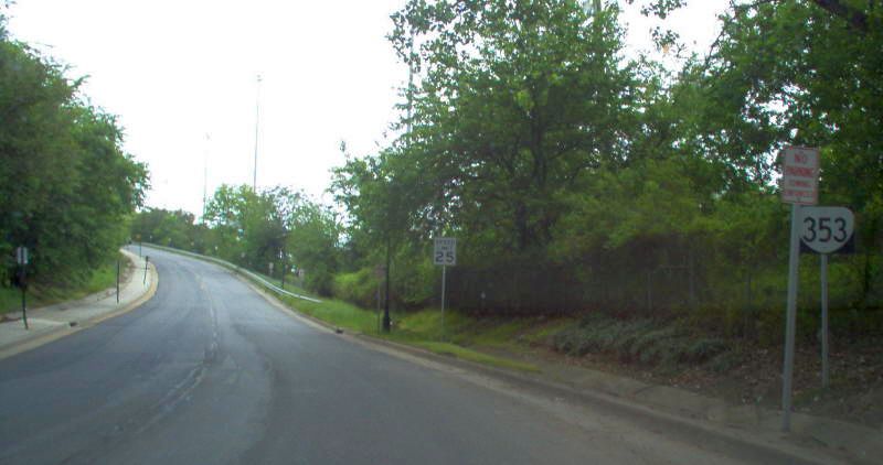
VA 353 from 13th St
Mapmipkey, April 2006
|
| Previous VA 353's:
1970 ROUTE LOG
Clay St: 0 - 0
END VA 353: 0.015 - 0.015
|
|
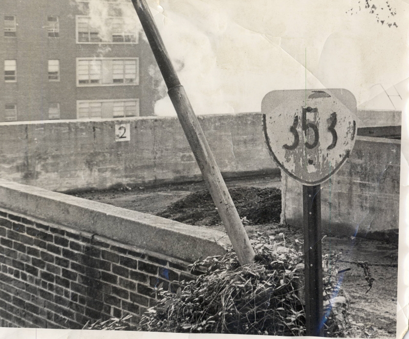
VA 353 #1: Appeared March 1942 (CTB) when 78 feet (0.015 miles) was added to the road to the Medical College of Virginia power plant south from the end of Clay St.
The May 1973 CTB clearly indicates that VA 353 is removed from the primary highway system.
This 78 feet of highway was posted (see title picture at top of page). Not surprisingly this does not show up on maps.
|