VA 370
< VA 369 | Home | VA 371 >
VA 370 view
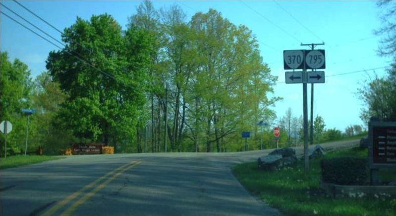
Photo: VA 370 from SR 646 (photo by Mapmikey, April 2010)
Natural Tunnel State Park (Scott County)
Total Length:  0.84 miles  
ROUTE LOG
Creation:  VA 370 was created Jan 1970 (CTB) as new primary routing, running from SR 871 into the state park. This is the only VA 370.
Adjustments:  In Feb 1980 (CTB), a two more pieces of VA 370 were created on the other side of the ravine, one west off SR 646 to the day use area and another off SR 795 heading for the campground.

VA 370 (1975 Scott County)
VA 370 original segment
1975 Scott County
VA 370 (1995 Scott County)
VA 370 expanded
1995 Scott County

Improvements:  paved upon inception; no multilane segments
Posted: Fully posted with shields on all segments; a white rectangle reassurance sign westbound leaving SR 646
Multiplexes:  None
Legislative names:  None
Other names:  None
Scenic Byway:  No segments
Comment:  VA 370 does not appear on official maps.


Previous: VA 369  |  Next: VA 371
Top  |  Virginia Hwy Index Home

Page last modified 10 September 2022