< VA 545 | Home | VA 547 >
| VA 546 not currently assigned | |||||
| Previous VA 546's: 1932 ROUTE LOG VA 510: 0 - 0 Surry-Sussex Line: 0.87 - 0.87 CR 1: 5.18 - 6.05 |
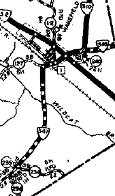
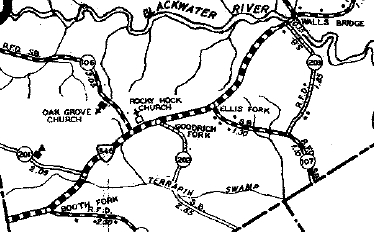
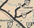
VA 546: Appeared in July 1932 (CTB) as an upgrade to CR 1, running from VA 510 (now VA 31) Wakefield east to about the Walls Bridge over Blackwater River towards Runnymede.
In July 1933, VA 546 became VA 196. Today, it is SR 617. VA 546 is shown on the 1932 Sussex and Surry County maps.
|
||||
Previous: VA 545 |
Next: VA 547
Top | Virginia Hwy Index
Home
Page last modified 23 August 2025