< SC 173 | Home \ SC 174 ALT | SC 175 >
|
|
|
| ROUTE LOG |
US 17: 0 - 0 SC 162: 2.6 - 2.6 SC 162: 1.1 - 3.7 Colleton-Charleston Line: 17.7 - 21.4 END SC 174: 4.5 - 25.9
|
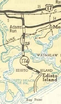
Creation: SC 174 appeared in 1936 as mostly new primary routing based on a mileage swap with SC 62 and Mathis Ferry Rd via SC Legisture, running from US 17 Alt (now SC 162) Adams Run south 9.12 miles. This is the only SC 174.
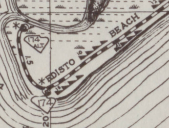
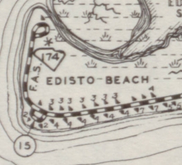
| In Nov 1937 (SCDOT), SC 174 was extended 7.5 miles to Edisto Island. In 1938, SC 174 was extended to the southwest corner of Edisto Beach where it ended in a little loop. SC 174 was also extended north to end at modern US 17 Osborne. The part between today's SC 162 and S-10-40 was a renumbering of a brief US 17 ALT. Adjustments: In 1947, SC 174 was extended around to the northwest corner of Edisto Beach where it ends now, replacing SC 174 ALT. The little loop where it ended before became S-10-15 (Colleton County took over Edisto Beach in 1975 so this is now S-15-679 Neptune St, S-15-681 Point St, and S-15-680 Billow St).
Improvements: SC 174 was paved in 1939; no map shows it, but SC 174 is undivided 4-lane for a 2.8 mile strect on Edisto Beach from Billow St east to where SC 174 turns north away from the ocean. This has been like this back to at least the mid-1980s. Comment: SC 174 also serves the Edisto Island Community. SC 174's endpoint in Edisto Beach had never been marked in my experience. The road curled around to meet back with SC 174 (there was a SC 174 marker at this intersection, indicating SC 174 went both ways), which by then you were on S-15-683. 2007-2013 GMSV shows an END SC 174 shield was placed. In the late 1970's SC 174 was very dangerous, with sharp curves in the marshes (some of this has been straightened out). | ||||||||
Previous: SC 173 |
Next: SC 174 ALT | SC 175
Top | South Carolina Hwy Index
Home
Page last modified 22 July 2017


