< SC 259 | Home | SC 261 >
|
|
|
| ROUTE LOG |
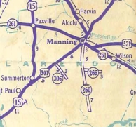
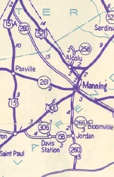
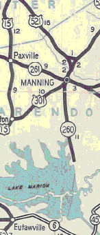
SC 261: 0 - 0 US 301: 0.3 - 0.3 END SC 260: 12.9 - 13.2
|
Creation: SC 260 appeared in 1939 as new primary routing, running as it does today. This is the only SC 260.
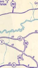
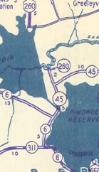
| Adjustments: In 1940, SC 260 was extended north with US 301, then northwest as new primary routing to end at US 15 south of Sumter. Also in 1940, a second piece of SC 260 was born in Berkeley County running from SC 311 near Cross north to SC 45 (now S-8-31) Eadytown. In 1942, the southern piece of SC 260 was extended north 2 miles to the Wilson anding area near the south end of Santee Dam. Eadytown south to SC 311 became parts of SC 45 and SC 6. Today this is SC 6; S-8-132; abandoned routing over the canal; SC 45; Timberline Way; S-8-23. In 1947, SC 260 was reduced to its current routing. Manning to US 15 became S-14-23 and S-43-25, while the Berkeley County piece became S-8-31.
Improvements: SC 260 was paved from Manning south to the dam in 1941. SC 260 has no mulitlane segments. Comment: SC 260 provides direct access to the Santee Dam. Rand McNally atlases for years have shown a road exists between Clarendon and Berkeley Counties just east of SC 260. As far as I can tell this has never been the actual case, even before Lake Moultrie came along. | |||||||||||
Previous: SC 259 |
Next: SC 261
Top | South Carolina Hwy Index
Home
Page last modified 7 August 2015