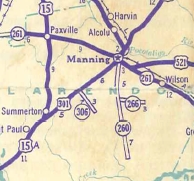
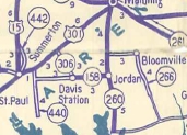
Previous SC 266's:
1946 ROUTE LOG
SC 260: 0 - 0
END SC 266: 6.9 - 6.9
|
|
SC 266: Appeared in 1939 as new primary routing, running from SC 260 east to Bloomville.
In 1942, SC 266 was extended 3.9 miles southeast as new primary routing to end at today's Great Savannah Church Rd.
In 1947, SC 266 was downgraded south of Bloomville to S-14-39 and S-14-43 (these are part of S-14-48 today). Between SC 260 and Bloomville was shown as a projected road on the 1943 Clarendon County map and to this day there is no road there. This means that SC 266 was in practice a floating state route, which I believe is the only one South Carolina ever had.

SC 266 south of Manning
1939 Official
|

SC 266 extended southeast
1942 Official
|
|