< SC 416 | Home | SC 418 >
|
|
|
| ROUTE LOG |
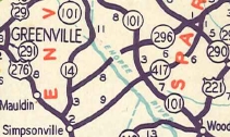
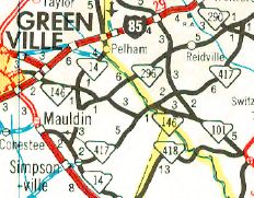
US 276: 0 - 0 I-185: 1.5 - 1.5 I-385 (exit 31): 0.1 - 1.6 SC 14 NB: 0.9 - 2.5 SC 14 SB: 1.5 - 4.0 SC 146 WB: 6.2 - 10.2 Spartanburg-Greenville Line: 1.0 - 11.2 SC 146 EB: 0.4 - 11.6 SC 101: 1.7 - 13.3 SC 290: 7.7 - 21.0 SC 296: 0.8 - 21.8
|
Creation: SC 417 appeared in 1949 as an upgrade to S-23-65 and S-42-84, running from US 276 (now SC 14) Simpsonville northeast to SC 296 west of Spartanburg. This is the only SC 417.
|
Adjustments: In 1964, SC 417 was extended west replacing US 276/SC 14 CONN (had been US 276 until 1958) to the newly built US 276 freeway in Mauldin.
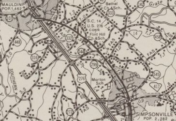
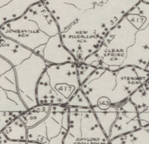
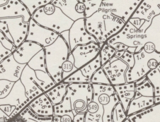
Between 1969-73, SC 417 was straightended out in eastern Greenville County leaving behind parts of S-23-143 Georgia Rd; Clear Springs Rd; S-23-145 Scuffletown Rd.
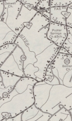
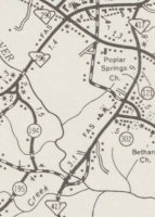
In 1975 (bridge date), SC 417 was striaghtened out at the South Tyger River, leaving behind Harmon Rd, Lightwood Knot Rd and abandoned routing.
Improvements: SC 417 paved upon designation; multilane from Mauldin to Simpsonville Comment: I used to used SC 417 (with SC 86 and SC 88, among other routes) as a backroad alternative to get to Spartanburg from Clemson. SC 417 is pretty quiet east of Simpsonville. | ||||||||||||
Previous: SC 416 |
Next: SC 418
Top | South Carolina Hwy Index
Home
Page last modified 5 September 2017