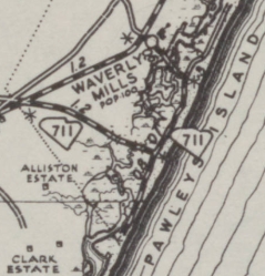
SC 711 ALT: Appeared in 1939, running as a 0.8 mile spur from SC 711 (S-22-10/266 intersection) south along Myrtle Ave in Pawleys Island, ending at roughly Hazard Ave.
In 1947, SC 711 ALT was downgraded to S-22-48.
Myrtle Ave south of SC 711 shown as primary and presumably SC 711 ALT.
It is also possible that the northern road back to US 17 was also SC 711 ALT.
1943 Georgetown County