< SC 706 | Home SC 711 >
|
|
|
| ROUTE LOG |
US 17 Bus: 0 - 0 US 17: 0.4 - 0.4 Horry-Georgetown Line: 0.4 - 0.8 SC 31: 7.0 - 7.8 US 17: 4.8 - 12.6
|
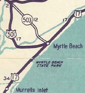
Creation: SC 707 appeared in 1949 as a renumbering of part of US 501, running from SC 544 Socastee east to US 501 Myrtle Beach. This is the 2nd SC 707.
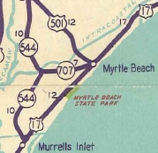
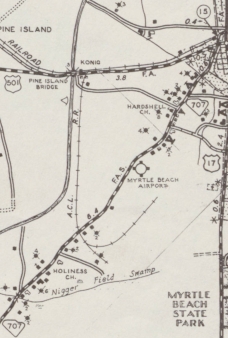
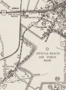
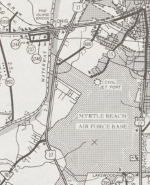
| Adjustments: In 1956, SC 707 was rerouted to meet US 501 further west, using Socastee Hwy. This left behind S-26-15 Old Conway Hwy. north of the airport and Emory Rd (now also Powell Lane) south of it. This change was made to make room for the current Myrtle Beach Airport/Air Force Base expansion. In 1981, SC 707 west was extended, replacing SC 544 from Socastee to Murrells Inlet.
Also, SC 707 east was truncated to the new US 17 Bypass of Myrtle Beach. About 2 miles of US 17 was built on the SC 707 right-of-way. The remainder became S-22-600, which has since been severed by more airport expansion - north of the airport is now S-22-1315 Grissom Pkwy.
Improvements: Fully paved at creation SC 707 was multilaned from its northern end west to Enterprise Rd in Socastee about 1999 (bridge date). Comment: SC 707 is not very exciting, although it was once the only way to get to Myrtle Beach as the original SC 38. When SC 544 was put on a new Intracoastal Waterway, SC 707 and SC 544 no longer intersect. | Previous SC 707's:
1946 ROUTE LOG US 701: 0 - 0 SC 723: 12.6 - 12.6 SC 51: 3.2 - 15.8 |
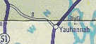
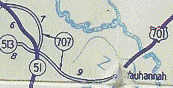
SC 707 #1: Appeared in 1939 as new primary routing, running from US 701 Yauhannah west to SC 51 (current SC 261-513 jct).
In 1940, SC 707 was rerouted at its west end to not touch SC 51 but instead curled around in a norther arc to meet SC 51 (now SC 261) at Oatland. In 1947, SC 707 was downgraded to S-22-13 from Yauhannah to where it used to nearly touch SC 51 (now this is part of SC 261); S-22-14 for the rest (part of this is now S-22-55).
|
||||||||||||||

Previous: SC 706 |
Next: SC 711
Top | South Carolina Hwy Index
Home
Page last modified 15 November 2019