ROUTE LOG
KY STATE LINE: 0 - 0
EXIT 1 - TN 48: 1.5 - 1.5
EXIT 4 - US 79, TN 13: 2.8 - 4.3
EXIT 8 - TN 237: 3.6 - 7.9
EXIT 11 - TN 76: 2.7 - 10.6
Montgomery-Robertson Line: 6.6 - 17.2
EXIT 19 - TN 256: 2.0 - 19.2
EXIT 24 - TN 49: 5.3 - 24.5
Robertson-Cheatham Line: 0.9 - 25.4
Cheatham-Robertson Line: 0.7 - 26.1
Robertson-Cheatham Line: 2.4 - 28.5
EXIT 31 - TN 249: 2.6 - 31.1
Cheatham-Davidson Line: 1.0 - 32.1
EXIT 35 - US 431, TN 65: 3.0 - 35.1
EXIT 40 - TN 45: 5.6 - 40.7
EXIT 43 - TN 155: 2.9 - 43.6
EXIT 44 - I-65 NB (exit 88): 1.4 - 45.0
EXIT 87 - US 431, TN 65: 1.3 - 46.3
EXIT 46 - I-65 SB (exit 86): 1.0 - 47.3
EXIT 47 - Jefferson St: 1.1 - 48.4
EXIT 48 - US 31, US 41, TN 6, TN 11: 0.4 - 48.8
EXIT 49 - Shelby Ave: 0.4 - 49.2
EXIT 50 - I-40 WB (exit 211): 0.9 - 50.1
EXIT 212 WB only - US 70, TN 24: 0.3 - 50.4
EXIT 212 EB only - Fesslers Ln: 0.7 - 51.1
EXIT 52B - I-40 EB (exit 213), I-440 Begin: 1.0 - 52.1
EXIT 52 (old exit 9) - US 41, US 70S, TN 1: 0.2 - 52.4
EXIT 53 - I-440 WB: 0.7 - 53.1
EXIT 54 (old exit 10) - TN 155: 1.2 - 54.3
EXIT 56 (old exit 11) - TN 255: 2.1 - 56.4
EXIT 57 (old exit 12) - Haywood Ln: 1.3 - 57.7
EXIT 59 (old exit 13) - TN 254: 2.4 - 60.1
EXIT 60 - Hickory Hollow Pkwy: 0.7 - 60.8
EXIT 62 (old exit 14) - TN 171: 2.3 - 63.1
Davidson-Rutherford Line: 0.6 - 63.7
EXIT 64 (old exit 15) - Waldron Rd: 1.2 - 64.9
EXIT 66 - TN 266: 2.0 - 66.9
EXIT 70 (old exit 16) - TN 102: 3.0 - 69.9
EXIT 74 - I-840 (exit 53): 4.7 - 74.6
EXIT 76 - Manson Pike: 1.6 - 76.2
EXIT 78 (old exit 17) - TN 96: 1.8 - 78.0
EXIT 80 - TN 99: 1.8 - 79.8
EXIT 81 (old exit 18) - US 231, TN 10: 1.5 - 81.3
EXIT 84 - Joe B Jackson Pkwy: 2.3 - 83.6
EXIT 89 (old exit 19) - Epps Mill Rd: 5.3 - 89.1
Rutherford-Bedford Line: 7.5 - 96.6
Bedford-Coffee Line: 0.5 - 97.1
EXIT 97 (old exit 20) - TN 64: 0 - 97.1
EXIT 105 (old exit 21) - US 41, TN 2: 8.4 - 105.5
EXIT 110 (old exit 22) - TN 53: 5.0 - 110.5
EXIT 111 (old exit 23) - TN 55: 1.0 - 111.5
EXIT 114 (old exit 24) - US 41, TN 2: 2.5 - 114.0
EXIT 117 (old exit 25) - Arnold Center Rd: 3.5 - 117.5
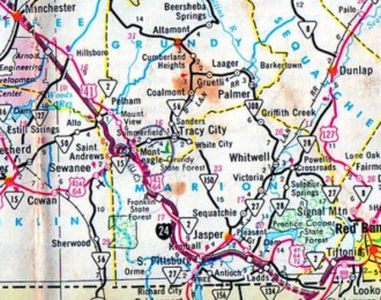
Coffee-Grundy Line: 9.7 - 127.2
EXIT 127 (old exit 26) - US 64 WB, TN 50: 0.5 - 127.7
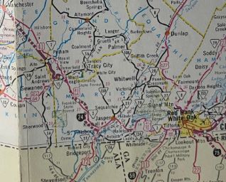
Grundy-Marion Line: 6.8 - 134.5
EXIT 134 (old exit 27) - US 41 ALT, TN 15: 0 - 134.5
EXIT 135 (old exit 28) - TN 2 NB: 1.4 - 135.9
EXIT 143 (old exit 29) - TN 2 SB: 7.0 - 142.9
EXIT 152 (old exit 30) - US 64 EB, US 72, TN 27 SB, TN 150: 9.1 - 152.0
EXIT 155 - TN 28: 3.6 - 155.6
EXIT 158 (old exit 31) - TN 27 NB: 3.1 - 158.7
EXIT 161 (old exit 32) - TN 156: 2.7 - 161.4
Marion-Hamilton Line: 5.5 - 166.9
GA STATE LINE: 0.3 - 167.2
EXIT 167 - I-59: 1.4 - 168.6
EXIT 169 - GA 299: 2.1 - 170.7
TN STATE LINE: 0.6 - 171.3
EXIT 174 (old exit 33) - US 41, US 64, US 72, TN 2: 2.9 - 174.2
EXIT 175 (old exit 34) - Browns Ferry Rd: 1.2 - 175.4
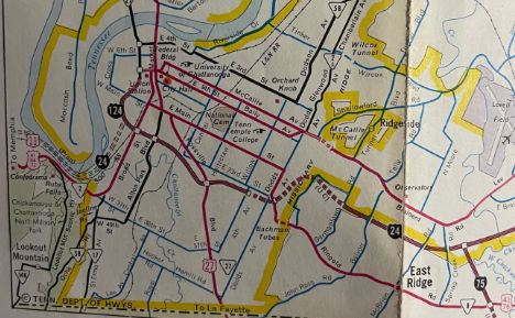
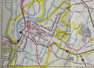
EXIT 178B - I-124, US 27 NB: 3.3 - 178.7
EXIT 178A (EB only) (old exit 35) - US 11, US 41, US 64, US 72, TN 2: 0.3 - 179.0
EXIT 178 (WB only) (old exit 37) - TN 27 NB, TN 58: 0.2 - 179.2
EXIT 180A (EB only) (old exit 38) - Central Ave: 0.6 - 179.8
EXIT 180 (old exit 38) - US 27 SB, TN 27 SB: 0.8 - 180.6
EXIT 181 (old exit 39) - 4th Ave: 0.7 - 181.3
EXIT 181A (EB only) (old exit 40) - US 41, US 76, TN 8: 0.5 - 181.8
EXIT 183 (old exit 41) - Germantown Rd: 1.5 - 183.3
EXIT 183A (old exit 42) - Belvoir Ave: 0.5 - 183.8
EXIT 184 (old exit 43) - Moore Rd: 0.8 - 184.6
EXIT 185 - I-75, US 74: 1.2 - 185.8
|
|
Creation: First appeared in 1939 from Nashville to Chattanooga as part of the long-term national planning leading to the Interstate system. Was numbered as I-24 in August, 1957.
Adjustments: In October 1957, I-24 was approved to extend northwest of Nashville to Cairo, Illinois (by mileage added and the June 1958 map of interstate numbering this was probably to I-57 where it goes now)
Per Wikipedia, which references newspaper articles, the first segment of I-24 to open was in 1958 from TN 58 Market St to 23rd St within Chattanooga, where a temporary access was built at Central Ave
In 1962, I-24 was open from TN 50 (now US 64) Pelham to US 41 (now unsigned TN 2) Monteagle; also from Germantown Rd to I-75
In 1963, I-24 was opened from Central Ave to 4th Ave within Chattanooga, closing off the temporary access to 23rd St.
In 1964, I-24 was opened from US 31-41 1st St to I-40 in Nashville
In 1965, I-24 was opened from US 431 Trinity Ln and US 31-41 1st St and on its I-40 overlay in Nashville also from 4th Ave to Germantown Rd in Chattanooga
In 1965-66, I-24 was opened between I-40 and TN 171
In 1966, I-24 was opened from Monteagle to TN 27; also from US 41-64-72 Lookout Valley to I-124
I-24 opened with a gap in eastern Chattanooga
1964 Official
|
I-24 finished through Chattanooga
1971 Official
|
In 1967, I-24 was opened from US 41 Manchester to TN 50 Pelham; also from TN 27 to TN 156
I-24 opened north of Monteagle
1964 Official
|
I-24 opened near Manchester to Chattanooga
with a gap in Monteagle and Georgia
1968 Official
|
In 1968, I-24 was opened from US 431 Trinity Ln to the I-65 north interchange
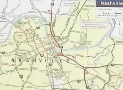
I-24 open through downtown Nashville
1966 Esso
|
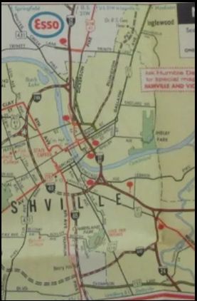
I-24 open up to I-65 north split
1969 Esso
|
Also in 1968. I-24 opened from TN 156 to US 41-64-72 Lookout Valley
In 1969, I-24 opened from US 41 near Beechgrove to US 41 Manchester
In 1970, I-24 opened from TN 171 near Nashville to TN 64 Beechgrove
In 1971, I-24 opened from TN 64 to US 41 Beechgrove
I-24 a short distance out of Nashville
1968 official
|
I-24 open Nashville to Manchester except Beechgrove
1971 official
|
I-24 open Nashville to Manchester
1972 official
|
In 1972, I-24 was completed from Monteagle east down the mountain.
I-24 opened through Georgia
1971 Official
|
I-24 opened east out of Monteagle
1972 Official
|
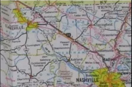
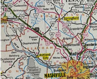
In 1975, I-24 opened from Kentucky to US 79 Clarksville
In 1976, I-24 was opened from US 79 to TN 49
In 1978, I-24 was opened from TN 49 to I-65 Nashville
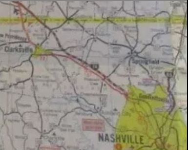
I-24 opened Kentucky to US 79
1976 Exxon
|
I-24 opened Kentucky to TN 49
1977 Official
|
I-24 completed to Nashville
1981 Official
|
Improvements: Upon opening, I-24 was 4-laned throughout except: I-65 north through Nashville to US 41-70S; Monteagle to the bottom of the mountain; I-124 to TN 58 and US 41-76 to I-75 in Chattanooga
In 1975, I-24 was 8-laned from Shelby Ave to I-40 in Nashville
In 1980, I-24 was 8-laned on the I-40 overlay in Nashville
In the late 1980s, I-24 was 6-laned from TN 58 to US 41-76 in Chattanooga
In 1990, I-24 was 6-laned from TN 255 to TN 254
In 1998, I-24 was 8-laned from Haywood Ln to TN 266 Smyrna, including making the left lane HOV-2
In 2000, I-24 was 8-laned from TN 266 Smyrna to TN 840
In 2002, I-24 was 8-laned from I-440 to Haywood Ln
In 2005, I-24 was 8-laned from TN 840 to TN 96 Murfreesboro
In 2008, I-24 was 8-laned from TN 96 to US 231 Murfreesboro
New Exits Added:TN 255 (around 1970)
TN 266 (ca. 1976)
Hickory Hollow Pkwy (around 1978)
TN 28 (1982)
I-440 (1986)
TN 840, now I-840 (1996)
Joe Jackson Pkwy (2002)
Manson Pike (2005)
TN 99 (2008)
Comments: The routing west out of Nashville was unsettled for a number of years in Tennessee. One route would have followed I-40 out to the Dickson area before heading northward towards Paducah. Some early maps showed the proposed routing in Kentucky a bit different from how it was built.
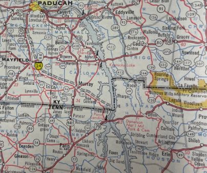
I-24 proposed routing south of actual routing
1961 RMcN
|