ROUTE LOG
GA STATE LINE: 0 - 0
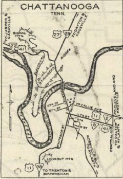
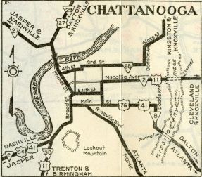
US 11 NB, US 41, US 64, US 72, TN 2: 3.0 - 3.0
|
|
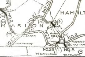
Creation: Appeared in 1923 as an original state highway running from TN 2 (now US 11-41-64-72) Lookout Mtn southwest to Georgia.
Adjustments: Although the biannual highway repoort route logs never changed descriptions, the 1930 Official map did have TN 38 north extended to Chattanooga (both on the map and its route log) during the time that TN 2 west from TN 38 to the Jasper area was under construction.
By 1932, TN 38 was truncated back to its original routing.
In 1933, TN 38 was removed from Wauhatchie Pike.
Posting: TN 38 is secondary routing that is completely unposted
Secret US Route Overlay: US 11 (entire route)
Comment: TN 38's "modern" alignment includes a railroad underpass that is less than two lanes wide.
TN 38
1924 Official
|
TN 38 into Chattanooga
1930 Official
|
TN 2 re-established west out of Chattanooga
1932 Official
|
|