< TN 74 | Home | TN 76 >
|
|
|
| ROUTE LOG |
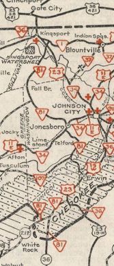
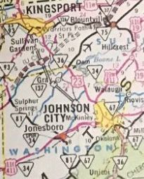
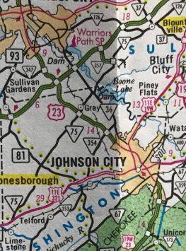
US 11E, US 321, TN 34: 0 - 0 TN 81: 7.8 - 7.8 I-26 (exit 13), US 23: 7.6 - 15.4 TN 36: 2.7 - 18.1 Sullivan-Washington Line: 0.6 - 18.7 TN 357: 3.3 - 22.0 TN 126: 5.7 - 27.7
|
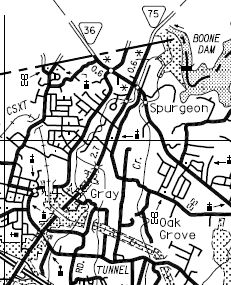
Creation: Appeared between 1964-69 running from US 23 (now TN 36) Spurgeon to TN 126 Blountville. This was a renumbering of part of TN 37. This is the 3rd TN 75.
| Adjustments: In 1983, TN 75 south was extended north with TN 36 a bit, then extended southwest to US 11E-321 Limestone.
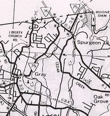
In 1998, TN 75 was removed from Gray Station Rd between I-26 and TN 36.
Posting: Posted as secondary routing everywhere. Secret US Route Overlay: None Comment: serves the Tri-Cities Airport as well as Boone Dam. | Previous TN 75's:
|
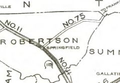
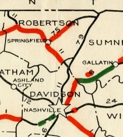
TN 75 #1: An original state highway which in 1924 ran from TN 11 (now US 41) Springfield northeast to the Kentucky State Line at Mitchell.
In 1925 or 1926, TN 75 north was truncated to and replaced by TN 79 at Reubensville. Today TN 75's routing from Reubensville to Mitchell is US 31W except: lengthy visible abandoned segment to the west from Old TN 52 WB to north of Byrum Chapel Rd; Old Hwy 31W in the Summers Branch area In 1927 or 1928, TN 75 was renumbered as TN 49 from Springfield to Orlinda and TN 52 from Orlina to Reubensville. Today this is still largely TN 49 and TN 52 except a couple abandoned TN 52 alignments near Handleyton and East Old highway 52 in Reubensville.
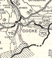
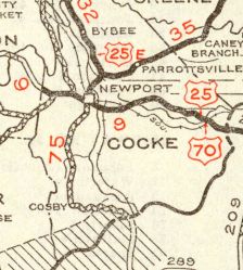
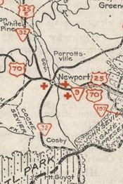
TN 75 #2: Appeared in 1927 or 1928 as new routing, running from US 25-70 Newport south through Cosby to the NOrth Carolina line near the Sevier-Cocke line.
| |||||||||||||||||