ROUTE LOG
US 11E, TN 34: 0 - 0
US 25W SB, US 70 EB, TN 9 SB: 5.4 - 5.4
Sevier-Jefferson Line: 0.4 - 5.8
US 25W NB, US 70 WB, TN 9 NB: 1.1 - 6.9
TN 66: 6.6 - 13.5
TN 338: 3.1 - 16.6
Jefferson-Sevier Line: 0.4 - 17.0
TN 92: 8.0 - 25.0
|
Creation: Appeared in 1950 running from US 25W-70 near Underwood to TN 66 (now TN 338) near the Douglas Dam.
Adjustments: In 1975, TN 139 east was truncated to TN 66 Henry Cross Roads.
In 1983, TN 139 east was re-extended along its original routing (east of TN 338 was old TN 66) to the Douglas Dam area, then further east to TN 92 Dandridge; separately, TN 139 west was extended east with US 25W-70 to Four Points, then northwest as new routing to US 11W Strawberry Fields.
Posting: Posted as secondary routing throughout
TN 139 is not posted on its overlays with US 25W-70.
Secret US Route Overlay: None
Comment: Runs along the north shore of Douglas Lake
Tn 139 is blown off by I-40 but access isn't too hard via either TN 66 or Kodak Rd.
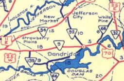
TN 139 original route
1951 Official
|
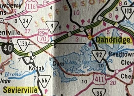
TN 139 truncated to new TN 66 routing
1981 Official
|
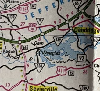
TN 139 expanded both directions
1989 Official
|
|