< US 127 | Home | US 129 ALT | US 143 >
| |||||||
| ROUTE LOG NC STATE LINE: 0 - 0 Foothills Pkwy: 14.3 - 14.3 Monroe-Blount Line: 6.2 - 20.5 TN 72: 0.9 - 21.4 Blount-Monroe Line: 0.2 - 21.6 TN 336: 3.4 - 25.0 US 411 SB, TN 35 SB: 7.0 - 32.0 TN 335: 1.8 - 33.8 US 411 NB, TN 33 NB: 2.5 - 36.3 US 321, TN 73: 0.9 - 37.2 TN 446: 0.2 - 37.4 TN 35: 2.8 - 40.2 TN 335: 0.7 - 40.9 I-140 (exit 11), TN 162: 2.7 - 43.6 TN 333: 2.2 - 45.8 Knox-Blount Line: 0.5 - 46.3 TN 168: 0.8 - 47.1 US 11, US 70, TN 1: 4.7 - 51.8 I-40 (exit 387), TN 115 END: 1.1 - 52.9 |
Creation: Approved for extension into Tennessee in 1935, running generally as it does today plus extended on paper to have replaced US 25W north into Kentucky. US 129 was added to TN 72 from NC to above Lonore; TN 33 north to Knoxville; (on paper) TN 9 to Kentucky. Tennessee tried to get AASHO to renumber US 25W as US 25A instead.
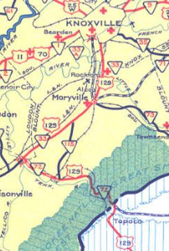
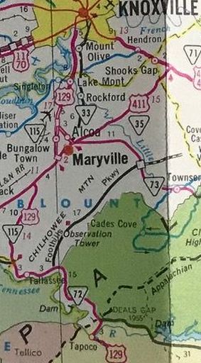
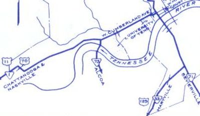
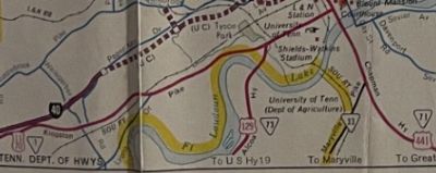
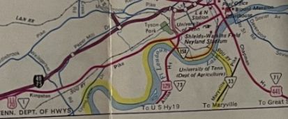
Adjustments: US 129 may have briefly used Maryville Pike in S. Knoxville but was moved to Ogle Ave/W. Martin Mill Pike by 1938. In 1939 or 1940, US 129 was rerouted near Tallassee to follow TN 115 towards Maryville instead of TN 72 and TN 33. The original US 129 west to today's US 411 used (west to east): Clearview Dr and Marina Harbor Dr on each side of Nine Mile Creek; current TN 72 to about where it turns away from the lake at Smoky Branch; "Old Hwy 72" that is accessible via Smoky Rd or Diamond Branch Rd; abandoned Old Hwy 72 that is not drivable just west of US 129. In 1952, US 129 on paper was truncated to end at US 11-70 Main and Henly Sts (per official TN route logs) and US 25W remained posted as it always was north of Knoxville. In 1956, US 129 was built on new alignment slightly north of the original from just west of Chilhowie Dam to the Tabcat Creek bridge, about 6 miles worth. The old alignment is now underwater though is visible during dryer times, especially the old Abrams Creek Bridge. In 1959, AASHO rejected a Tennessee request to extend US 129 with US 441 to Halls Crossroads, then follow TN 33 to Tazewell, then join US 25E to end at Cumberland Gap. In 1961, US 129 was rerouted at south of Maryville to instead follow the TN 115 bypass of Maryville, then TN 73 (now also TN 115) to Knoxville, ending at US 11-70 a little west of downtown Knoxville. The old route to Knoxville remained part of TN 33 (Tennessee tried to have this become US 129 ALT but AASHO rejected it).
In 1962, AASHO rejected a 2nd attempt to extend US 129 to Cumberland Gap on the same path as the 1959 request. In 1963, AASHO rejected a 3rd attempt to extend US 129 to Cumberland Gap on the same path as the 1959 request. In 1966, US 129 was extended north to I-40 as newly constructed freeway.
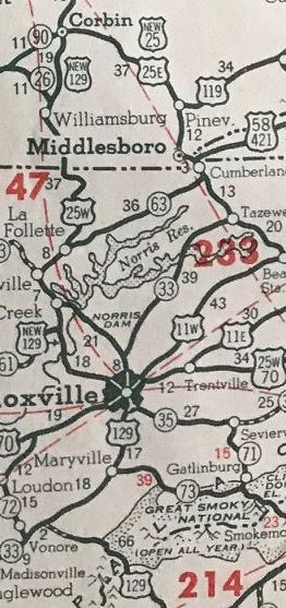
In 1979, Tennessee presented AASHO a proposal, as part of eliminating US 25W, that would have extended US 129 from Knoxville to replace US 441 to Halls Crossroads, then added to TN 33 to end at US 25E Tazewell.
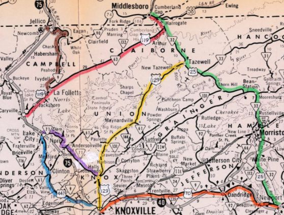 US 129 proposed extension north of Knoxville 1979 TDOT Correspondence to AASHO Posting: Fully posted Secret TN Route Overlay: TN 115 (entire length) Comment: US 129 is the "Tail of the Dragon" highway that runs from the NC Line to the Tabcat Creek Bridge...famous for its multitude of mountainous curves and is popular with motorcyclists. Mapmikey drove this one time in 1987...at night and in a 1984 Chevette. Guessing it isn't the same sort of experience. Enthusiasts might find TN 32 from US 321 to North Carolina to be more challenging. US 129 is the alternative gateway to the Great Smoky Mountains (with US 321 east) via Maryville | ||||||