Virginia Highway 30

Southern Terminus

Northern Terminus

At I-64/SR 607 near Croaker, VA At US 1 at Doswell, VA

Southern Terminus

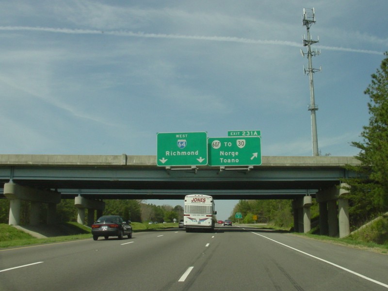
Overhead signage along westbound I-64 outside WIlliamsburg.  The exit sign is in error....VA 30 actually begins here, so the "TO" should be a "NORTH" instead.  Photo by Adam Froehlig, taken April 6, 2003.

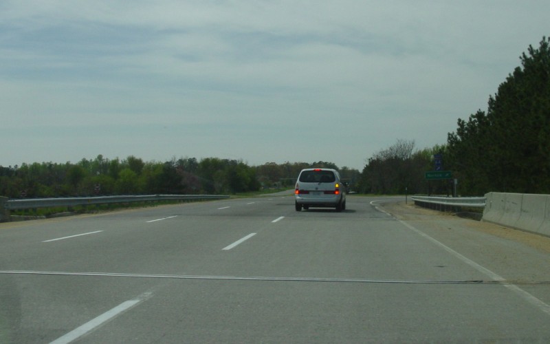
On the bridge over I-64.  Beyond the van and the interchange is the intersection where VA 30 turns off of SR 607.  Photo by Adam Froehlig, taken April 6, 2003.

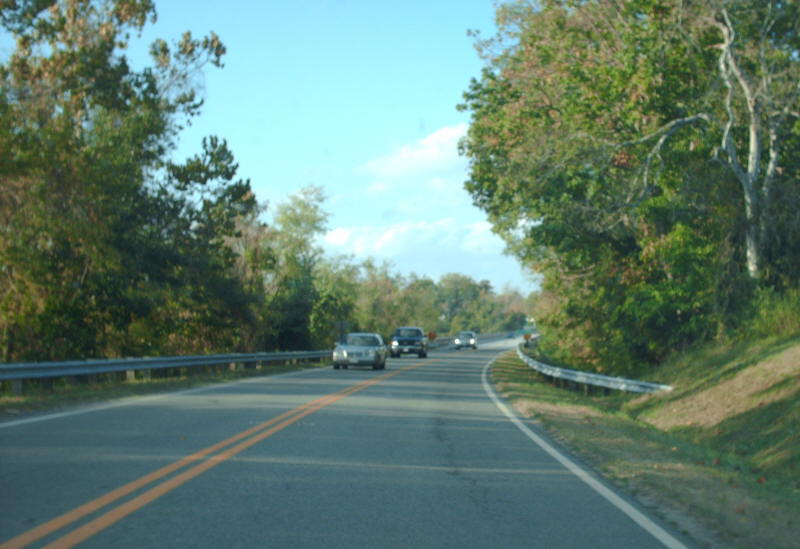
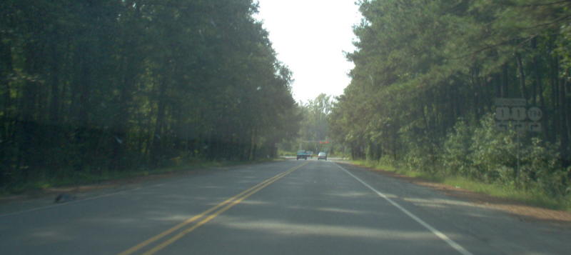
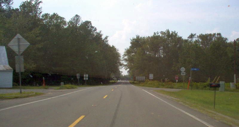
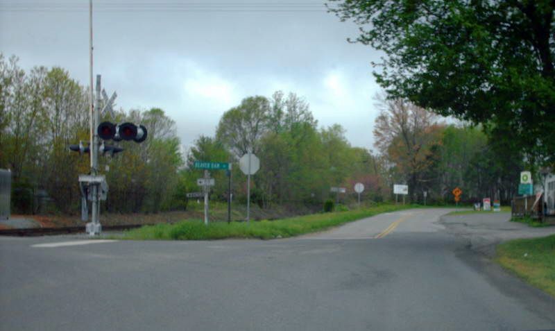
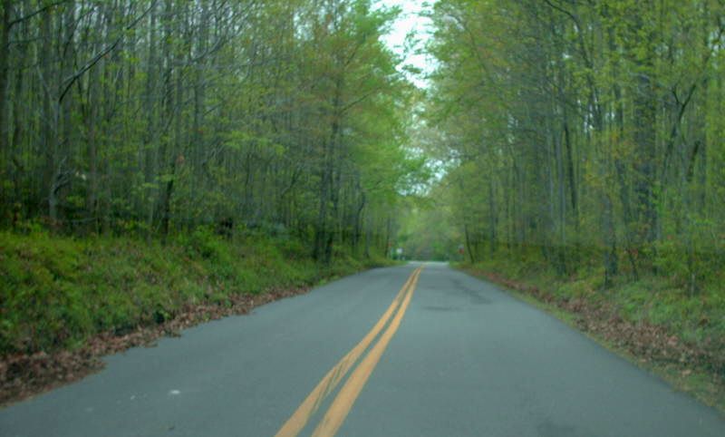
This is from VA 30 southbound at SR 607. This is where posting for VA 30 begins. Straight ahead is F137.  Photo by Mapmikey, taken January 7, 2006.

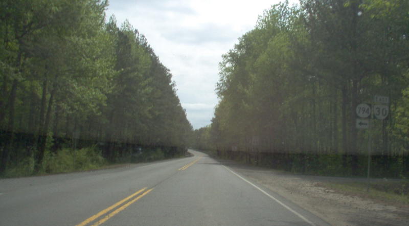
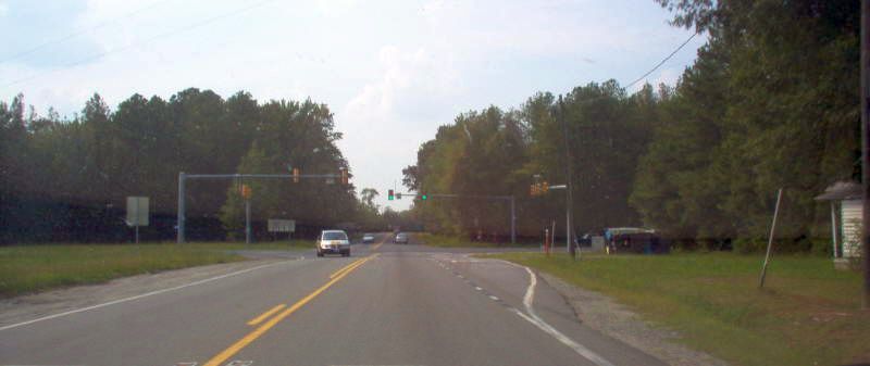
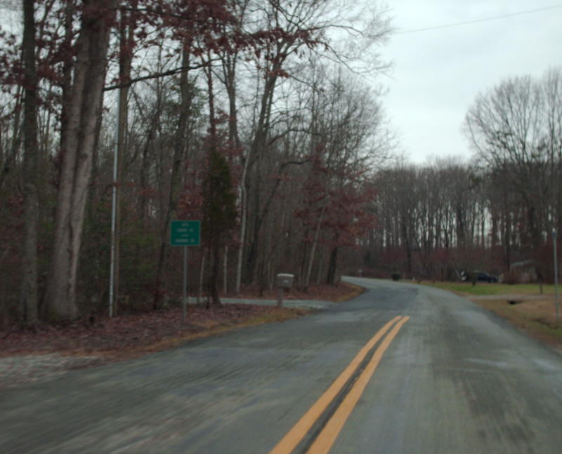
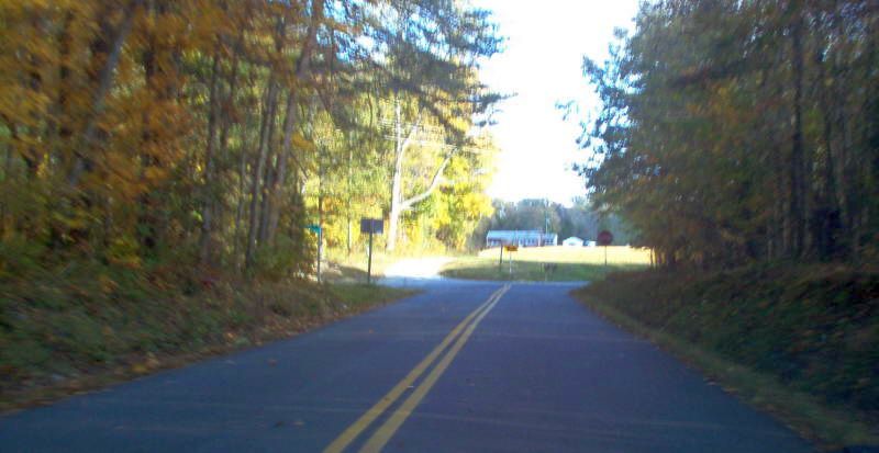
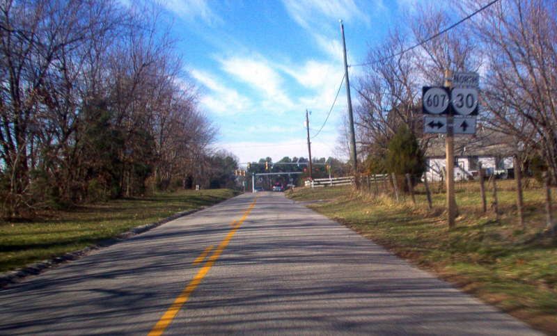
This is from F137 approaching VA 30/SR 607.   Photo by Mapmikey, taken December 10, 2005.

This is the first VA 30 reassurance shield, leaving SR 607.   Photo by Mapmikey, taken January 7, 2006.

Former Southern Terminus (1923-28)

From 1923-28, this was VA 30 east coming to an end approaching the bridge to Urbanna which was ever so slightly east of this bridge.   Photo by Mapmikey, taken October 27, 2007.

Northern Terminus

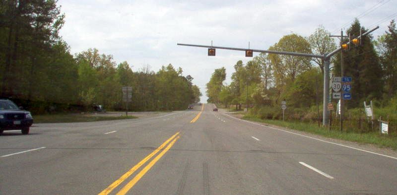
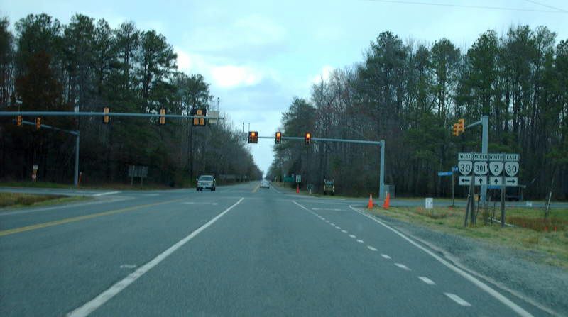
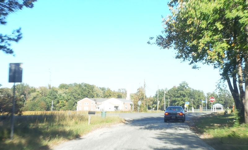
From US 1 northbound.  VA 30 is signed east-west on this end.  Photo by Mapmikey, taken February 3, 2007.

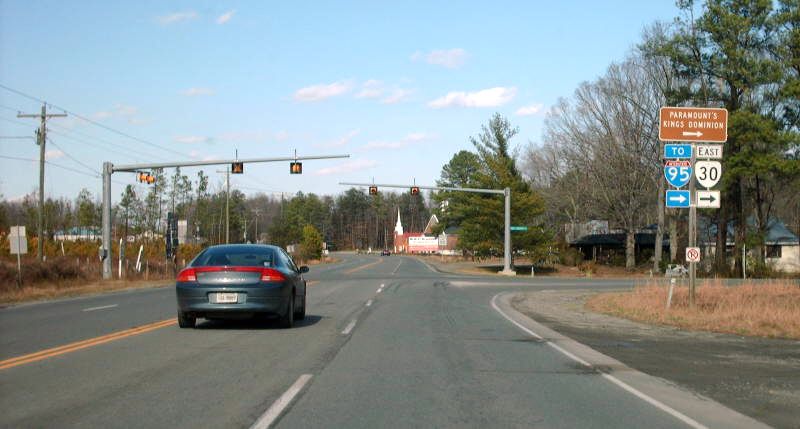
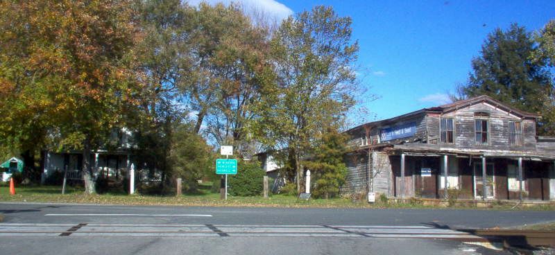
Beginning down VA 30.  I-95 and Kings Dominion are just ahead. VA 30 has ended here since 1971.   Photo by Mapmikey, taken April 26, 2006.

From US 1 southbound.  Photo by Mapmikey, taken April 26, 2006.

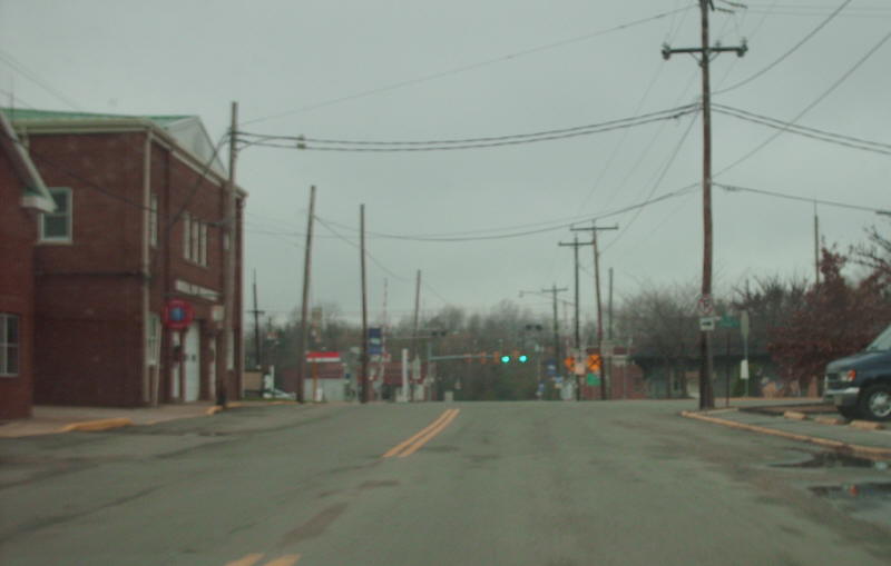
Approaching US 1 from VA 30.  Photo by Mapmikey, taken September 9, 2006.

Former Northern Terminus (1937-71)

From 1937-71, this was VA 30 west coming to an end at VA 2 in Dawn.   Photo by Mapmikey, taken September 9, 2006.

Here is US 301/VA 2 north at VA 30 which began to the right.   Photo by Mapmikey, taken March 17, 2007.

Former Northern Terminus (1933-37)

From 1933-37, VA 30 used SR 651 north from Dawn to end at the new alignment of VA 2. Here is US 301/VA 2 north at SR 651 (old VA 30).   Photo by Mapmikey, taken March 17, 2007.

Here is the view from SR 602 looking across US 301/VA 2 at SR 651 and so this is the view of VA 30 south beginning. Note that SR 651 was VA 50 prior to VA 30.   Photo by Mapmikey, taken January 7, 2012.

Former Northern Terminus (1932-33)

From 1932-33, VA 30 and at today's SR 651 (was VA 50) Dawn.   Photo by Mapmikey, taken September 9, 2006.

Here is VA 30 south leaving SR 651 (old VA 50).   Photo by Mapmikey, taken October 18, 2016.

Here is SR 651 (old VA 50) north at VA 30 which used to begin to the right.   Photo by Mapmikey, taken October 18, 2016.

Former Western Terminus, Segment II (1933-43)

From 1933-46, a second piece of VA 30 existed in the Beaverdam area.   From 1933-43, this separate segment of VA 30 ended at the Louisa-Hanover line. This is westbound on SR 715.   Photo by Mapmikey, taken December 20, 2008.

This is eastbound on SR 715.   Photo by Mapmikey, taken April 21, 2015.

Early route logs actually defined VA 30 as running to Mineral but the mileage was never adopted into the primary system in Louisa County. But this would've been VA 30's western endpoint, at VA 49 (now US 522/VA 208) which was straight and right at this intersection.   Photo by Mapmikey, taken December 20, 2008.

Former Western Terminus, Segment II (1943-46)

From 1933-46, a second piece of VA 30 existed in the Beaverdam area.   From 1943-46, this separate segment of VA 30 (now SR 739) ended at SR 715 in Beaverdam. From 1933-43 VA 30 kept straight here heading for Louisa County.   Photo by Mapmikey, taken April 23, 2008.

This is SR 715 east at SR 739 (old VA 30) straight ahead.   Photo by Mapmikey, taken April 23, 2008.

This is SR 715 west (turns left) at SR 739 (old VA 30) to the right.   Photo by Mapmikey, taken October 25, 2006.

Former Eastern Terminus, Segment II

From 1933-46, a second piece of VA 30 existed in the Beaverdam area.   This is northbound SR 738 (old VA 51) approaching SR 739 (old VA 30) which is on the left.   Photo by Mapmikey, taken October 25, 2006.

This is southbound SR 738 (old VA 51) at SR 739 (old VA 30) on the right.   Photo by Mapmikey, taken April 23, 2008.

This is old VA 30 leaving old VA 51.   Photo by Mapmikey, taken April 23, 2008.

This is old VA 30 ending at old VA 51.   Photo by Mapmikey, taken October 25, 2006.

Back to VA Highway Endings
Back to VA 30 listing

Last Updated:  May 25, 2017

(C) 2017-2005, Adam Froehlig, Mike Roberson