WV 58
< WV 57 | Home | WV 59 >
From: Stonewood (Harrison County)
To: Bridgeport (Harrison County)
Total Length: 6.2 miles  
ROUTE LOG
WV 20: 0 - 0
I-79 (exit 117): 3.2 - 3.2
US 50: 2.9 - 6.2

Creation: WV 58 was designated between 1957-60 as an upgrade to parts of CR 26, 21, and 23; new construction along CR 20/45 corridor; used some CR 20/42. This is the 3rd WV 58.
Adjustments: WV 58 was shifted slightly south to accomodate I-79. The two pieces of Smithfield St Extd east of I-79 are former alignments of WV 58.
Improvements: Paved upon designation; no multilane segments
Comment: Not sure why this wasn't extended west when WV 98 was created...
1964 Traffic Count
WV 58 near Clarksburg
1964 Traffic Count

Previous WV 58's:

1927 ROUTE LOG
WV 56: 0 - 0
WV 72 NB: 21 - 21
WV 72 SB: 2 - 23
WV 40: 9 - 32
Maryland State Line: 10 - 42


1940 ROUTE LOG
Virginia State Line: 0 - 0
WV 23: 20 - 20
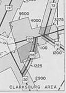
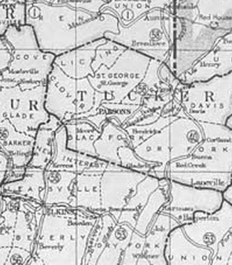
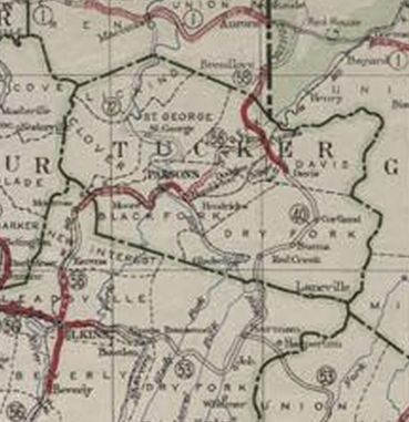
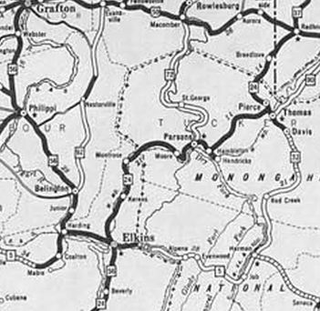
WV 58 #1: Appeared 1922 as new primary routing, running from WV 56 (now WV 92) Elkins north through Parsons to end at WV 1 (now US 50) Brookside
In 1924, WV 58 north was rerouted at Breedlove to instead head into Maryland. The old route to WV 1 became secondary for a few years and is now WV 24.
About 1928, WV 58 was renumbered as WV 24. Today it is US 219 except leaving Elkins it used CR 219/86 to Kerens and CR 219/5 into Maryland.

1922 Official
WV 58 Elkins to WV 1
1922 Official
1924 Official
WV 58 rerouted into Maryland
1924 Official
1931 Official
WV 24 replaces WV 58
1931 Official

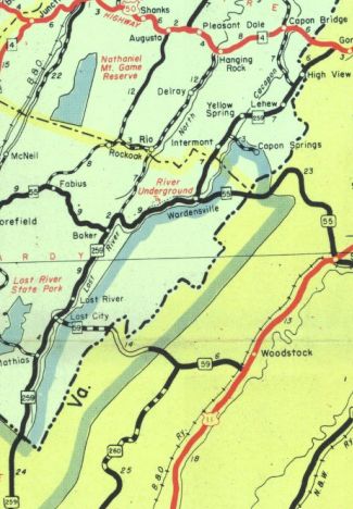
WV 58 #2: Appeared 1929 as new primary routing running from the Virginia State Line below Mathias and ending at WV 23 (now CR 55/20 Old WV 55) Baker.
In 1941, WV 58 was renumbered as WV 259.

1931 Official
WV 58 through Mathias to Baker
1931 Official
1946 Official
WV 58 becomes WV 259
1946 Official


Previous: WV 57 | Next: WV 59
Top  |  West Virginia Hwy Index Home

Page last modified 24 February 2018