< WV 67 | Home | WV 69 >
|
|
|
| ROUTE LOG |
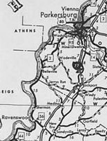
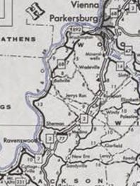
US 33 EB, WV 2: 0 - 0 US 33 WB: 0.4 - 0.4 Wood-Jackson Line: 12.9 - 13.3 WV 892: 10.7 - 24.0 WV 95: 3.6 - 27.6 US 50 WB, WV 892: 0.1 - 27.7 US 50 EB: 2.4 - 30.1 WV 14 SB, WV 618 WB: 0.6 - 30.7 WV 618 EB: 0.2 - 30.9 WV 14 NB: 1.2 - 32.1 I-77 (exit 179), WV 2: 4.4 - 36.5
|
Creation: WV 68 was designated between 1977-80 as a renumbering of WV 2. This is the 4th WV 68.
| Adjustments: None Improvements: WV 68 was fully paved upon designation; multilane through Parkersburg Comment: WV 68 has one-way alignments through Parkersburg: NB uses Juliana/8th/Murdoch while SB uses Emerson/Ohio/Garfield/Ann
| Previous WV 68's:
1932 ROUTE LOG WV 5: 0 - 0 Braxton-Gilmer Line: 11 - 11 US 19: 12 - 23 1946 ROUTE LOG US 119, US 250: 0 - 0 US 50, US 250: 2.5 - 2.5 1977 ROUTE LOG Kentucky State Line: 0 - 0 WV 49: 0.3 - 0.3 |
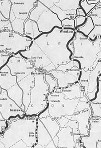
WV 68 #1: Appeared 1922 as new primary routing running from WV 5 (now US 33-119) Glenville southeast to WV 4 (now US 19) Napier.
Between 1929-31, WV 68 was renumbered as part of WV 18. Today it is WV 5 from Glenville to Burnsville; CR 5/10 into Burnsville; CR 5/11 east of BUrnsville; abandoned routing covered by Burnsville Lake. Some of old WV 69 from US 19 Napier northwestward still exists as an access road. This was the highest number used in the original layout of the West Virginia primary system.
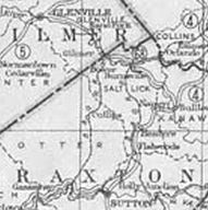
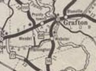
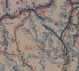
WV 68 #2: Appeared in 1932 as new primary routing running from WV 56 (now US 250) near Webster northwest to US 50 near Pruntytown. Between 1947-1949, WV 68 became part of US 250. The 1933 Taylor County map prematurely showed this as US 250...
WV 68 #3: Appeared about 1961 as a renumbering of WV 64 running from WV 49 Matewan across the river to Kentucky. Between 1978-80, WV 68 was downgraded to CR 49/10.
|
||||||||||||||