| N.C.
268 92 miles |
|
|
|
|
| The Road: |
|
Begins at US 321 Happy Valley (Caldwell County) and ends at NC 89 near Moores Springs (Stokes County).
|
Towns and Attractions: |
|
Caldwell Co: None
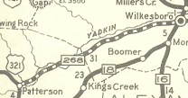
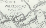
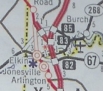
Wilkes Co: Ferguson, W Kerr Scott Reservoir, Wilkesboro, North Wilkesboro, West Elkin
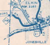
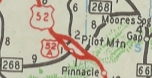
Surry Co: Elkin, Pilot Mtn
Stokes Co: None
|
History: |
|
NC 268 is an original state highway. It ran from NC 26 (now US 21 Bus) Elkin east to NC 80 (now US 601) Fairview. The 1922 Auto Trails map incorrectly shows it running from State Road to Dobson and Official maps in the 20s show it ending very close to Dobson but there has never been a road that does this.
In 1930, NC 268 was extended east as new routing to end at US 121/NC 66 (now just Main St) Pilot Mountain.
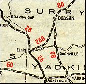
NC 268, slightly misrepresented
1924 Official
|
NC 268 extended to Pilot Mtn
1930 Official
|
In 1931, NC 268 was extended west from Elkin as new routing to end at NC 18 North Wilkesboro.
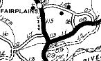
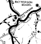
In 1933, NC 268 was extended with NC 18 to Wilkesboro, then as new routing southwest to US 321/NC 17 (now Yadkin River Rd) Patterson.
NC 268 extended to N. Wilkesboro
1932 Texaco
|
NC 268 extended to US 321
1933 Official
|
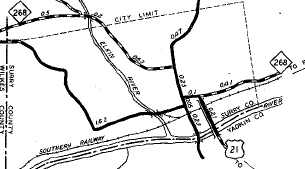
Between 1939-44, NC 268 was rerouted in Elkin to its current US 21 duplex with now-268 Business. Previously, NC 268 crossed US 21 on Main St and continued northwest.
NC 268 crosses US 21
1938 Surry County
|
NC 268 follows US 21
1944 Wilkes County
|
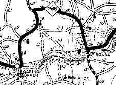
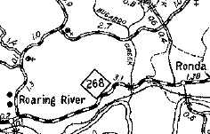
In 1938, NC 268 was rerouted to run directly from Roaring Fork to Rhonda. Before, it looped around using Bethany Ford Rd and Austin Rd.
NC 268 looping around
1936 Wilkes County
|
NC 268 direct route
1944 Wilkes County
|
In 1940, NC 268 was rerouted to meet NC 18 further south. This left behind today's NC 268-A.
In 1938, NC 268 was rerouted to run directly from Roaring Fork to Rhonda. Before, it looped around using Bethany Ford Rd and Austin Rd.
NC 268 original NC 18 approach
1936 Wilkes County
|
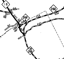
NC 268 redirected at NC 18
1944 Wilkes County
|
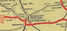
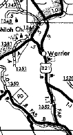
In 1941, NC 268 was extended west to the new location of US 321, (replacing a piece of US 321), then duplexed with US 321 south to NC 90 near Valmead.
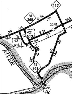
In 1943 or 1944, NC 268's routing in North Wilkesboro changed. Before, NC 268 used 6th St north from B St. to Hinshaw then northeast on SR 1517 out to the current NC 18-268 split area. Afterwards it used B St to 2nd St.
In 1952, NC 268 west was truncated to its current US 321 endpoint, leaving behind today's SR 1352 Valway Rd.
NC 268 original west end
1936 Caldwell County
|
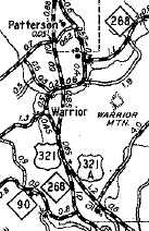
NC 268 extended to NC 90
1944 Caldwell County
|
NC 268 truncated to Happy Valley
1962 Caldwell County
|
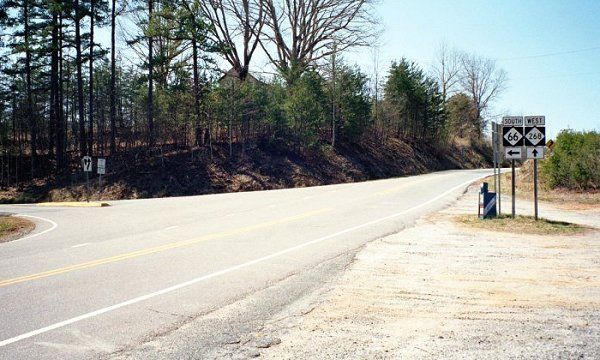
In 1953, NC 268 was extended east with US 52-A through Pilot Mountain, then east as new routing to end at NC 66.
In 1962, NC 268 was rerouted to the south of the W Kerr Scott Reservoir, leaving behind a small Old NC 268 (SR 1145) and a couple miles became underwater.
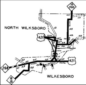
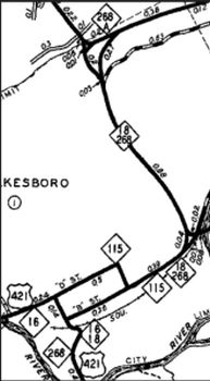
In May 1962 (NCDOT), NC 268 was rerouted in N. Wilkesboro. Originally it used B St. Now, there was a one-way pair with NB using 10th and SB using Forester between Wilkesboro Blvd and D St. NC 18 then used D St east to 6th, then south back to B St.
In August 1978 (NCDOT), NC 18-268 through N. Wilkesboro formed a "square", using A St, 6th St, D St, and CBD Loop.
NC 268 initially using 6th/Hinshaw
1936 Wilkes County
|
NC 268 using 2nd St
1953 Wilkes County
|
NC 268 one way pair
1968 Wilkes County
|
NC 268 using CBD Loop
1982 Wilkes County
|
In September 2002 (NCDOT), NC 268 was put on a northern bypass around Elkin which was part new construction and partly an upgrade to SR 1138. This left behind NC 268 Business.
|
NC 268 bypasses Elkin
2006 Official
|
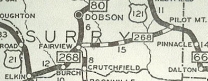
In May 2003 (NCDOT), NC 268 was extended east to NC 89 as an upgrade to SR 1504.
NC 268 extended to NC 66
1953 Official
|
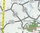
NC 268 extended to NC 89
2004 Official
|
|
Comment: |
|
NC 268 follows the Yadkin River for about 3/4 of its run.
The section between Elkin and US 601 is especially gnarly.
Lou Corsaro reports: NC 268 is very curvy for piedmont standards from the northern terminus to US 601. It is very similar to NC 66 in northern Stokes Co.
|